Craig Township, Switzerland County, Indiana
| Craig Township | |
|---|---|
| Township | |
 The Venoge Farmhouse, a historic site in the township | |
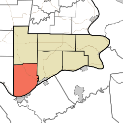 Location in Switzerland County | |
| Coordinates: 38°44′48″N 85°08′53″W / 38.74667°N 85.14806°W / 38.74667; -85.14806Coordinates: 38°44′48″N 85°08′53″W / 38.74667°N 85.14806°W / 38.74667; -85.14806 | |
| Country | |
| State | |
| County | Switzerland |
| Government | |
| • Type | Indiana township |
| Area | |
| • Total | 39.56 sq mi (102.5 km2) |
| • Land | 39.26 sq mi (101.7 km2) |
| • Water | 0.3 sq mi (0.8 km2) 0.76% |
| Elevation | 574 ft (175 m) |
| Population (2010) | |
| • Total | 900 |
| • Density | 22.9/sq mi (8.8/km2) |
| ZIP codes | 47011, 47043, 47250 |
GNIS feature ID | 453249 |
Craig Township is one of six townships in Switzerland County, Indiana, United States. As of the 2010 census, its population was 900 and it contained 477 housing units.[1]
Contents
1 History
2 Geography
2.1 Unincorporated towns
2.2 Adjacent townships
2.3 Cemeteries
2.4 Major highways
2.5 Airports and landing strips
3 School districts
4 Political districts
5 References
6 External links
History
Craig Township has the name of George Craig, a pioneer settler and afterward state legislator.[2]
The Thiebaud Farmstead, Venoge Farmstead, and Thomas T. Wright House are listed on the National Register of Historic Places.[3]
Geography
According to the 2010 census, the township has a total area of 39.56 square miles (102.5 km2), of which 39.26 square miles (101.7 km2) (or 99.24%) is land and 0.3 square miles (0.78 km2) (or 0.76%) is water.[1]
Unincorporated towns
Braytown at 38°43′50″N 85°09′31″W / 38.730617°N 85.158564°W / 38.730617; -85.158564
Five Points at 38°44′48″N 85°10′30″W / 38.746728°N 85.174953°W / 38.746728; -85.174953
Lamb at 38°41′31″N 85°11′17″W / 38.692007°N 85.188009°W / 38.692007; -85.188009
Long Run at 38°45′11″N 85°07′04″W / 38.753117°N 85.117729°W / 38.753117; -85.117729
(This list is based on USGS data and may include former settlements.)
Adjacent townships
Pleasant Township (north)
Jefferson Township (northeast)
Milton Township, Jefferson County (west)
Cemeteries
The township contains these two cemeteries: McKay and Old Bethel.
Major highways
 Indiana State Road 56
Airports and landing strips
- Robinson Airport
School districts
- Switzerland County School Corporation
Political districts
- Indiana's 9th congressional district
- State House District 68
- State Senate District 45
References
- United States Census Bureau 2008 TIGER/Line Shapefiles
- United States Board on Geographic Names (GNIS)
- IndianaMap
^ ab "Population, Housing Units, Area, and Density: 2010 - County -- County Subdivision and Place -- 2010 Census Summary File 1". United States Census. Retrieved 2013-05-10..mw-parser-output cite.citation{font-style:inherit}.mw-parser-output q{quotes:"""""""'""'"}.mw-parser-output code.cs1-code{color:inherit;background:inherit;border:inherit;padding:inherit}.mw-parser-output .cs1-lock-free a{background:url("//upload.wikimedia.org/wikipedia/commons/thumb/6/65/Lock-green.svg/9px-Lock-green.svg.png")no-repeat;background-position:right .1em center}.mw-parser-output .cs1-lock-limited a,.mw-parser-output .cs1-lock-registration a{background:url("//upload.wikimedia.org/wikipedia/commons/thumb/d/d6/Lock-gray-alt-2.svg/9px-Lock-gray-alt-2.svg.png")no-repeat;background-position:right .1em center}.mw-parser-output .cs1-lock-subscription a{background:url("//upload.wikimedia.org/wikipedia/commons/thumb/a/aa/Lock-red-alt-2.svg/9px-Lock-red-alt-2.svg.png")no-repeat;background-position:right .1em center}.mw-parser-output .cs1-subscription,.mw-parser-output .cs1-registration{color:#555}.mw-parser-output .cs1-subscription span,.mw-parser-output .cs1-registration span{border-bottom:1px dotted;cursor:help}.mw-parser-output .cs1-hidden-error{display:none;font-size:100%}.mw-parser-output .cs1-visible-error{font-size:100%}.mw-parser-output .cs1-subscription,.mw-parser-output .cs1-registration,.mw-parser-output .cs1-format{font-size:95%}.mw-parser-output .cs1-kern-left,.mw-parser-output .cs1-kern-wl-left{padding-left:0.2em}.mw-parser-output .cs1-kern-right,.mw-parser-output .cs1-kern-wl-right{padding-right:0.2em}
^ Cottman, George Streibe (1916). Indiana Magazine of History. p. 153.
^ National Park Service (2010-07-09). "National Register Information System". National Register of Historic Places. National Park Service.
External links
- Indiana Township Association
- United Township Association of Indiana
Places adjacent to Craig Township, Switzerland County, Indiana | ||||||||||
|---|---|---|---|---|---|---|---|---|---|---|
| ||||||||||
Municipalities and communities of Switzerland County, Indiana, United States | ||
|---|---|---|
County seat: Vevay | ||
| Towns |
| |
| Townships |
| |
| CDPs |
| |
| Other unincorporated communities |
| |


