Ligurian Sea

The Ligurian Sea

The Ligurian Sea: in red the border according to International Hydrographic Organization, in blue the border according to Istituto Idrografico della Marina
The Ligurian Sea (Italian: Mar Ligure; French: Mer Ligurienne) is an arm of the Mediterranean Sea, between the Italian Riviera (Liguria) and the island of Corsica. The sea is theorized to be named after the ancient Ligures people.
Contents
1 Geography
1.1 Extent
2 Conservation
3 Image gallery
4 References
Geography
The sea borders Italy as far as its border with France, and the French island of Corsica. In the east the sea borders the Tyrrhenian Sea, while in the west it borders the Mediterranean Sea proper. Genoa is the most prominent city in the area. The northwest coast is noted for its scenic beauty and favourable climate.
The Gulf of Genoa is its northernmost part. The sea receives the Arno River from the east and many other rivers that originate in the Apennines. The ports of Genoa, La Spezia, and Livorno are on its rocky coast. It reaches a maximum depth of more than 2,800 m (9,300 ft) northwest of Corsica.
Extent
The International Hydrographic Organization defines the limits of the Ligurian Sea as follows:[1]
On the Southwest. A line joining Cape Corse (Cape Grosso, 9°23′E) the Northern point of Corsica to the frontier between France and Italy (7°31′E).
On the Southeast.
A line joining Cape Corse with Tinetto Island (44°01′N 9°51′E / 44.017°N 9.850°E / 44.017; 9.850) and thence through Tino and Palmaria Islands to San Pietro Point (44°03′N 9°50′E / 44.050°N 9.833°E / 44.050; 9.833) on the Coast of Italy.
On the North The Ligurian Coast of Italy.
Conservation
In order to provide protection for the numerous cetacean (whales and dolphins; porpoises are not found in this part of the Mediterranean Sea) species in the Ligurian Sea the bordering countries established the sea as a SPAMI in 1999. The International Ligurian Sea Cetacean Sanctuary now covers 84,000 km2 (32,000 sq mi) covering territorial waters as well as high sea.
Image gallery

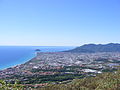
Massa

Livorno

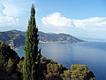
Rogliano

Pietracorbara
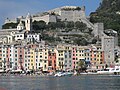
Portovenere
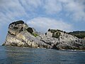
Palmaria
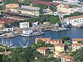
La Spezia

Vernazza

Corniglia

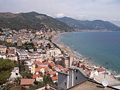
Monterosso al Mare

Riomaggiore

Manarola

Sori

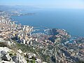
Genoa

Savona
Ceriale
Alassio
Laigueglia

Imperia

Sanremo

Ventimiglia

Cannes
Monaco
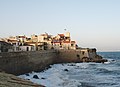
Antibes


References
| Wikimedia Commons has media related to Ligurian Sea. |
^ "Limits of Oceans and Seas, 3rd edition" (PDF). International Hydrographic Organization. 1953. Retrieved 7 February 2010..mw-parser-output cite.citation{font-style:inherit}.mw-parser-output .citation q{quotes:"""""""'""'"}.mw-parser-output .citation .cs1-lock-free a{background:url("//upload.wikimedia.org/wikipedia/commons/thumb/6/65/Lock-green.svg/9px-Lock-green.svg.png")no-repeat;background-position:right .1em center}.mw-parser-output .citation .cs1-lock-limited a,.mw-parser-output .citation .cs1-lock-registration a{background:url("//upload.wikimedia.org/wikipedia/commons/thumb/d/d6/Lock-gray-alt-2.svg/9px-Lock-gray-alt-2.svg.png")no-repeat;background-position:right .1em center}.mw-parser-output .citation .cs1-lock-subscription a{background:url("//upload.wikimedia.org/wikipedia/commons/thumb/a/aa/Lock-red-alt-2.svg/9px-Lock-red-alt-2.svg.png")no-repeat;background-position:right .1em center}.mw-parser-output .cs1-subscription,.mw-parser-output .cs1-registration{color:#555}.mw-parser-output .cs1-subscription span,.mw-parser-output .cs1-registration span{border-bottom:1px dotted;cursor:help}.mw-parser-output .cs1-ws-icon a{background:url("//upload.wikimedia.org/wikipedia/commons/thumb/4/4c/Wikisource-logo.svg/12px-Wikisource-logo.svg.png")no-repeat;background-position:right .1em center}.mw-parser-output code.cs1-code{color:inherit;background:inherit;border:inherit;padding:inherit}.mw-parser-output .cs1-hidden-error{display:none;font-size:100%}.mw-parser-output .cs1-visible-error{font-size:100%}.mw-parser-output .cs1-maint{display:none;color:#33aa33;margin-left:0.3em}.mw-parser-output .cs1-subscription,.mw-parser-output .cs1-registration,.mw-parser-output .cs1-format{font-size:95%}.mw-parser-output .cs1-kern-left,.mw-parser-output .cs1-kern-wl-left{padding-left:0.2em}.mw-parser-output .cs1-kern-right,.mw-parser-output .cs1-kern-wl-right{padding-right:0.2em}
Earth's oceans and seas | |
|---|---|
| Arctic Ocean |
|
| Atlantic Ocean |
|
| Indian Ocean |
|
| Pacific Ocean |
|
| Southern Ocean |
|
| Endorheic basins |
|
| |
Coordinates: 43°30′N 9°00′E / 43.500°N 9.000°E / 43.500; 9.000
Authority control |
|
|---|