Olomouc Region
Olomouc Region Olomoucký kraj | |||
|---|---|---|---|
| Region | |||
 Olomouc | |||
| |||
 | |||
| Coordinates: 49°43′N 17°07′E / 49.72°N 17.11°E / 49.72; 17.11Coordinates: 49°43′N 17°07′E / 49.72°N 17.11°E / 49.72; 17.11 | |||
| Country | Czech Republic | ||
| Capital | Olomouc | ||
| Districts | Olomouc District, Přerov District, Prostějov District, Šumperk District | ||
| Government | |||
| • Governor | Ladislav Okleštěk | ||
| Area | |||
| • Total | 5,266.57 km2 (2,033.43 sq mi) | ||
| Highest elevation | 1,492 m (4,895 ft) | ||
| Population (03/2011) | |||
| • Total | 647,770 | ||
| • Density | 120/km2 (320/sq mi) | ||
| ISO 3166 code | CZ-OL | ||
| Vehicle registration | M | ||
| Website | http://www.kr-olomoucky.cz/ | ||


Olomouc Region (Czech: Olomoucký kraj, Polish: Kraj ołomuniecki) is an administrative unit (Czech: kraj) of the Czech Republic, located in the north-western and central part of its historical region of Moravia (Morava) and in a small part of the historical region of Czech Silesia (České Slezsko). It is named for its capital Olomouc.
Olomouc region borders with the Moravian-Silesian Region (in the east), Zlín Region (in the south-east), South Moravian Region (in the south-west) and Pardubice Region (in the west). Furthermore, the region shares a 104 km long border with Poland (in the north).
Contents
1 Administrative divisions
2 Population
2.1 Cities
3 Geography
4 Economy
4.1 Agriculture
4.2 Transport
4.3 Tourism
5 Quality of life
5.1 Health care
5.2 Education
6 Places of interest
7 Photo gallery
8 References
9 External links
Administrative divisions
The Olomouc Region is divided into 5 districts:
 | |||||||||||||
Districts of Olomouc Region
| |||||||||||||
On the territory of the region there are 13 administrative districts of municipalities with extended powers and 20 administrative districts of municipalities with authorized local authority.
Population

Example of vernacular architecture of Hanakia
In September 2013 the population of the Olomouc Region totalled 636,585 inhabitants. As of 2012, 56.6% of region’s population lived in towns or cities. Out of 399 municipalities located in the region, 30 had a status of town. Region’s capital Olomouc is with approximately 100 thousand inhabitants the largest city. With 121.3 inhabitants per square kilometre the region was close to the national average of 133.2 persons per km2. There were, of course, differences within the region: the lowest population density was in the Jeseník District (56.3 persons per km2).
In the long term, the population of the region has been aging. The share of children aged 0–14 has been decreasing (14.6% of the total population in 2011), while the proportion of those aged 65+ has been increasing (16.4% in 2011).[1]
Cities
The table below provides the list of region's most populous cities and town as of 31 December 2012.
| Name | Population[2] | Area (km²) | District |
|---|---|---|---|
| 99,471 | 103 | Olomouc District | |
| 44,824 | 59 | Přerov District | |
| 44,330 | 39 | Prostějov District | |
| 26,870 | 28 | Šumperk District | |
| 18,745 | 50 | Přerov District | |
| 13,867 | 35 | Šumperk District | |
| 13,548 | 49 | Olomouc District | |
| 11,711 | 38 | Jeseník District | |
| 11,638 | 48 | Olomouc District | |
| 9,874 | 46 | Olomouc District | |
| 9,460 | 46 | Šumperk District | |
| 8,240 | 31 | Přerov District | |
| 6,330 | 31 | Přerov District |
Geography

Aerial view of Praděd
The total area of the region amounts to 5,266 km2, which is 6.7% of the entire area of the Czech Republic.
The northern part of the region is of mountainous nature. The Jeseníky mountains are located here, including Praděd, which is the highest point of the region (1,492 m above sea level). The southern part of the region consists of the Hanakian lowland. The lowest point of the region is situated on the water level of the Morava River near to Kojetín in the Přerov District (190 m above sea level).
The Morava river flows through the region and the majority of the region's territory belongs to Morava’s drainage basin. A small northern part of the region belongs to the drainage basin of Odra River, which flows to the Baltic Sea.
The Olomouc Region offers a great variety of natural points of interest. Protected landscape area of the Jeseníky mountains offers a number of scenic places such as the largest Moravian peatbog Rejvíz and the 45m high Vysoký Waterfall. Another scenic place is Dlouhé Stráně water reservoir situated on the top of a hill. Protected landscape area Litovelské Pomoraví offers floodplain forests with many endangered species of plants and animals. Finally, many caves can be found in the region: Javoříčko Caves (Czech: Javoříčské jeskyně), Mladeč Caves (Czech: Mladečské jeskyně) and Zbrašov aragonite caves (Czech: Zbrašovské jeskyně).[3]
Economy

Olomoucké syrečky, a ripened soft cheese made in Loštice
The region's economy focuses on traditional agriculture, processing industry and
services. Conditions for further development of the region are its attractive location, transport accessibility, developed infrastructure, enough qualified labour force and entry of foreign investors.
In 2011, the total economically active population of the Olomouc Region was 307.2 thousand people, of which 283.9 thousand were employed and 23.3 thousand unemployed. The unemployment rate in late 2013 was 9%.
The Olomouc Region is an industrial area with developed services. The economy of the
Hanakian districts is more stable and diverse than the economy of the Jeseník District and northern part of the Šumperk District. The latter two districts belong to economically weaker regions due to their position, transport accessibility and disturbance of social and economic life after the Second World War (displacement of German population).
The gross domestic product of the Olomouc Region amounted to 4.7% of the nation GDP in 2011. The GDP per capita of the region reaches 76.5% of the national average. The average monthly wage of employees in businesses based in the region reached 21,727 CZK (EUR 780) in late 2013.
Significant sectors of the region’s economy are agriculture, food industry, textile and clothing industry, manufacture of machinery, optics and optical equipment.
In 2011, there were 138,970 businesses, organisations and entrepreneurs based in the region. Most of them were private entrepreneurs registered according to the trade law (76.6%) and business companies (8.4%). 157 industrial enterprises had 100 or more employees, employing in total 41,222 employees.
Agriculture
The share of arable land was 39.4% in 2011 but was showing a decreasing trend over past years while the share of non-agricultural land has been increasing and reached 46.9% in 2011.
Southern and central parts of the region belong to areas with the most fertile land. Crop yields (barley, wheat, rape and industrial sugar beet) reach the highest amounts of the entire country.
Transport
Transport accessibility of the region is provided by 3,582 km of roads, of which only 12.3% are first class roads. The motorways with two lanes connect Olomouc with Brno (I/46), Ostrava (I/35 followed by D1) and the Pardubice Region (I/35). Once finished, the d1 motorway will connect Brno with Ostrava and will cross the southern part of Olomouc Region.
There is 601 km of railways in the region. Important rail junctions are in Olomouc and Přerov. The railway network is spread equally all over the Region´s territory. Road network is denser in the southern flat part of the Region.
Near to the city of Olomouc there is an airport for small airliners, which obtained status of an international airport.
Tourism
The Olomouc Region belongs to regions with the smallest number of accommodation establishments. In 2009 there were 338 collective accommodation establishments. These were placed primarily in the Jeseník District and the Šumperk District that are most visited by tourists.[4]
Quality of life
In 2011, 14,347 crimes were committed in the region, of which 6,744 (47%) were solved.
Compared to other regions of the Czech Republic, the environment of Olomouc Region can be marked as relatively less damaged. The values of specific emissions do not reach the average national values. Mountain areas and foothills have excellent air quality and are important sources of drinking water.
Health care
In 2011 the region counted 9 hospitals, 16 specialized therapeutic institutions and other health establishments by 2,897 physicians and 6,466 paramedical workers. Health care is provided also in many spa establishments that are placed all over the region. Well known spas are in Jeseník, Velké Losiny, Teplice nad Bečvou, Slatinice, Skalka, etc.
Education
In 2011, the network of school establishments consists of 367 nursery schools, 369 basic schools, 20 grammar schools, 81 programmes vocational training and 8 higher schools. The second oldest university in the Czech Republic, the Palacký University (Czech: Univerzita Palackého), is situated in Olomouc. It is attended by over 23,000 students.[5]
Places of interest

National costume of Hanakia
Bouzov Castle;
Hanakian region (Czech: Haná) with its folkways, folklore shows and festivals that are organised in Náměšť, Prostějov, Kojetín, etc.
Helfštýn castle;
Jánský vrch château;- Náměšť na Hané château;
Olomouc with a large urban conservation area preserving a large set of buildings that are important for their historical, architectonic or artistic value;- Sovinec castle;
- Svatý Kopeček with its well-known Pilgrimage Church of the Visitation of the Virgin Mary
- Šternberk castle;
- Tovačov château;
- Úsov château;
- Velké Losiny château, historic paper factory, spa;
- For winter sports many downhill courses and pistes are prepared in the Jeseníky mountains in areas of Červenohorské sedlo, Kouty nad Desnou, Petříkov, Ostružná, Ramzová and many others.
Photo gallery
Bouzov Castle

Čekyňský kopec, statue of a mammoth

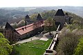
Dlouhé stráně Hydro Power Plant

Hanakian vernacular architecture in Příkazy
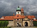
Helfštýn castle

Jánský vrch château
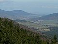
A view at Jeseník from Červenohorské sedlo

Kostelec na Hané, town hall
Litovel

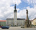
City center of Olomouc

Astronomical clock at town hall in Olomouc
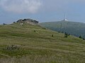
Petrovy kameny and Praděd

National House in Prostějov
Přerov
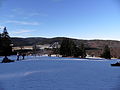
Ramzová

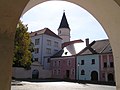
Staré Město

Šternberk castle

Šumperk

A view from Velký Kosíř mountain
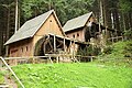
Mills in Zlaté Hory


References
^ Characteristics of the Olomoucký Region, Available online at: http://www.czso.cz/csu/2010edicniplan.nsf/engt/F80031C6B4/$File/71101110chen.pdf
^ Data as of 26 March 2011 from the Czech Statistical Office
^ Characteristics of the Olomoucký Region, Available online at: http://www.czso.cz/csu/2010edicniplan.nsf/engt/F80031C6B4/$File/71101110chen.pdf
^ Characteristics of the Olomoucký Region, Available online at: http://www.czso.cz/csu/2010edicniplan.nsf/engt/F80031C6B4/$File/71101110chen.pdf
^ Characteristics of the Olomoucký Region, Available online at: http://www.czso.cz/csu/2010edicniplan.nsf/engt/F80031C6B4/$File/71101110chen.pdf
External links
![]() Media related to Olomouc Region at Wikimedia Commons
Media related to Olomouc Region at Wikimedia Commons
Official website (in Czech)
- Region statistics
Regions of the Czech Republic | ||
|---|---|---|
| ||
Silesia topics | |||||||||||||||||||||||||||||
|---|---|---|---|---|---|---|---|---|---|---|---|---|---|---|---|---|---|---|---|---|---|---|---|---|---|---|---|---|---|
| |||||||||||||||||||||||||||||
| |||||||||||||||||||||||||||||
| |||||||||||||||||||||||||||||
| |||||||||||||||||||||||||||||
| |||||||||||||||||||||||||||||
| |||||||||||||||||||||||||||||


