Świętokrzyskie Voivodeship
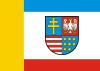
Świętokrzyskie Voivodeship Województwo świętokrzyskie | |||
|---|---|---|---|
Voivodeship | |||
| |||
 Location within Poland | |||
 Division into counties | |||
| Coordinates (Kielce): 50°53′N 20°37′E / 50.883°N 20.617°E / 50.883; 20.617 | |||
| Country | |||
| Capital | Kielce | ||
| Counties | 1 city, 13 land counties *
| ||
| Area | |||
| • Total | 11,672 km2 (4,507 sq mi) | ||
| Population (30-06-2014) | |||
| • Total | 1,263,176 | ||
| • Density | 110/km2 (280/sq mi) | ||
| • Urban | 581,322 | ||
| • Rural | 700,474 | ||
| Car plates | T | ||
HDI (2017) | 0.837[1] very high · 14th | ||
| Website | http://www.kielce.uw.gov.pl/ | ||
| |||
Świętokrzyskie Voivodeship, Świętokrzyskie Province,[2] or Holy Cross Province (Polish: województwo świętokrzyskie [vɔjɛˈvut͡stfɔ ɕfʲɛntɔˈkʂɨskʲɛ]) is one of the 16 voivodeships (provinces) into which Poland is divided. It is situated in southeastern Poland, in the historical province of Lesser Poland, and takes its name from the Świętokrzyskie (Holy Cross) mountain range. Its capital and largest city is Kielce.
Świętokrzyskie Province is bounded by six other voivodeships: Masovian to the north, Lublin to the east, Subcarpathian to the southeast, Lesser Poland to the south, Silesian to the southwest, and Łódź to the northwest.
The province was created on 1 January 1999, out of the former Kielce Voivodeship, eastern part of Częstochowa Voivodeship and western part of Tarnobrzeg Voivodeship, pursuant to the Polish local government reforms adopted in 1998. It covers an area of 11,672 square kilometres (4,507 sq mi), making it the second smallest of the voivodeships (after Opole). As at 2006, the total population of Świętokrzyskie Voivodeship is 1,281,796.
Contents
1 Cities and towns
2 Administrative division
3 Protected areas
4 See also
5 References
6 External links
Cities and towns

Kielce is the capital of the voivodeship

Ostrowiec Świętokrzyski is the second most populous city

Sandomierz is one of the main tourist destinations in the Świętokrzyskie Voivodeship

Kurozwęki Palace
The voivodeship contains 32 cities and towns. These are listed below in descending order of population (according to official figures for 2006[3] ):
Kielce (207,718)
Ostrowiec Świętokrzyski (73,937)
Starachowice (53,092)
Skarżysko-Kamienna (49,131)
Sandomierz (25,088)
Końskie (20,667)
Busko-Zdrój (17,297)
Jędrzejów (16,577)
Staszów (15,499)
Pińczów (11,886)
Włoszczowa (10,782)
Suchedniów (8,911)
Połaniec (8,316)
Opatów (6,846)
Sędziszów (6,813)
Stąporków (5,986)
Kazimierza Wielka (5,730)
Ożarów (4,816)
Chęciny (4,252)
Chmielnik (4,005)
Małogoszcz (3,943)
Radoszyce (3,267)
Ćmielów (3,172)
Kunów (3,127)
Daleszyce (2,800)
Wąchock (2,760)
Koprzywnica (2,531)
Bodzentyn (2,241)
Osiek (1,955)
Zawichost (1,853)
Stopnica (1,545)
Skalbmierz (1,323)
Działoszyce (1,068)
Administrative division
Świętokrzyskie Voivodeship is divided into 14 counties (powiats): 1 city county and 13 land counties. These are further divided into 102 gminas.
The counties are listed in the following table (ordering within categories is by decreasing population).
English and Polish names | Area (km²) | Population (2006) | Seat | Other towns | Total gminas |
City counties | |||||
Kielce | 110 | 207,718 | 1 | ||
Land counties | |||||
Kielce County powiat kielecki | 2,247 | 198,581 | Kielce * | Chęciny, Chmielnik, Daleszyce, Bodzentyn | 19 |
Ostrowiec County powiat ostrowiecki | 616 | 116,179 | Ostrowiec Świętokrzyski | Ćmielów, Kunów | 6 |
Starachowice County powiat starachowicki | 523 | 94,395 | Starachowice | Wąchock | 5 |
Jędrzejów County powiat jędrzejowski | 1,257 | 89,304 | Jędrzejów | Sędziszów, Małogoszcz | 9 |
Końskie County powiat konecki | 1,140 | 84,239 | Końskie | Stąporków, Radoszyce | 8 |
Sandomierz County powiat sandomierski | 676 | 81,733 | Sandomierz | Koprzywnica, Zawichost | 9 |
Skarżysko County powiat skarżyski | 395 | 80,024 | Skarżysko-Kamienna | Suchedniów | 5 |
Staszów County powiat staszowski | 925 | 74,004 | Staszów | Połaniec, Osiek | 8 |
Busko County powiat buski | 967 | 73,940 | Busko-Zdrój | 8 | |
Opatów County powiat opatowski | 912 | 56,645 | Opatów | Ożarów | 8 |
Włoszczowa County powiat włoszczowski | 906 | 47,137 | Włoszczowa | 6 | |
Pińczów County powiat pińczowski | 611 | 42,127 | Pińczów | Działoszyce | 5 |
Kazimierza County powiat kazimierski | 422 | 35,770 | Kazimierza Wielka | Skalbmierz | 5 |
| * seat not part of the county | |||||
Protected areas

Świętokrzyski National Park
Protected areas in Świętokrzyskie Voivodeship include one National Park and nine Landscape Parks. These are listed below.
- Świętokrzyski National Park
- Chęciny-Kielce Landscape Park
- Cisów-Orłowiny Landscape Park
- Jeleniowska Landscape Park
- Kozubów Landscape Park
- Nida Landscape Park
Przedbórz Landscape Park (partly in Łódź Voivodeship)- Sieradowice Landscape Park
- Suchedniów-Oblęgorek Landscape Park
- Szaniec Landscape Park
See also
- Świętokrzyskie cuisine
Second Polish Republic’s Kielce Voivodeship (1919–1939)- Lesser Polish Way
References
^ "Sub-national HDI - Area Database - Global Data Lab". hdi.globaldatalab.org. Retrieved 2018-09-13..mw-parser-output cite.citation{font-style:inherit}.mw-parser-output q{quotes:"""""""'""'"}.mw-parser-output code.cs1-code{color:inherit;background:inherit;border:inherit;padding:inherit}.mw-parser-output .cs1-lock-free a{background:url("//upload.wikimedia.org/wikipedia/commons/thumb/6/65/Lock-green.svg/9px-Lock-green.svg.png")no-repeat;background-position:right .1em center}.mw-parser-output .cs1-lock-limited a,.mw-parser-output .cs1-lock-registration a{background:url("//upload.wikimedia.org/wikipedia/commons/thumb/d/d6/Lock-gray-alt-2.svg/9px-Lock-gray-alt-2.svg.png")no-repeat;background-position:right .1em center}.mw-parser-output .cs1-lock-subscription a{background:url("//upload.wikimedia.org/wikipedia/commons/thumb/a/aa/Lock-red-alt-2.svg/9px-Lock-red-alt-2.svg.png")no-repeat;background-position:right .1em center}.mw-parser-output .cs1-subscription,.mw-parser-output .cs1-registration{color:#555}.mw-parser-output .cs1-subscription span,.mw-parser-output .cs1-registration span{border-bottom:1px dotted;cursor:help}.mw-parser-output .cs1-hidden-error{display:none;font-size:100%}.mw-parser-output .cs1-visible-error{font-size:100%}.mw-parser-output .cs1-subscription,.mw-parser-output .cs1-registration,.mw-parser-output .cs1-format{font-size:95%}.mw-parser-output .cs1-kern-left,.mw-parser-output .cs1-kern-wl-left{padding-left:0.2em}.mw-parser-output .cs1-kern-right,.mw-parser-output .cs1-kern-wl-right{padding-right:0.2em}
^ Tłumaczenie polskich nazw geograficznych na język angielski [Translation of Polish Geographical Names into English], Arkadiusz Belczyk, 2002-2006.
^ https://web.archive.org/web/20071227152516/http://www.stat.gov.pl/gus/45_655_PLK_HTML.htm. Archived from the original on 27 December 2007. Retrieved 2 January 2008. Missing or empty|title=(help)
External links
| Wikivoyage has a travel guide for Świętokrzyskie. |
| Wikimedia Commons has media related to Świętokrzyskie Voivodeship. |
Świętokrzyskie Voivodeship official website (Polish, English, German)
Świętokrzyski Urząd Wojewódzki Official website (Polish, English, Russian, Ukrainian, French)
Regional Tourist Information Center official website (Polish, English, German)
Places adjacent to Świętokrzyskie Voivodeship | ||||||||||
|---|---|---|---|---|---|---|---|---|---|---|
Counties of Świętokrzyskie Voivodeship | ||
|---|---|---|
| City counties |
|  |
| Land counties |
| |
Voivodeships of Poland | ||
|---|---|---|
| ||
Coordinates: 50°45′56″N 20°46′25″E / 50.76556°N 20.77361°E / 50.76556; 20.77361
Authority control |
|
|---|


