South 24 Parganas
South 24 Parganas district | |
|---|---|
District of West Bengal | |
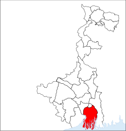 Location of South 24 Parganas district in West Bengal | |
| Country | India |
| State | West Bengal |
| Administrative division | Presidency |
| Headquarters | Alipore |
| Government | |
| • Lok Sabha constituencies | Jaynagar (SC), Mathurapur (SC), Diamond Harbour, Jadavpur, Kolkata Dakshin |
| • Assembly seats | Gosaba (SC), Basanti (SC), Kultali (SC), Patharpratima, Kakdwip, Sagar, Kulpi (SC), Raidighi, Mandirbazar (SC), Jaynagar (SC), Baruipur Purba (SC), Canning Paschim (SC), Canning Purba, Baruipur Paschim, Magrahat Purba (SC), Magrahat Paschim, Diamond Harbour, Falta, Satgachia, Bishnupur (SC), Sonarpur Dakshin, Bhangar, Kasba, Jadavpur, Sonarpur Uttar, Tollyganj, Behala Purba, Behala Paschim, Maheshtala, Budge Budge, Metiaburuz |
| Area | |
| • Total | 9,960 km2 (3,850 sq mi) |
| Population (2011) | |
| • Total | 8,153,176 |
| • Density | 820/km2 (2,100/sq mi) |
| • Urban | 1,089,730 |
| Demographics | |
| • Literacy | 78.57 per cent |
| • Sex ratio | 937 |
| Major highways | NH 12 |
| Average annual precipitation | 1750 mm |
| Website | Official website |
South 24 Parganas (Pron: pɔrɡɔnɔs) (abv. 24 PGS (S)) or sometimes South Twenty Four Parganas is a district in the Indian State of West Bengal, headquartered in Alipore. It is the largest district of West Bengal state by area and second largest by population. It is the sixth most populous district in India (out of 640). On one side is the urban fringe of Kolkata and on the other, the remote riverine villages in the Sundarbans.[1]
Contents
1 History
2 Economy
3 Divisions
3.1 Administrative Subdivisions
3.2 Alipore Sadar Subdivision
3.3 Baruipur Subdivision
3.4 Canning Subdivision
3.5 Diamond Harbour Subdivision
3.6 Kakdwip Subdivision
3.7 Parliamentary Constituencies
3.8 Assembly Constituencies
3.8.1 1997 to 2008
3.8.2 2008 to Date
4 Demographics
5 Flora & Fauna
6 References
7 External links
8 See also
History
Originally, the capital of Raja Bikramaditya and Maharaja Pratapaditya was at Dhumghat. Later it was transferred to Ishwaripur (Originated from the name Jeshoreshwaripur). Maharaja Pratapaditya declared the independence of South Bengal from the Mughal Empire.
Pratapaditya's father Shrihari (Shridhar), a Kayastha, was an influential officer in the service of Daud Khan Karrani. Upon the fall of Daud, he fled with the government treasure in his custody. He then, in 1574, set up a kingdom for himself in the marshy land to the extreme south of Khulna district and took the title of Maharaja. Pratapaditya inherited the kingship in 1574. The Baharistan and travel diary of Abdul Latif, and the contemporary European writers, testify to Pratapaditya's personal ability, political pre-eminence, material resources and martial strength, particularly in war-boats. His territories covered the greater part of what is now included in the greater Jessore, Khulna and Barisal districts. He established his capital at Dhumghat, a strategic position at the confluence of the Jamuna and Ichhamati rivers.
Among the Bengal zamindars, Pratapaditya was the first to send his envoy to Islam Khan Chisti with a large gift to win the favour of the Mughals, and then, in 1609, tendered personal submission to the Subahdar. He promised military assistance and personal service in the Mughal campaign against Musa Khan, a pledge he did not keep. To punish Pratapaditya for his disloyalty and to subjugate his territory, a large expedition was launched under the command of Ghiyas Khan, which soon reached Salka, near the confluence of the Jamuna and Ichhamati, in 1611. Pratapaditya equipped a strong army and fleet and placed them under expert officers. His eldest son Udayaditya constructed an almost impregnable fort at Salka with natural barriers on three sides. In battle, the Jessore fleet gained an initial advantage but the imperial army cut off the Jessore fleet, made a breach in its ranks and broke its unity and discipline. In the melee that followed, the admiral, Khwaja Kamal, was killed. Udayaditya lost heart and hastily fled to his father, narrowly escaping capture.
Pratapaditya prepared himself to fight a second time from a new base near the confluence of the Kagarghat canal and the Jamuna river. He constructed a fort and gathered all his available forces there. The imperialists began the battle on January, 1612 with an attack on the Jessore fleet, compelling it to seek shelter beneath the fort. But their advance was checked by the heavy cannonade of the Jessore artillery. However, a sudden attack by the imperialists completely defeated the Jessore fleet and they fell upon the fort with elephants in front, compelling Pratapaditya to evacuate the fort and retreat.
This second defeat sealed the fate of Pratapaditya. At Kagarghat he tendered submission to Ghiyas Khan, who personally escorted Pratapaditya to Islam Khan at Dhaka. The Jessore king was put in chains and his kingdom was annexed. Pratapaditya was kept confined at Dhaka. No authentic information is available regarding his last days, however, he probably died as a prisoner at Benares, on his way to Delhi.[2]
Economy
Agriculture, Industry and Pisciculture are all at their peak in the district. On the west side of the district is the Falta Special Economic Zone (SEZ), which houses various types of industry.
In 2006, the Ministry of Panchayati Raj named South 24 Parganas one of the country's 250 most backward districts (out of a total of 640).
Divisions
Administrative Subdivisions
The district comprises five subdivisions: Alipore Sadar, Baruipur, Diamond Harbour, Canning and Kakdwip.[3]
Alipore is the district headquarters. There are 33 police stations, 29 community development blocks, 7 municipalities and 312 gram panchayats in the district.[3][4] The Sunderbans area is covered by 12 CD blocks, viz. Sagar, Namkhana, Kakdwip, Patharpratima, Kultali, Mathurapur I, Mathurapur II, Jaynagar II, Canning I, Canning II, Basanti and Gosaba.[4] The district contains 37 islands.[4]
Other than the municipality areas, each subdivision contains community development blocks which in turn are divided into rural areas and census towns. In total there are 118 urban units: 7 municipalities and 111 census towns.[4][5]
Alipore Sadar Subdivision
The Alipore Sadar subdivision consists of:[3]
- Urban areas which are part of Kolkata Municipal Corporation: Alipore, New Alipore, Garden Reach, Taratala, Behala, Bhowanipore, Kalighat, Tollygunge, Garia, New Garia, Baghajatin, Jadavpur, Dhakuria, Ballygunge, Kustia, Gariahat.
- Three municipalities: Maheshtala, Budge Budge and Pujali.
Bishnupur I, a community development block consisting of rural areas with eleven gram panchayats and four census towns: Daulatpur, Bhasa, Bishnupur and Kanyanagar.
Bishnupur II, a community development block consisting of rural areas with eleven gram panchayats and eleven census towns: Nahazari, Nadabhanga, Kanganbaria, Bora Gagangohalia, Chanddandaha, Barkalikapur, Patharberia, Ramkrishnapur, Amtala, Kriparampur and Chak Enayetnagar.
Budge Budge I, a community development block consisting of rural areas with six gram panchayats and seven census towns: Uttar Raypur, Balarampur, Buita, Benjanhari Acharial (P), Abhirampur, Nischintapur and Birlapur.
Budge Budge II, a community development block consisting of rural areas with eleven gram panchayats and five census towns: Chak Kashipur, Chak Alampur, Bowali, Dakshin Raypur and Poali.
Thakurpukur Maheshtala, a community development block consisting of rural areas with six gram panchayats and nine census towns: Joka, Chata Kalikapur, Ganye Gangadharpur, Rameswarpur, Asuti, Hanspukuria, Kalua, Ramchandrapur and Samali.
Baruipur Subdivision
The Baruipur subdivision consists of:[3]
- Three municipalities: Rajpur Sonarpur, Baruipur and Jaynagar Majilpur.[4]
Baruipur, a community development block consisting of rural areas with nineteen gram panchayats and twelve census towns: Petua, Garia, Panchghara, Mallikpur, Hariharpur, Champahati, Solgohalia, Naridana, Baruipur (P), Salipur (P), Khodar Bazar and Komarhat.
Bhangar I, a community development block consisting of rural areas with nine gram panchayats and three census towns: Maricha, Bhangar Raghunathpur and Gobindapur.
Bhangar II, a community development block consisting of rural areas with only ten gram panchayats.
Jaynagar I, a community development block consisting of rural areas with twelve gram panchayats and six census towns: Raynagar, Kalikapur Barasat, Baharu, Uttarparanij, Alipur and Uttar Durgapur.
Jaynagar II, a community development block consisting of rural areas with ten gram panchayats and two census towns: Nimpith and Tulshighata.
Kultali, a community development block consisting of rural areas with only nine gram panchayats.
Sonarpur, a community development block consisting of rural areas with eleven gram panchayats and seven census towns: Radhanagar, Danga, Ramchandrapur, Bidyadharpur, Kalikapur, Chak Baria and Sahebpur.
Canning Subdivision
The Canning subdivision consists of:[3]
Basanti, a community development block consisting of rural areas with thirteen gram panchayats and one census town: Basanti.
Canning I, a community development block consisting of rural areas with ten gram panchayats and eight census towns: Kalaria, Gaur Daha, Banshra, Rajapur, Taldi, Bayarsing, Matla and Dighirpar.
Canning II, a community development block consisting of rural areas with nine gram panchayats and one census town: Makhal Tala.
Gosaba, a community development block consisting of rural areas with only fourteen gram panchayats.
Diamond Harbour Subdivision
The Diamond Harbour subdivision consists of:[3]
- One municipality: Diamond Harbour
Diamond Harbour I, a community development block consisting of rural areas with eight gram panchayats and four census towns: Masat, Sangrampur, Mohanpur and Durganagar.
Diamond Harbour II, a community development block consisting of rural areas with eight gram panchayats and one census town: Patdaha.
Falta, a community development block consisting of rural areas with thirteen gram panchayats and four census towns: Hasimnagar, Baneshwarpur, Chandpala Anantapathpur and Fatepur.
Kulpi, a community development block consisting of rural areas with fourteen gram panchayats and two census towns: Berandari Bagaria and Dhola.
Magrahat I, a community development block consisting of rural areas with eleven gram panchayats and nine census towns: Ajodhyanagar, Sirakol, Uttar Bishnupur, Ghola Noapara, Usthi, Barijpur, Uttar Kusum, Kalikapota and Bamna.
Magrahat II, a community development block consisting of rural areas with fourteen gram panchayats and eight census towns: Dhamua, Shyampur, Nainan, Uttar Kalas, Dihi Kalas, Swangrampur, Bilandapur and Magrahat.
Mandirbazar, a community development block consisting of rural areas with ten gram panchayats and three census towns: Chandpur (M), Bangsidharpur (M) (P) and Purba Bishnupur (M).
Mathurapur I, a community development block consisting of rural areas with ten gram panchayats and four census towns: Purba Ranaghat, Lalpur, Krishna Chandrapur and Mathurapur.
Mathurapur II, a community development block consisting of rural areas with only eleven gram panchayats.
Kakdwip Subdivision
The Kakdwip subdivision consists of:[3]
Kakdwip, a community development block consisting of rural areas with only eleven gram panchayats.
Namkhana, a community development block consisting of rural areas with only seven gram panchayats.
Patharpratima, a community development block consisting of rural areas with only fifteen gram panchayats.
Sagar, a community development block consisting of rural areas with only nine gram panchayats.
Parliamentary Constituencies
The district has five parliament constituencies:[6]
- 19-Jaynagar (SC) Parliamentary Constituency
- 20-Mathurapur (SC) Parliamentary Constituency
- 21-Diamond Harbour Parliamentary Constituency
- 22-Jadavpur Parliamentary Constituency
- 23-Kolkata Dakshin Parliamentary Constituency
Assembly Constituencies
1997 to 2008
Based on the 1991 census, the district was divided into thirty-two assembly constituencies:[7]
Gosaba (SC) (assembly constituency no. 100)
Basanti (SC) (assembly constituency no. 101)
Kultali (SC) (assembly constituency no. 102)
Jaynagar (assembly constituency no. 103)
Baruipur (assembly constituency no. 104)
Canning West (SC) (assembly constituency no. 105)
Canning East (assembly constituency no. 106)
Bhangar (assembly constituency no. 107)
Jadavpur (assembly constituency no. 108)
Sonarpur (SC) (assembly constituency no. 109)
Bishnupur East (SC) (assembly constituency no. 110)
Bishnupur West (assembly constituency no. 111)
Behala East (assembly constituency no. 112)
Behala West (assembly constituency no. 113)
Garden Reach (assembly constituency no. 114)
Maheshtala (assembly constituency no. 115)
Budge Budge (assembly constituency no. 116)
Satgachia (assembly constituency no. 117)
Falta (assembly constituency no. 118)
Diamond Harbour (assembly constituency no. 119)
Magrahat West (assembly constituency no. 120)
Magrahat East (SC) (assembly constituency no. 121)
Mandirbazar (SC) (assembly constituency no. 122)
Mathurapur (assembly constituency no. 123)
Kulpi (SC) (assembly constituency no. 124)
Patharpratima (assembly constituency no. 125)
Kakdwip (assembly constituency no. 126)
Sagar (assembly constituency no. 127)
Kabitirtha (assembly constituency no. 147)
Alipore (assembly constituency no. 148)
Tollygunge (assembly constituency no. 150)
Dhakuria (assembly constituency no. 151)
Gosaba, Basanti, Kultali, Canning West, Sonarpur, Bishnupur East, Magrahat East, Mandirbazar and Kulpi constituencies are reserved for Scheduled Castes (SC) candidates. Along with one assembly constituency from North 24 Parganas district, Gosaba, Basanti, Kultali, Jaynagar, Canning West and Canning East assembly constituencies form the Jaynagar (Lok Sabha constituency), which is reserved for Scheduled Castes (SC). Baruipur, Jadavpur, Bishnupur East, Behala East, Behala West, Magrahat West and Kabitirtha constituencies form the Jadavpur (Lok Sabha constituency). Bishnupur West, Garden Reach, Maheshtala, Budge Budge, Satgachia, Falta and Diamond Harbour constituencies form the Diamond Harbour (Lok Sabha constituency). Magrahat East, Mandirbazar, Mathurapur, Kulpi, Patharpratima, Kakdwip and Sagar constituencies form the Mathurapur (Lok Sabha constituency), which is reserved for Scheduled Castes (SC). Along with six assembly segments from North 24 Parganas district, Bhangar assembly constituency forms the Basirhat (Lok Sabha constituency). Along with three assembly constituencies from Kolkata district, Sonarpur, Alipore, Tollygunge and Dhakuria form the Calcutta South (Lok Sabha constituency).
2008 to Date
In the 2008 order of the Delimitation Commission in respect of the delimitation of constituencies in the West Bengal, the district was divided into thirty-one assembly constituencies. Baruipur East, Basanti, Bishnupur, Canning West, Gosaba, Kultali, Jaynagar, Magrahat East and Mandirbazar constituencies are reserved for Scheduled Castes (SC) candidates.[8][9]
Jaynagar LSC | Mathurapur LSC | Diamond Harbour LSC | Jadavpur LSC | Calcutta South LSC | |||||
|---|---|---|---|---|---|---|---|---|---|
| Assembly Constituency | No. | Assembly Constituency | No. | Assembly Constituency | No. | Assembly Constituency | No. | Assembly Constituency | No. |
| Gosaba (SC) | 127 | Patharpratima | 130 | Diamond Harbour | 143 | Baruipur East (SC) | 137 | Kasba | 149 |
| Basanti (SC) | 128 | Kakdwip | 131 | Falta | 144 | Baruipur West | 140 | Behala East | 153 |
| Kultali (SC) | 129 | Sagar | 132 | Satgachhia | 145 | Sonarpur South | 147 | Behala West | 154 |
| Jaynagar (SC) | 136 | Kulpi | 133 | Bishnupur (SC) | 146 | Bhangar | 148 | ** | |
| Canning West (SC) | 138 | Raidighi | 134 | Maheshtala | 155 | Jadavpur | 150 | ** | |
| Canning East | 139 | Mandirbazar (SC) | 135 | Budge Budge | 156 | Sonarpur North | 151 | ** | |
| Magrahat East (SC) | 141 | Magrahat West | 142 | Metiaburuz | 157 | Tollyganj | 152 | ** | |
**constituencies from Kolkata District
Demographics
According to the 2011 census of India, South 24 Parganas district had a total population of 8,153,176,[1] roughly equal to the nation of Honduras[10] or the US state of Virginia.[11] This made in the 6th most populous district in India out of a total of 640.[1] The district had a population density of 819 inhabitants per square kilometre (2,120/sq mi).[1] Its population growth rate over the decade 2001-2011 was 18.05%.[1] South 24 Parganas had a sex ratio of 949 females for every 1000 males,[1] and a literacy rate of 78.57%.[1]
The following Municipalities and Census Towns in South 24 Parganas district were part of Kolkata Urban Agglomeration in 2011 census: Joka (CT), Chata Kalikapur (CT), Ganye Gangadharpur (CT), Rameswarpur (CT), Asuti (CT), Hanspukuria (CT), Kalua (CT), Ramchandrapur (CT), Samali (CT), Maheshtala (M), Uttar Raypur (CT), Balarampur (CT), Buita (CT), Benjanhari Acharial (CT), Abhirampur (CT), Nischintapur (CT), Birlapur (CT), Chak Kashipur (CT), Chak Alampur (CT), Bowali (CT), Dakshin Raypur (CT), Poali (CT), Pujali (M), Budge Budge (M), Daulatpur (CT), Bhasa (CT), Bishnupur (CT), Kanyanagar (CT), Nahazari (CT), Nadabhanga (CT), Kanganbaria (CT), Bora Gagangohalia (CT), Chanddandaha (CT), Barkalikapur (CT), Patharberia (CT), Ramkrishnapur (CT), Amtala (CT), Kriparampur (CT), Chak Enayetnagar (CT), Maricha (CT), Bhangar Raghunathpur (CT), Gobindapur (CT), Radhanagar (CT), Danga (CT), Ramchandrapur (CT), Bidyadharpur (CT), Kalikapur (CT), Chak Baria (CT), Sahebpur (CT), Rajpur Sonarpur (M), Petua (CT), Garia (CT), Panchghara (CT), Mallikpur (CT), Hariharpur (CT), Champahati (CT), Solgohalia (CT), Naridana (CT), Salipur (CT), Khodar Bazar (CT), Komarhat (CT),
Baruipur (M), Raynagar (CT), Kalikapur Barasat (CT), Baharu (CT), Uttarparanij (CT), Alipur (CT), Uttar Durgapur (CT) and Jaynagar Majilpur (M).[12]
Flora & Fauna
In 1984, South 24 Parganas district became home to Sundarbans National Park, which has an area of 1,330 km2 (513.5 sq mi).[13] It shares the park with North 24 Parganas district and is also home to four wildlife sanctuaries: Haliday Island, Lothian Island, Narendrapur, and Sajnekhali.[13][14]
Sundarbans, formerly Sunderbunds, is a vast tract of forest and saltwater swamp forming the lower part of the Ganges Delta and extending about 260 kilometres (160 mi) along the Bay of Bengal from the Hooghly River Estuary in the north to the Meghna River Estuary in Bangladesh in the east. The whole tract reaches inland for 100 to 130 kilometres (60– to 80 miles).
A network of estuaries, tidal rivers, and creeks intersected by numerous channels, it encloses flat, marshy islands covered with dense forests. The name Sundarbans is perhaps derived from the word meaning "forest of sundari," a reference to the large mangrove tree that provides valuable fuel. Along the coast the forest passes into a mangrove swamp; the southern region, with numerous wild animals and crocodile-infested estuaries, is virtually uninhabited. It is one of the last preserves of the Royal Bengal tiger and the site of a tiger preservation project. The cultivated northern area yields rice, sugarcane, timber, and betel nuts.
The region is also famous for some commonly domesticated livestock breeds which includes the Garole breed of sheep and China hens or Muscovy ducks, the Garole sheep is considered as the progenitor of the Booroola merino sheep and is noted for its prolific character. However, the wool of the sheep which can be a valuable natural asset does not find any use among the natives. Bakkhali beach resort, located on one of the islands jutting out into the Bay of Bengal, is gaining in popularity, with improvements in transport links with Kolkata. The area has been declared as world heritage site by the UNESCO. Boat tours are provided at many places in the region.
References
^ abcdefg "District Census 2011". Registrar General and Census Commissioner, India. 2011. Retrieved 28 May 2013..mw-parser-output cite.citation{font-style:inherit}.mw-parser-output q{quotes:"""""""'""'"}.mw-parser-output code.cs1-code{color:inherit;background:inherit;border:inherit;padding:inherit}.mw-parser-output .cs1-lock-free a{background:url("//upload.wikimedia.org/wikipedia/commons/thumb/6/65/Lock-green.svg/9px-Lock-green.svg.png")no-repeat;background-position:right .1em center}.mw-parser-output .cs1-lock-limited a,.mw-parser-output .cs1-lock-registration a{background:url("//upload.wikimedia.org/wikipedia/commons/thumb/d/d6/Lock-gray-alt-2.svg/9px-Lock-gray-alt-2.svg.png")no-repeat;background-position:right .1em center}.mw-parser-output .cs1-lock-subscription a{background:url("//upload.wikimedia.org/wikipedia/commons/thumb/a/aa/Lock-red-alt-2.svg/9px-Lock-red-alt-2.svg.png")no-repeat;background-position:right .1em center}.mw-parser-output .cs1-subscription,.mw-parser-output .cs1-registration{color:#555}.mw-parser-output .cs1-subscription span,.mw-parser-output .cs1-registration span{border-bottom:1px dotted;cursor:help}.mw-parser-output .cs1-hidden-error{display:none;font-size:100%}.mw-parser-output .cs1-visible-error{font-size:100%}.mw-parser-output .cs1-subscription,.mw-parser-output .cs1-registration,.mw-parser-output .cs1-format{font-size:95%}.mw-parser-output .cs1-kern-left,.mw-parser-output .cs1-kern-wl-left{padding-left:0.2em}.mw-parser-output .cs1-kern-right,.mw-parser-output .cs1-kern-wl-right{padding-right:0.2em}
^ Muazzam Hussain Khan (Banglapedia)
^ abcdefg "Directory of District, Sub division, Panchayat Samiti/ Block and Gram Panchayats in West Bengal". National Informatics Centre, India. 19 March 2008. Retrieved 3 December 2008.
[permanent dead link]
^ abcde "District Profile". Official website of South 24 Parganas district. Archived from the original on 7 February 2009. Retrieved 3 December 2008.
^ "Population, Decadal Growth Rate, Density and General Sex Ratio by Residence and Sex, West Bengal/ District/ Sub District, 1991 and 2001". West Bengal. Directorate of census operations. Archived from the original on 19 July 2011. Retrieved 3 December 2008.
^ "PARLIAMENTARY CONSTITUENCY MAP, South 24 Parganas". Archived from the original on 22 March 2012. Retrieved 17 April 2011.
^ "General Election to the Legislative Assembly, 2001 – List of Parliamentary and Assembly Constituencies: West Bengal" (PDF). Election Commission of India. Archived from the original (PDF) on 4 May 2006.
^ "Press Note, Delimitation Commission" (PDF). Assembly Constituencies in West Bengal. Delimitation Commission. Archived from the original (PDF) on 29 May 2013. Retrieved 21 November 2008.
^ "Electors Details as on 30-10-2010: South 24 Parganas" (PDF). South 24 Parganas District. Archived from the original (PDF) on 29 May 2013.
^ US Directorate of Intelligence. "Country Comparison:Population". Retrieved 1 October 2011.Honduras 8,143,564
^ "2010 Resident Population Data". U. S. Census Bureau. Archived from the original on 19 October 2013. Retrieved 30 September 2011.Virginia 8,001,024
^ "Provisional Population Totals, Census of India 2011" (PDF). Constituents of Urban Agglomeration Having Population Above 1 Lakh. Census of India 2011. Retrieved 26 April 2016.
^ ab Indian Ministry of Forests and Environment. "Protected areas: West Bengal".
[dead link]
^ "Protected Area Network in India" (PDF). Ministry of Environment and Forests, Government of India. 1 September 2011.
External links
| Wikimedia Commons has media related to South 24 Parganas district. |
- South 24 Parganas district official website - homepage
Places adjacent to South 24 Parganas | ||||||||||
|---|---|---|---|---|---|---|---|---|---|---|
| ||||||||||
Cities, towns and locations in South 24 Parganas district | |||||||||||
|---|---|---|---|---|---|---|---|---|---|---|---|
Cities, municipal and census towns |
| ||||||||||
| Locations other than cities and towns |
| ||||||||||
| Related topics |
| ||||||||||
Coordinates: 22°32′N 88°20′E / 22.53°N 88.33°E / 22.53; 88.33
See also
- List of districts of West Bengal
- List of districts in India


