Cam Ranh
Cam Ranh Thành phố Cam Ranh | |
|---|---|
City (Class-3) | |
| Cam Ranh City | |
 Cam Ranh Postal Office | |
 Seal | |
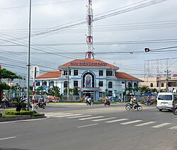
 Cam Ranh Location of in Vietnam | |
| Coordinates: 11°54′49″N 109°8′13″E / 11.91361°N 109.13694°E / 11.91361; 109.13694Coordinates: 11°54′49″N 109°8′13″E / 11.91361°N 109.13694°E / 11.91361; 109.13694 | |
| Country | |
| Province | Khánh Hòa |
| Capital | Cam Ranh |
| Area | |
| • Total | 316 km2 (122 sq mi) |
| Population (2003) | |
| • Total | 121,050 |
| Climate | Aw |
| Website | http://saobiencamranh.net |
Cam Ranh (![]() listen) is a city in southern Khánh Hòa Province, in the South Central Coast region of Vietnam.
listen) is a city in southern Khánh Hòa Province, in the South Central Coast region of Vietnam.
Contents
1 Geography
2 Infrastructures
3 Climate
4 References
5 External links
Geography
It is the second-largest city in the province, after Nha Trang. It is located on Cam Ranh Bay. As of 2009 the city had a population of 121,050.[1] and covers an area of 316 km².[2]
Cam Ranh becomes the second city of Khanh Hoa province from December 23, 2010.
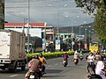
Street in Cam Ranh

Infrastructures
- Cam Ranh International Airport
- Ba Ngoi Port
Climate
| Climate data for Cam Ranh | |||||||||||||
|---|---|---|---|---|---|---|---|---|---|---|---|---|---|
| Month | Jan | Feb | Mar | Apr | May | Jun | Jul | Aug | Sep | Oct | Nov | Dec | Year |
| Record high °C (°F) | 31.5 (88.7) | 33.0 (91.4) | 33.9 (93.0) | 37.1 (98.8) | 38.1 (100.6) | 37.7 (99.9) | 37.4 (99.3) | 39.0 (102.2) | 37.3 (99.1) | 33.4 (92.1) | 32.4 (90.3) | 32.0 (89.6) | 39.0 (102.2) |
| Average high °C (°F) | 28.1 (82.6) | 29.4 (84.9) | 30.9 (87.6) | 32.2 (90.0) | 33.1 (91.6) | 33.2 (91.8) | 33.1 (91.6) | 33.3 (91.9) | 31.9 (89.4) | 30.1 (86.2) | 28.6 (83.5) | 27.5 (81.5) | 31.0 (87.8) |
| Daily mean °C (°F) | 24.3 (75.7) | 24.9 (76.8) | 26.4 (79.5) | 27.9 (82.2) | 28.8 (83.8) | 28.9 (84.0) | 28.7 (83.7) | 28.6 (83.5) | 27.7 (81.9) | 26.6 (79.9) | 25.7 (78.3) | 24.5 (76.1) | 26.9 (80.4) |
| Average low °C (°F) | 21.7 (71.1) | 22.0 (71.6) | 23.1 (73.6) | 24.7 (76.5) | 25.5 (77.9) | 25.6 (78.1) | 25.3 (77.5) | 25.4 (77.7) | 24.6 (76.3) | 23.9 (75.0) | 23.3 (73.9) | 22.3 (72.1) | 24.0 (75.2) |
| Record low °C (°F) | 14.4 (57.9) | 16.4 (61.5) | 17.1 (62.8) | 19.9 (67.8) | 21.5 (70.7) | 21.1 (70.0) | 21.3 (70.3) | 21.0 (69.8) | 21.6 (70.9) | 19.3 (66.7) | 18.7 (65.7) | 15.7 (60.3) | 14.4 (57.9) |
| Average precipitation mm (inches) | 23 (0.9) | 6 (0.2) | 32 (1.3) | 29 (1.1) | 81 (3.2) | 62 (2.4) | 49 (1.9) | 50 (2.0) | 152 (6.0) | 305 (12.0) | 315 (12.4) | 140 (5.5) | 1,243 (48.9) |
| Average precipitation days | 4.7 | 2.5 | 1.9 | 3.4 | 8.2 | 8.0 | 7.7 | 8.7 | 13.7 | 15.4 | 14.2 | 10.8 | 99.2 |
| Average relative humidity (%) | 75.5 | 76.0 | 76.3 | 76.9 | 76.3 | 74.4 | 74.0 | 74.3 | 79.7 | 81.6 | 79.5 | 76.3 | 76.7 |
| Mean monthly sunshine hours | 227 | 238 | 286 | 266 | 255 | 217 | 234 | 224 | 200 | 182 | 167 | 175 | 2,672 |
| Source: Vietnam Institute for Building Science and Technology[3] | |||||||||||||
References
^ http://www.chinhphu.vn/vanbanpq/lawdocs/NQ65CP.PDF?id=103466
^ "Districts of Vietnam". Statoids. Retrieved March 20, 2009..mw-parser-output cite.citation{font-style:inherit}.mw-parser-output .citation q{quotes:"""""""'""'"}.mw-parser-output .citation .cs1-lock-free a{background:url("//upload.wikimedia.org/wikipedia/commons/thumb/6/65/Lock-green.svg/9px-Lock-green.svg.png")no-repeat;background-position:right .1em center}.mw-parser-output .citation .cs1-lock-limited a,.mw-parser-output .citation .cs1-lock-registration a{background:url("//upload.wikimedia.org/wikipedia/commons/thumb/d/d6/Lock-gray-alt-2.svg/9px-Lock-gray-alt-2.svg.png")no-repeat;background-position:right .1em center}.mw-parser-output .citation .cs1-lock-subscription a{background:url("//upload.wikimedia.org/wikipedia/commons/thumb/a/aa/Lock-red-alt-2.svg/9px-Lock-red-alt-2.svg.png")no-repeat;background-position:right .1em center}.mw-parser-output .cs1-subscription,.mw-parser-output .cs1-registration{color:#555}.mw-parser-output .cs1-subscription span,.mw-parser-output .cs1-registration span{border-bottom:1px dotted;cursor:help}.mw-parser-output .cs1-ws-icon a{background:url("//upload.wikimedia.org/wikipedia/commons/thumb/4/4c/Wikisource-logo.svg/12px-Wikisource-logo.svg.png")no-repeat;background-position:right .1em center}.mw-parser-output code.cs1-code{color:inherit;background:inherit;border:inherit;padding:inherit}.mw-parser-output .cs1-hidden-error{display:none;font-size:100%}.mw-parser-output .cs1-visible-error{font-size:100%}.mw-parser-output .cs1-maint{display:none;color:#33aa33;margin-left:0.3em}.mw-parser-output .cs1-subscription,.mw-parser-output .cs1-registration,.mw-parser-output .cs1-format{font-size:95%}.mw-parser-output .cs1-kern-left,.mw-parser-output .cs1-kern-wl-left{padding-left:0.2em}.mw-parser-output .cs1-kern-right,.mw-parser-output .cs1-kern-wl-right{padding-right:0.2em}
^ "Vietnam Building Code Natural Physical & Climatic Data for Construction" (PDF). Vietnam Institute for Building Science and Technology. Archived from the original (PDF) on 22 July 2018. Retrieved 20 July 2018.
External links
| Wikimedia Commons has media related to Cam Ranh. |
- Du lịch Cam Ranh
Districts of Vietnam South Central Coast | ||
|---|---|---|
Da Nang city※ |
|  |
| Bình Định Province |
| |
| Bình Thuận Province |
| |
| Khánh Hòa Province |
| |
| Ninh Thuận Province |
| |
| Phú Yên Province |
| |
| Quảng Nam Province |
| |
| Quảng Ngãi Province |
| |
※ denotes provincial seat. / § Sovereignty over Hoàng Sa Island & Trường Sa Island is disputed as 31 March 2019. | ||
This article about a location in Khánh Hòa Province, Vietnam is a stub. You can help Wikipedia by expanding it. |


