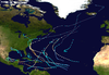
Hurricane Connie
| Category 4 major hurricane (SSHWS/NWS) | |
 Hurricane Connie west of Cape Hatteras | |
| Formed | August 3, 1955 |
|---|---|
| Dissipated | August 15, 1955 |
| Highest winds | 1-minute sustained: 140 mph (220 km/h) |
| Lowest pressure | 944 mbar (hPa); 27.88 inHg |
| Fatalities | 74 total |
| Damage | At least $86 million (1955 USD) |
| Areas affected | Leeward Islands, Puerto Rico, North Carolina, Mid-Atlantic states, New England, Canada |
| Part of the 1955 Atlantic hurricane season | |
Hurricane Connie contributed to significant flooding across the eastern United States in August 1955, just days before Hurricane Diane affected the same general area. Connie formed on August 3 from a tropical wave in the eastern Atlantic Ocean. It moved quickly west-northwestward, strengthening into a hurricane by August 4. Connie first posed a threat to the Lesser Antilles, ultimately passing about 105 mi (165 km) north of the island group. In the United States Virgin Islands, three people died due to the hurricane, and a few homes were destroyed. The outer rainbands produced hurricane-force wind gusts and intense precipitation, reaching 8.65 in (220 mm) in Puerto Rico. On the island, Connie destroyed 60 homes and caused crop damage. After affecting Puerto Rico, Connie reached maximum sustained winds of 140 mph (220 km/h), and a barometric pressure of 944 mbar (27.9 inHg), as observed by the Hurricane Hunters on August 7. The hurricane later weakened, slowed its forward motion, and turned to the north, striking North Carolina on August 12 as a Category 2 on the Saffir-Simpson scale. Connie was the first of three damaging tropical cyclones in the 1955 hurricane season to hit the state, along with Diane and Ione. The storm progressed inland after moving through the Chesapeake Bay region, and was later absorbed by a cold front over Lake Huron on August 15.
Ahead of the storm, the United States Weather Bureau issued widespread hurricane warnings, spurring evacuations, flight cancelations, and beach closures. Connie produced strong winds, high tides, and heavy rainfall as it moved ashore, causing heavy crop damage and 27 deaths in the state. Four people were killed in Washington, D.C. due to a traffic accident caused by slick roads. In Chesapeake Bay, Connie capsized a boat, killing 14 people and prompting a change in Coast Guard regulation. There were six deaths each in Pennsylvania and New Jersey, and eleven deaths in New York, where record rainfall flooded homes and subways. At least 225,000 people nationwide lost power during the storm. Damage in the United States totaled around $86 million (1955 USD).[nb 1] The rains from Connie contributed to flooding from Hurricane Diane that caused $700 million in damage. The remnants of Connie killed three people in Ontario, and also destroyed a few houses and boats in the Canadian province. As a result of its impacts, including a death toll of 74, the name Connie was retired from the Atlantic hurricane naming list.
Contents
1 Meteorological history
2 Preparations
3 Impact
3.1 Caribbean
3.2 United States and Canada
4 Aftermath
5 See also
6 Notes
7 References
8 External links
Meteorological history

Map plotting the track and the intensity of the storm, according to the Saffir–Simpson scale
A tropical wave developed into a tropical depression to the west of the Cape Verde islands on August 3, 1955, based on reports from two nearby ships. The depression moved quickly west-northwestward and intensified into Tropical Storm Connie. A Hurricane Hunters flight on August 4 reported a developing eye feature. Observations from the flight, as well as a nearby ship, suggested that Connie attained hurricane status on August 4. The hurricane continued to intensify as it approached the northern Lesser Antilles, passing about 105 mi (165 km) north of the island group on August 6. Later that day, the storm strengthened to major hurricane status, or a Category 3 on the Saffir-Simpson scale.[1][2]
After passing the Lesser Antilles, Connie turned more to the northwest as it rounded a large ridge. A Hurricane Hunters flight on August 7 observed an eye shaped like an inverted cone – larger at flight-level, and a diameter of 9 mi (15 km) at the surface. The plane also observed a minimum barometric pressure of 944 mbar (27.88 inHg), the lowest in association with the hurricane. Based on the observations, the Hurricane Research Division estimated maximum sustained winds of 140 mph (220 km/h), making Connie a Category 4 hurricane.[2] The hurricane progressed northwestward, passing northeast of The Bahamas. The eye grew in size, and the combination of upwelling and cooler air resulted in weakening. Connie fell below major hurricane status on August 9. A building ridge to its northeast, as well as some interaction with developing Hurricane Diane to its southeast, caused Connie to move slower toward the west-northwest. On August 10, the hurricane turned to the north as it moved toward the southeast United States coast. On August 12, Connie restrengthened slightly, reaching a secondary peak intensity of 100 mph (160 km/h). The hurricane made landfall near Fort Macon State Park in North Carolina at that intensity around 15:00 UTC.[1][2]
Hurricane Connie weakened as it moved through eastern North Carolina. The storm approached the Atlantic coast near the North Carolina/Virginia border. After passing through the Hampton Roads area, Connie turned back to the north-northwest, steered by a strengthening upper-level trough and low, located over Illinois. On August 13, Connie fell below hurricane intensity as it moved through the Chesapeake Bay region. The track shifted to the northwest, and Connie moved across western Pennsylvania, into Lake Ontario. While still a tropical storm, Connie moved across portions of Southwestern Ontario, Lake Huron, and Michigan. On August 15, an approaching cold front absorbed the dissipating storm.[2]
Preparations

Connie rainfall in Puerto Rico
On August 5, Hurricane Connie began to become an apparent threat to the northeastern Caribbean Islands, with maximum winds in the storm reaching 125 mph (205 km/h). The National Weather Bureau issued hurricane warnings for Barbuda, Saba and Antigua. The Virgin Islands and Puerto Rico were placed on hurricane alert as warnings were possible later that day.[3] Along the northern coast of Puerto Rico, the threat of Connie forced 40,000 people to evacuate their homes.[4] After Connie affected Puerto Rico, a storm warning was issued for the northern coast of the Dominican Republic, and a hurricane warning was issued for the eastern Bahamas.[5]
While Connie was meandering in the western Atlantic Ocean, its potential track posed problems for forecasters, due to its slow movement near the southeast United States coastline.[1] On August 7, a hurricane warning was issued from North Carolina to Norfolk, Virginia, with a hurricane alert issued farther north to New York City.[6] The Weather Bureau later extended the hurricane warnings to Delaware Breakwater, with storm warnings farther northeast to Provincetown, Massachusetts. The alert for North Carolina was up for about three days until Connie moved inland.[7]
Ahead of the storm, the United States military flew its planes away from the coast to safer shelters further inland.[8] Two people were killed when they crashed the Navy plane they were evacuating. Naval ships rode out the storm at sea, while small boats were secured at port. The American Red Cross opened at least 79 shelters, and mobilized 41 officials with hurricane experience. The Coast Guard ordered four towns along beaches to evacuate, and overall about 14,000 people evacuated the coastline.[9][10] About 2,000 people evacuated from flood-prone areas in New Bern, North Carolina.[7] In Philadelphia, the Boy Scouts evacuated 800 scouts from Camp Delmont due to the threat of the hurricane.[11] The threat of Connie also canceled a flight by President Dwight Eisenhower from Gettysburg to Washington, D.C., prompting him to travel instead by car.[12] Residents were also evacuated in coastal portions of New Jersey.[13] Beaches were closed in New Jersey and New York. An annual parade in Ocean City, New Jersey was postponed due to the storm. Dozens of flights in and out of the New York area were canceled due to weather conditions. The storm also prompted the Canadian Army to halt military exercises.[14]
Impact

Radar image of Hurricane Connie in the northeastern United States
Caribbean
As the hurricane passed north of the Lesser Antilles, the outer rainbands of Connie produced wind gusts as high as 104 mph (166 km/h) on Tortola in the British Virgin Islands.[4] On Anguilla, sustained winds reached 51 mph (83 km/h).[2] Wind gusts reached 46 mph (74 km/h) in Puerto Rico and the United States Virgin Islands, although there were estimates of 80 mph (130 km/h) wind gusts on Saint Thomas.[4] The outer rainbands of Connie also produced heavy rainfall in the northeastern Caribbean.[1] The highest precipitation total in Puerto Rico was 8.65 in (220 mm) along the lower Río Blanco,[15] of which 7.50 in (191 mm) fell in one day. Rainfall reached 7.04 in (179 mm) in Charlotte Amalie on Saint Thomas. Two people drowned on the island, and one person was electrocuted due to Connie's passage. The hurricane also destroyed a few shacks and boats on Saint Thomas. In Puerto Rico, high winds and waves destroyed 60 poorly-built houses. Connie also damaged crops and utilities in Puerto Rico.[4] Later, San Salvador Island in the Bahamas reported winds of 24 mph (39 km/h).[2]
United States and Canada

Rainfall map from Connie in the United States
Hurricane Connie produced hurricane-force winds in North Carolina and Virginia.[2] Storm-related rainfall spread from the Carolinas through New England, and as far west as Michigan.[15] Across the northeastern United States, many areas were in drought conditions before the storm struck. Unusually moist air caused above normal air and water temperatures, contributing to the high rainfall. The rains from Connie preceded additional rainfall from Hurricane Diane just four days later, which together caused widespread flooding.[16] Along Connie's western periphery, the rainbands spawned at least six tornadoes, of which five in South Carolina and one in North Carolina.[1] Damage from Connie in the United States was estimated at $86,065,000, mostly in North Carolina, Virginia, and Maryland.[17]
When Connie struck North Carolina, it produced sustained winds of 72 mph (116 km/h) in Morehead City, with gusts to 83 mph (134 km/h). Wind gusts near where the hurricane moved ashore reached 100 mph (160 km/h), although it was uncertain whether the gust was estimated or measured.[1]Frying Pan Shoals, located offshore, reported a gust of 92 mph (148 km/h).[18] The hurricane produced tides that were up to 8 ft (2.4 m) above normal while moving slowly ashore, which resulted in significant beach erosion.[1] Tides were higher at Swansboro, North Carolina than during Hurricane Hazel the previous October,[18] and many piers that were rebuilt after Hazel were damaged or destroyed by Connie.[7] The storm surge flooded low-lying portions of Wilmington.[19] High waves in advance of the storm flooded coastal roads along the Outer Banks.[9] Rainfall amounts of over 10 in (250 mm) in the area west of where Connie made landfall.[15] Stream flooding occurred as far inland as Raleigh, but was most significant near the coast.[20] Along the Pamlico River in Washington, National Guardsmen were ordered to help about 1,000 people evacuate during the storm.[7] Outer rainbands knocked out power lines in coastal North Carolina.[18] Flooding-induced rainfall closed U.S. Route 17 near New Bern.[7] Throughout North Carolina, the hurricane caused about $40 million in damage, of which about 75% was from crop damage.[1] There were 27 deaths in the state related to Connie, including traffic deaths, drownings, people in damaged buildings, and electrocutions.[19]
In South Carolina to the south of the center, the hurricane destroyed 40 buildings in Myrtle Beach, South Carolina.[19] As Connie progressed northward, it continued to drop significant amounts of precipitation. Totals of over 10 in (250 mm) were reported on both sides of the Chesapeake Bay, in Pennsylvania, and in southeastern New York.[15] Rainfall in Richmond, Virginia totaled 8.79 in (223 mm) on August 12, breaking the day's precipitation record.[21] Severe river flooding occurred in Virginia, from the coast inland to Richmond.[20] Floods washed out a portion of the Richmond, Fredericksburg and Potomac Railroad near Lankford, and covered portions of U.S. 1 and U.S. 301. The storm downed trees and caused scattered power outages for at least 5,000 people in the state.[21] Ten river gauges in Virginia, as well as sixteen in neighboring Maryland, reached the highest stage on record.[20] In Washington D.C., slick roads caused a car accident that killed four people, after a car was sideswiped and knocked into a swollen creek where the occupants drowned.[22]
The combination of strong winds and high waves wrecked a 125 ft (38 m) schooner in the Chesapeake Bay named the Levin J. Marvel.[19] The 64–year old boat was described as "unseaworthy" when it left from Annapolis, Maryland, and capsized near Fairhaven. Of the 23 passengers and four crew members, 14 people drowned, making it "one of the worst maritime calamities in the history of Tidewater Maryland", as described by The Baltimore Sun. The other passengers were later rescued after holding onto wreckage.[23]
Record rainfall also occurred in Philadelphia and New York City.[24] The highest precipitation related to Connie was 13.24 in (336 mm) at Fort Schuyler in New York. Rainfall also extended as far west as Michigan and as far east as Maine.[15] In Delaware, the rains caused flooding that was described as "inconsequential" by the United States Geological Survey, due to preceding drought conditions.[25] Rainfall reached 9 in (230 mm) in southeastern Pennsylvania, causing flooding that entered basements in low-lying areas and covered roads. Two people drowned after floods swept away their cars.[26] There were six deaths in the state, and also six deaths in neighboring New Jersey.[24] Hurricane Connie brought the heaviest rain seen in New York in over 50 years, dropping 5.32 in (135 mm) in New York City within a 20-hour span.[22] Large areas of the city, including subways and thousands of houses, were flooded, and about 100,000 people were left without power.[27] Between New York and New Jersey, about 225,000 people lost power.[28] High winds and tides from the storm cancelled ferry service,[27] and forced LaGuardia Airport to temporarily shut down after flooding reached 1 ft (0.30 m) deep.[19][24] The rains caused heavy damage across southeastern New York,[25] and 11 people were killed across the state.[24] In coastal Connecticut, the rainfall from Connie increased levels along streams, but there was little damage.[20]
Farther inland, gusts from Connie reached 65 mph (105 km/h) along Lake Huron in Michigan, which caused high waves that damaged or sank many small boats. Damage in the state was estimated at $150,000.[29] Before Connie affected Canada, residents in Humber valley prepared for potential evacuations, after Hurricane Hazel in the previous October produced deadly flooding.[30] When the remnants of Connie entered Ontario on August 14, it continued to produce winds of up to 46 mph (75 km/h), and the storm dropped 2.56 in (65 mm) of rainfall near the Great Lakes. In Burlington, 27 boats were destroyed, and one person drowned in Lake Erie after his boat sank. Two other people drowned in the province. Connie destroyed six houses and damaged several others due to high waves. The storm also caused power outages and damage to the tobacco crop.[31]
Aftermath
Flooding caused by Connie generally did not attract much media attention; however, the floods were important in setting the conditions for later significant flooding across the northeastern United States.[20] Just five days after Connie struck North Carolina,[1] Hurricane Diane affected the same area, but instead of continuing to the northwest it turned to the northeast. Diane produced further rainfall in already wet areas from Connie.[32] Damage from Diane totaled at least $700 million,[1] and six states were declared federal disaster areas from the combined hurricanes' impact; this allowed federal assistance for the affected areas.[32]
The loss of the Levin J. Marvel during the hurricane prompted the United States Congress to pass a law in 1956, which allowed the Coast Guard to inspect all vessels with more than six passengers; the previous law only allowed inspections for boats of more than 700 tons, greatly higher than the 183 tons that the Marvel weighed. A federal courthouse charged the inexperienced captain with negligence, giving him a one-year probation.[23]
Due to its destructive impacts, the name Connie was retired from the Atlantic hurricane naming list.[33]
See also
- List of North Carolina hurricanes (1950–1979)
1933 Chesapeake–Potomac hurricane – one of the most damaging hurricanes in the Mid-Atlantic
Hurricane Isabel – a hurricane in 2003 that also struck North Carolina and also moved over the Great Lakes
Notes
^ All damage totals are in 1955 United States dollars unless otherwise noted.
References
^ abcdefghij
Gordon E. Dunn; Walter R. Davis; Paul L. Moore (December 1955). "Hurricanes of 1955" (PDF). United States Weather Bureau; Monthly Weather Review. Archived (PDF) from the original on 2017-05-07. Retrieved March 5, 2019..mw-parser-output cite.citation{font-style:inherit}.mw-parser-output .citation q{quotes:"""""""'""'"}.mw-parser-output .citation .cs1-lock-free a{background:url("//upload.wikimedia.org/wikipedia/commons/thumb/6/65/Lock-green.svg/9px-Lock-green.svg.png")no-repeat;background-position:right .1em center}.mw-parser-output .citation .cs1-lock-limited a,.mw-parser-output .citation .cs1-lock-registration a{background:url("//upload.wikimedia.org/wikipedia/commons/thumb/d/d6/Lock-gray-alt-2.svg/9px-Lock-gray-alt-2.svg.png")no-repeat;background-position:right .1em center}.mw-parser-output .citation .cs1-lock-subscription a{background:url("//upload.wikimedia.org/wikipedia/commons/thumb/a/aa/Lock-red-alt-2.svg/9px-Lock-red-alt-2.svg.png")no-repeat;background-position:right .1em center}.mw-parser-output .cs1-subscription,.mw-parser-output .cs1-registration{color:#555}.mw-parser-output .cs1-subscription span,.mw-parser-output .cs1-registration span{border-bottom:1px dotted;cursor:help}.mw-parser-output .cs1-ws-icon a{background:url("//upload.wikimedia.org/wikipedia/commons/thumb/4/4c/Wikisource-logo.svg/12px-Wikisource-logo.svg.png")no-repeat;background-position:right .1em center}.mw-parser-output code.cs1-code{color:inherit;background:inherit;border:inherit;padding:inherit}.mw-parser-output .cs1-hidden-error{display:none;font-size:100%}.mw-parser-output .cs1-visible-error{font-size:100%}.mw-parser-output .cs1-maint{display:none;color:#33aa33;margin-left:0.3em}.mw-parser-output .cs1-subscription,.mw-parser-output .cs1-registration,.mw-parser-output .cs1-format{font-size:95%}.mw-parser-output .cs1-kern-left,.mw-parser-output .cs1-kern-wl-left{padding-left:0.2em}.mw-parser-output .cs1-kern-right,.mw-parser-output .cs1-kern-wl-right{padding-right:0.2em}
^ abcdefg Documentation of Atlantic Tropical Cyclones Changes in HURDAT (Report). Hurricane Research Division. May 2015. Archived from the original on 2011-06-04. Retrieved February 28, 2019.
^ "Hurricane Connie Nears Leeward Isles". Free Lance-Star. Associated Press. August 5, 1955. Retrieved March 4, 2019.
^ abcd Climatological Data: Puerto Rico and Virgin Islands. 1. Asheville, North Carolina: United States Weather Bureau. 1957. p. 54. Retrieved March 4, 2019.
^ "Puerto Rico Escapes Lash of Hurricane". Daytona Beach Morning-Herald. Associated Press. August 6, 1955. Retrieved March 4, 2019.
^ "Hurricane Connie on Her Way". The Nevada Daily Mail. Associated Press. August 7, 1955. Retrieved March 4, 2019.
^ abcde
"Coastal, NC Hurricane Connie Strikes Coast, Aug 1955". The Robesonian. August 12, 1955. GenDisasters.com. Archived from the original on 2018-04-17. Retrieved March 4, 2019.
^ "Connie May Chase Planes and Curb Talbott Farewell". The Milwaukee Journal. Associated Press. August 10, 1955. Retrieved March 4, 2019.
^ ab "Hurricane Idles 225 Miles SE Wilmington Pointing at N.C." The Robesonian. August 10, 1955. Retrieved January 23, 2013.
^ "Hurricane Loses Some Punch Raking Northward Along N. Carolina Coast". Ellensburg Daily Record. Associated Press. August 12, 1955. Retrieved March 4, 2019.
^
"Connie Speeds Closing of Boy Scout Camp". The Reading Eagle. Associated Press. August 11, 1955. Archived from the original on 2017-05-11. Retrieved March 4, 2019.
^ "Eisenhower Abandons Plane Trip Because of Hurricane". The Reading Eagle. Associated Press. August 11, 1955. Retrieved March 4, 2019.
^ "Connie Loses Punch After Taking 28 Lives, Causing Millions in Damage". The Times Daily. Associated Press. August 13, 1955. Retrieved March 4, 2019.
^ Charles Grutzner (August 12, 1955). "City Alert Ended as Connie Whirls Toward Carolina". The New York Times. Retrieved March 7, 2019. – via The New York Times (subscription required)
^ abcde
David M. Roth (March 6, 2013). "Hurricane Connie - August 6-14, 1955". Weather Prediction Center. Archived from the original on 2018-08-23. Retrieved March 4, 2019.
^ Jerome Namias; Carlos R. Dunn (August 1955). "The Weather and Circulation of August 1955" (PDF). United States Weather Bureau; Monthly Weather Review. Retrieved March 9, 2019.
^ E.V.W. Jones (February 5, 1956). "1955 Broke All Records for Hurricane Damage". Meriden Record. Retrieved March 9, 2019.
^ abc "Hurricane Connie Is Losing Punch; Carolina Area Pounded". The Reading Eagle. Associated Press. August 11, 1955. Retrieved March 9, 2019.
^ abcde David Longshore (2008). Encyclopedia of Hurricanes, Typhoons, and Cyclones, New Edition. Facts on File, Inc. p. 105. ISBN 9781438118796. Retrieved March 9, 2019.
^ abcde Floods of August-October 1955: New England to North Carolina. Washington, D.C.: United States Geological Survey. 1960. pp. 15, 27. Retrieved March 9, 2019.
^ ab "Connie's Heavy Rains Do Moderate Damage". The Free Lance-Star. August 13, 1955. Retrieved March 9, 2019.
^ ab "Vacationers Caught As Gales Spread Out". The Victoria Advocate. United Press. August 13, 1955. Retrieved March 9, 2019.
^ ab
Frederick N. Rasmussen (April 24, 2004). "Ship was a tragedy waiting to happen". The Baltimore Sun. Archived from the original on 2015-10-15. Retrieved March 9, 2019.
^ abcd "Hurricane Connie Now Medium-Sized". Lewiston Morning-Tribune. Associated Press. August 14, 1955. Retrieved January 24, 2013.
^ ab National Weather Summary - Hydrologic Events and Floods and Droughts. United States Geological Survey. 1991. pp. 225, 419. Retrieved March 9, 2019.
^ Ben Gelber (2002). The Pennsylvania Weather Book. pp. 204, 235. ISBN 9780813530567. Retrieved January 23, 2013.
^ ab "New York Wallows in Heavy Rains". The Times Daily. Associated Press. August 13, 1955. Archived from the original on 2017-05-11. Retrieved March 9, 2019.
^ "Waning Hurricane Connie Poses Threat to Ontario". The Vancouver Sun. Associated Press. August 13, 1955. Retrieved March 9, 2019.
^ Lucius W. Dye (August 1955). Climatological Data: Michigan. 70. p. 116. Retrieved March 9, 2019.
^ "Humber Valley Ready for Hurricane Connie". The Vancouver Sun. August 10, 1955. Retrieved March 9, 2019.
^ 1955-Connie (Report). Environment Canada. 2009-11-09. Retrieved March 9, 2019.
^ ab Lee Davis (2008). "Hurricanes". Natural Disasters. Facts on File Science Library. p. 282. Retrieved March 9, 2019.
^ Gary Padgett; Jack Beven; James Lewis Free; Sandy Delgado (May 23, 2012). Subject: B3) What storm names have been retired? (Report). Hurricane Research Division. Archived from the original on December 6, 2006. Retrieved March 9, 2019.
External links
| Wikimedia Commons has media related to Hurricane Connie. |
- Flood of '55 from The Hartford Courant
Retired Atlantic hurricane names | |
|---|---|
| 1950s |
|
| 1960s |
|
| 1970s |
|
| 1980s |
|
| 1990s |
|
| 2000s |
|
| 2010s |
|
| |
Tropical cyclones of the 1955 Atlantic hurricane season | ||||||||||||||||||||||||||||||
|---|---|---|---|---|---|---|---|---|---|---|---|---|---|---|---|---|---|---|---|---|---|---|---|---|---|---|---|---|---|---|
 |
| |||||||||||||||||||||||||||||
| ||||||||||||||||||||||||||||||


