Kamilaroi Highway
Kamilaroi Highway New South Wales | |
|---|---|
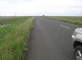 | |
A small mirage on the Kamilaroi Highway near Cryon. | |
 | |
| General information | |
| Type | Highway |
| Length | 605 km (376 mi)[1] |
| Route number(s) |
|
| Former route number |
|
| Major junctions | |
| NW end |
|
| |
| SE end |
|
| Location(s) | |
| Major settlements | Brewarrina, Walgett, Cryon, Burren Junction, Wee Waa, Narrabri, Boggabri, Gunnedah, Curlewis, Breeza, Quirindi, Braefield |
| Highway system | |
| |
The Kamilaroi Highway is a 605-kilometre (376 mi)[1] state highway located in the north-western region of New South Wales, Australia. The highway's northwestern terminus is at a junction with the Mitchell Highway at Bourke. Its southeastern terminus is a junction with the New England Highway north of Willow Tree.
The highway is named after the Kamilaroi Indigenous Australian people who live in the area.[citation needed]
Contents
1 History
2 Major junctions
3 Route attractions and features
4 See also
5 References
6 External links
History
It was formerly signed National Route 37, poorly west of Walgett. This route was replaced by the alpha numeric route number B51 between the New England Highway and Newell Highway, before continuing to Walgett unnumbered. Here at its junction with the Castlereagh Highway it becomes the B76, and continues along the formerly largely unsigned part of National Route 37 towards Bourke and the Mitchell Highway. Its status as a highway is fairly new, having only become State Highway 29 in February 1999, the same point in time that it was named the Kamilaroi Highway.
The Kamilaroi Highway crosses the Bogan River 43 kilometres (27 mi) east of Bourke.[2]
The Brewarrina Lift Bridge which was built in 1888 over Barwon River on the Kamilaroi Highway has been assessed as being of State significance.[3]
Major junctions
| LGA | Location | km[1] | mi | Destinations | Notes | |
|---|---|---|---|---|---|---|
| Bourke | Bourke | 0 | 0.0 | T intersection northwestern terminus; north and southeast (B71) as the Mitchell Highway; south (B87) as the Kidman Way | ||
| Barwon River | 42 | 26 | Bourke Bridge | |||
| Brewarrina | Brewarrina | 97 | 60 | Belmore Street – Walgett, Goodooga | Uncontrolled 4-way intersection; | |
| Barwon River | 99 | 62 | Brewarrina Lift Bridge | |||
| Brewarrina | Brewarrina | 105 | 65 | Goodooga Road – Goodooga | T intersection; Kamilaroi Highway (B76) continues southeast | |
| Barwon River | 224 | 139 | Dangar Bridge | |||
| Walgett | Walgett | 223 | 139 | Ginge Road | T intersection; Kamilaroi Highway (B76) continues south | |
| 230 | 140 | Roundabout; Kamilaroi Highway (B76) continues east | ||||
| Namoi River | 231 | 144 | Bridge (no known official name) | |||
| Walgett | Walgett | 235 | 146 | T intersection; concurrency terminus; Kamilaroi Highway continues south | ||
| Namoi River | 370 | 230 | Tulladunna Bridge | |||
| Namoi River | 379 | 235 | Collins Bridge | |||
| Narrabri | Narrabri | 412 | 256 | T intersection; Kamilaroi Highway continues south | ||
| Narrabri Creek | 413 | 257 | Narrabri Creek Bridge | |||
| Narrabri | Narrabri | 417 | 259 | Roundabout; concurrency terminus; | ||
| Gunnedah | Gunnedah | 509 | 316 | Uncontrolled 4-way intersection; Kamilaroi Highway continues south | ||
| 512 | 318 | Roundabout; concurrency terminus; | ||||
| Liverpool Plains | Willow Tree | 605 | 376 | Directional T interchange; southeastern terminus; continues north and south as the New England Highway (A15) | ||
1.000 mi = 1.609 km; 1.000 km = 0.621 mi
| ||||||
Route attractions and features
Approximately 5 kilometres (3 mi) north of Boggabri is a spectacular landmark called Gin’s Leap, that was known in the days of Cobb and Co as "The Rock". It is said that a young Aboriginal girl, being pursued by white settlers on horseback, jumped to her death rather than be raped and shot like others in her family.[4]
See also
@media all and (max-width:720px){.mw-parser-output .mobile-float-reset{float:none!important;width:100%!important}}.mw-parser-output .stack-container{box-sizing:border-box}.mw-parser-output .stack-clear-left{float:left;clear:left}.mw-parser-output .stack-clear-right{float:right;clear:right}.mw-parser-output .stack-left{float:left}.mw-parser-output .stack-right{float:right}.mw-parser-output .stack-object{margin:1px;overflow:hidden}
- Highways in Australia
- List of highways in New South Wales
References
^ abc 1 Warraweena Street, Bourke NSW 2840 to New England Highway, Willow Tree NSW 2339 (Map). Google Maps, Google Inc. 2016. Retrieved 30 October 2016..mw-parser-output cite.citation{font-style:inherit}.mw-parser-output .citation q{quotes:"""""""'""'"}.mw-parser-output .citation .cs1-lock-free a{background:url("//upload.wikimedia.org/wikipedia/commons/thumb/6/65/Lock-green.svg/9px-Lock-green.svg.png")no-repeat;background-position:right .1em center}.mw-parser-output .citation .cs1-lock-limited a,.mw-parser-output .citation .cs1-lock-registration a{background:url("//upload.wikimedia.org/wikipedia/commons/thumb/d/d6/Lock-gray-alt-2.svg/9px-Lock-gray-alt-2.svg.png")no-repeat;background-position:right .1em center}.mw-parser-output .citation .cs1-lock-subscription a{background:url("//upload.wikimedia.org/wikipedia/commons/thumb/a/aa/Lock-red-alt-2.svg/9px-Lock-red-alt-2.svg.png")no-repeat;background-position:right .1em center}.mw-parser-output .cs1-subscription,.mw-parser-output .cs1-registration{color:#555}.mw-parser-output .cs1-subscription span,.mw-parser-output .cs1-registration span{border-bottom:1px dotted;cursor:help}.mw-parser-output .cs1-ws-icon a{background:url("//upload.wikimedia.org/wikipedia/commons/thumb/4/4c/Wikisource-logo.svg/12px-Wikisource-logo.svg.png")no-repeat;background-position:right .1em center}.mw-parser-output code.cs1-code{color:inherit;background:inherit;border:inherit;padding:inherit}.mw-parser-output .cs1-hidden-error{display:none;font-size:100%}.mw-parser-output .cs1-visible-error{font-size:100%}.mw-parser-output .cs1-maint{display:none;color:#33aa33;margin-left:0.3em}.mw-parser-output .cs1-subscription,.mw-parser-output .cs1-registration,.mw-parser-output .cs1-format{font-size:95%}.mw-parser-output .cs1-kern-left,.mw-parser-output .cs1-kern-wl-left{padding-left:0.2em}.mw-parser-output .cs1-kern-right,.mw-parser-output .cs1-kern-wl-right{padding-right:0.2em}
^ "Bogan River Bridge Replacement HW29". NSW eTendering. Government of New South Wales. 2011. Retrieved 21 October 2012.
^ "Brewarrina Bridge over Barwon River, The". Office of Heritage & Environment. Government of New South Wales. 14 August 2002. Retrieved 4 November 2016.
^ Elder, Bruce. Blood on the Wattle: Massacres and maltreatment of Aboriginal Australians since 1788. New Holland Publishers Ltd. ISBN 1864364106.
External links
![]() Media related to Kamilaroi Highway at Wikimedia Commons
Media related to Kamilaroi Highway at Wikimedia Commons
Kamilaroi Highway website - website
"The Kamilaroi Highway" (PDF brochure). www.kamilaroihighway.com.au. The Kamilaroi Highway Project. 2013.
Kamilaroi Highway - Narrabri information website
Road infrastructure in regional New South Wales | ||
|---|---|---|
| Motorways |
| |
| National highways |
| |
| Highways |
| |
| Local highways |
| |
| Bridges |
| |
| Tunnels |
| |
| Proposals |
| |


