Granger, Texas
Granger, Texas | |
|---|---|
City | |
 Historic former city hall in downtown Granger | |
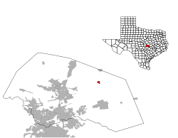
 Location of Granger, Texas | |
 | |
| Coordinates: 30°43′5″N 97°26′28″W / 30.71806°N 97.44111°W / 30.71806; -97.44111Coordinates: 30°43′5″N 97°26′28″W / 30.71806°N 97.44111°W / 30.71806; -97.44111 | |
| Country | United States |
| State | Texas |
| County | Williamson |
| Area | |
| • Total | 0.7 sq mi (1.7 km2) |
| • Land | 0.7 sq mi (1.7 km2) |
| • Water | 0.0 sq mi (0.0 km2) |
| Elevation | 577 ft (176 m) |
| Population (2010) | |
| • Total | 1,419 |
| • Density | 2,000/sq mi (830/km2) |
| Time zone | UTC-6 (Central (CST)) |
| • Summer (DST) | UTC-5 (CDT) |
| ZIP code | 76530 |
| Area code(s) | 512 & 737 |
| FIPS code | 48-30548[1] |
GNIS feature ID | 1358264[2] |
Granger is a city in Williamson County, Texas, United States. The population was 1,419 at the 2010 census. Granger was the site for the filming of the 2003 remake of The Texas Chainsaw Massacre and the 2010 remake of the movie True Grit, as well as an episode of the NBC drama Revolution.
Contents
1 History
2 Geography
3 Demographics
4 Education
5 Climate
6 References
7 External links
8 Gallery
History
In the late 19th century, Granger was one of the centers of the large Moravian Czech immigrant population in Texas. This Czech Texan heritage is evidenced by the historic Catholic Church, Czech Brethren Church, and SPJST hall. Jno P. Trlica, the son of a Moravian immigrant, set up a photography business here. His photos offer a rare look into the places and people of Granger in the early 20th century.[3]
Geography
Granger is located at 30°43′05″N 97°26′28″W / 30.718081°N 97.440996°W / 30.718081; -97.440996 (30.718081, -97.440996),[4] 36 miles (58 km) northeast of Austin. Granger Lake is located just east of the city.
According to the United States Census Bureau, the city has a total area of 0.7 square miles (1.7 km2), all of it land.
Demographics
| Historical population | |||
|---|---|---|---|
| Census | Pop. | %± | |
| 1890 | 261 | — | |
| 1900 | 841 | 222.2% | |
| 1910 | 1,708 | 103.1% | |
| 1920 | 1,944 | 13.8% | |
| 1930 | 1,703 | −12.4% | |
| 1940 | 1,723 | 1.2% | |
| 1950 | 1,637 | −5.0% | |
| 1960 | 1,339 | −18.2% | |
| 1970 | 1,256 | −6.2% | |
| 1980 | 1,236 | −1.6% | |
| 1990 | 1,190 | −3.7% | |
| 2000 | 1,299 | 9.2% | |
| 2010 | 1,419 | 9.2% | |
| Est. 2016 | 1,514 | [5] | 6.7% |
| U.S. Decennial Census[6] | |||
As of the census[1] of 2010, there were 1,419 people, 502 households, and 323 families residing in the city. The population density was 1,951.6 people per square mile (748.6/km2). There were 565 housing units at an average density of 848.8/sq mi (325.6/km2). The racial makeup of the city was 81.37% White, 8.55% African American, 0.31% Native American, 0.31% Asian, 0.08% Pacific Islander, 8.47% from other races, and 0.92% from two or more races. Hispanic or Latino of any race were 25.40% of the population.
There were 502 households out of which 35.7% had children under the age of 18 living with them, 49.4% were married couples living together, 11.2% had a female householder with no husband present, and 35.5% were non-families. 33.5% of all households were made up of individuals and 19.7% had someone living alone who was 65 years of age or older. The average household size was 2.48 and the average family size was 3.20.
In the city, the population was spread out with 27.0% under the age of 18, 7.8% from 18 to 24, 25.5% from 25 to 44, 18.9% from 45 to 64, and 20.9% who were 65 years of age or older. The median age was 37 years. For every 100 females, there were 89.6 males. For every 100 females age 18 and over, there were 85.9 males.
The median income for a household in the city was $32,542, and the median income for a family was $37,188. Males had a median income of $30,000 versus $21,250 for females. The per capita income for the city was $12,254. About 11.5% of families and 12.0% of the population were below the poverty line, including 12.6% of those under age 18 and 21.3% of those age 65 or over.
Education
The City of Granger is served by the Granger Independent School District. It is home of the Granger Lions.
Climate
The climate in this area is characterized by hot, humid summers and generally mild to cool winters. According to the Köppen Climate Classification system, Granger has a humid subtropical climate, abbreviated "Cfa" on climate maps.[7]
References
^ ab "American FactFinder". United States Census Bureau. Archived from the original on 2013-09-11. Retrieved 2008-01-31..mw-parser-output cite.citation{font-style:inherit}.mw-parser-output q{quotes:"""""""'""'"}.mw-parser-output code.cs1-code{color:inherit;background:inherit;border:inherit;padding:inherit}.mw-parser-output .cs1-lock-free a{background:url("//upload.wikimedia.org/wikipedia/commons/thumb/6/65/Lock-green.svg/9px-Lock-green.svg.png")no-repeat;background-position:right .1em center}.mw-parser-output .cs1-lock-limited a,.mw-parser-output .cs1-lock-registration a{background:url("//upload.wikimedia.org/wikipedia/commons/thumb/d/d6/Lock-gray-alt-2.svg/9px-Lock-gray-alt-2.svg.png")no-repeat;background-position:right .1em center}.mw-parser-output .cs1-lock-subscription a{background:url("//upload.wikimedia.org/wikipedia/commons/thumb/a/aa/Lock-red-alt-2.svg/9px-Lock-red-alt-2.svg.png")no-repeat;background-position:right .1em center}.mw-parser-output .cs1-subscription,.mw-parser-output .cs1-registration{color:#555}.mw-parser-output .cs1-subscription span,.mw-parser-output .cs1-registration span{border-bottom:1px dotted;cursor:help}.mw-parser-output .cs1-hidden-error{display:none;font-size:100%}.mw-parser-output .cs1-visible-error{font-size:100%}.mw-parser-output .cs1-subscription,.mw-parser-output .cs1-registration,.mw-parser-output .cs1-format{font-size:95%}.mw-parser-output .cs1-kern-left,.mw-parser-output .cs1-kern-wl-left{padding-left:0.2em}.mw-parser-output .cs1-kern-right,.mw-parser-output .cs1-kern-wl-right{padding-right:0.2em}
^ "US Board on Geographic Names". United States Geological Survey. 2007-10-25. Retrieved 2008-01-31.
^ williamson-county-historical-commission.org http://www.williamson-county-historical-commission.org/Granger/Granger_Texas_in_Williamson_County.htm. Missing or empty|title=(help)
^ "US Gazetteer files: 2010, 2000, and 1990". United States Census Bureau. 2011-02-12. Retrieved 2011-04-23.
^ "Population and Housing Unit Estimates". Retrieved June 9, 2017.
^ "Census of Population and Housing". Census.gov. Archived from the original on May 12, 2015. Retrieved June 4, 2015.
^ Climate Summary for Granger, Texas
External links
- Williamson County Historical Commission page on Granger
Granger from the Handbook of Texas Online
Gallery

Granger 1893.
W O Davidson, 1st bale, 1913.

Saints Cyril and Methodius Catholic Church, 2016.


Municipalities and communities of Williamson County, Texas, United States | ||
|---|---|---|
County seat: Georgetown | ||
| Cities |
|  |
| CDPs |
| |
| Unincorporated communities |
| |
| Ghost town |
| |
| Footnotes | ‡This populated place also has portions in an adjacent county or counties | |
Austin (capital) | ||
| Topics |
|  Seal of Texas |
| Society |
| |
| Regions |
| |
| Metropolitan areas |
| |
| Counties | See: List of counties in Texas | |


