Imphal West district
Imphal West district | |
|---|---|
district | |
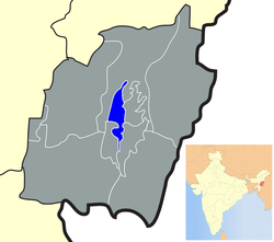 Location of Imphal West district in Manipur | |
| Coordinates: 24°49′N 93°54′E / 24.817°N 93.900°E / 24.817; 93.900Coordinates: 24°49′N 93°54′E / 24.817°N 93.900°E / 24.817; 93.900 | |
| Country | |
| State | Manipur |
| Headquarters | Lamphelpat |
| Area | |
| • Total | 558 km2 (215 sq mi) |
| Population (2011) | |
| • Total | 514,683 |
| • Density | 920/km2 (2,400/sq mi) |
| Languages | |
| • Official | Meiteilon (Manipuri) |
| Time zone | UTC+5:30 (IST) |
| ISO 3166 code | IN-MN-WI |
| Vehicle registration | MN |
| Website | imphalwest.nic.in |
Imphal West district (Pron:/ˈɪmfəl or ɪmˈfɑːl/) is one of the sixteen districts of Manipur state in northeastern India. As of 2011 it is the most populous district in the state.[1]
Contents
1 Geography
1.1 Climate
2 Economy
3 Demographics
4 Administrative divisions
5 Areas under Imphal Urban Agglomoration
6 References
7 External links
Geography
Lamphelpat city is the administrative headquarters of the district. The district occupies an area of 558 km2.
Climate
| Imphal | ||||||||||||||||||||||||||||||||||||||||||||||||||||||||||||
|---|---|---|---|---|---|---|---|---|---|---|---|---|---|---|---|---|---|---|---|---|---|---|---|---|---|---|---|---|---|---|---|---|---|---|---|---|---|---|---|---|---|---|---|---|---|---|---|---|---|---|---|---|---|---|---|---|---|---|---|---|
| Climate chart (explanation) | ||||||||||||||||||||||||||||||||||||||||||||||||||||||||||||
| ||||||||||||||||||||||||||||||||||||||||||||||||||||||||||||
| ||||||||||||||||||||||||||||||||||||||||||||||||||||||||||||
Economy
The district ranks first on the basis of "District Infrastructure Index " calculated under the patronage of Ministry of North East Region(DoNER).[2][clarification needed]
Demographics
According to the 2011 census Imphal West district has a population of 514,683,[1] roughly equal to the nation of Cape Verde.[3] This gives it a ranking of 545th in India (out of a total of 640).[1] The district has a population density of 992 inhabitants per square kilometre (2,570/sq mi) .[1] Its population growth rate over the decade 2001-2011 was 15.82%.[1] Imphal West has a sex ratio of 1029 females for every 1000 males,[1] and a literacy rate of 86.7%.[1]
Administrative divisions
The district is divided into 4 sub-divisions and 10 Circles:
- Lamphalphat Sub-Division: Lamphelpat
- Patsoi Sub-Division: Patsoi, Konthoujam
- Lamsang Sub-Division: Salam, Lamsang, Sekmai
- Wangoi Sub-Division: Hiyangthang, Lilong Chajing, Wangoi, Mayang Imphal
Areas under Imphal Urban Agglomoration
- Lamphelpat
- Patsoi
- Hiyangthang
- Lilong Chajing
References
^ abcdefg "District Census 2011". Census2011.co.in. 2011. Retrieved 2011-09-30..mw-parser-output cite.citation{font-style:inherit}.mw-parser-output q{quotes:"""""""'""'"}.mw-parser-output code.cs1-code{color:inherit;background:inherit;border:inherit;padding:inherit}.mw-parser-output .cs1-lock-free a{background:url("//upload.wikimedia.org/wikipedia/commons/thumb/6/65/Lock-green.svg/9px-Lock-green.svg.png")no-repeat;background-position:right .1em center}.mw-parser-output .cs1-lock-limited a,.mw-parser-output .cs1-lock-registration a{background:url("//upload.wikimedia.org/wikipedia/commons/thumb/d/d6/Lock-gray-alt-2.svg/9px-Lock-gray-alt-2.svg.png")no-repeat;background-position:right .1em center}.mw-parser-output .cs1-lock-subscription a{background:url("//upload.wikimedia.org/wikipedia/commons/thumb/a/aa/Lock-red-alt-2.svg/9px-Lock-red-alt-2.svg.png")no-repeat;background-position:right .1em center}.mw-parser-output .cs1-subscription,.mw-parser-output .cs1-registration{color:#555}.mw-parser-output .cs1-subscription span,.mw-parser-output .cs1-registration span{border-bottom:1px dotted;cursor:help}.mw-parser-output .cs1-hidden-error{display:none;font-size:100%}.mw-parser-output .cs1-visible-error{font-size:100%}.mw-parser-output .cs1-subscription,.mw-parser-output .cs1-registration,.mw-parser-output .cs1-format{font-size:95%}.mw-parser-output .cs1-kern-left,.mw-parser-output .cs1-kern-wl-left{padding-left:0.2em}.mw-parser-output .cs1-kern-right,.mw-parser-output .cs1-kern-wl-right{padding-right:0.2em}
^ "District at a glance". Imphal West district website. Retrieved 19 May 2010.
^ US Directorate of Intelligence. "Country Comparison:Population". Retrieved 2011-10-01.Cape Verde 516,100 July 2011 est.
External links
- Official district government website
Places adjacent to Imphal West district | ||||||||||
|---|---|---|---|---|---|---|---|---|---|---|
| ||||||||||


