Płock County
Płock County Powiat płocki | |||
|---|---|---|---|
County | |||
| |||
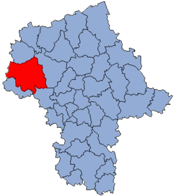 Location within the voivodeship | |||
 Division into gminas | |||
| Coordinates (Płock): 52°33′N 19°42′E / 52.550°N 19.700°E / 52.550; 19.700Coordinates: 52°33′N 19°42′E / 52.550°N 19.700°E / 52.550; 19.700 | |||
| Country | |||
| Voivodeship | Masovian | ||
| Seat | Płock | ||
| Gminas | Total 15
| ||
| Area | |||
| • Total | 1,798.71 km2 (694.49 sq mi) | ||
| Population (2006) | |||
| • Total | 106,455 | ||
| • Density | 59/km2 (150/sq mi) | ||
| • Urban | 9,889 | ||
| • Rural | 96,566 | ||
| Car plates | WPL | ||
| Website | http://www.powiat.plock.pl | ||


Płock County (Polish: powiat płocki) is a unit of territorial administration and local government (powiat) in Masovian Voivodeship, east-central Poland. It came into being on January 1, 1999, as a result of the Polish local government reforms passed in 1998. Its administrative seat is the city of Płock, although the city is not part of the county (it constitutes a separate city county). The county contains three towns: Gąbin, 17 km (11 mi) south of Płock, Drobin, 29 km (18 mi) north-east of Płock, and Wyszogród, 39 km (24 mi) south-east of Płock.
The county covers an area of 1,798.71 square kilometres (694.5 sq mi). As of 2006 its total population is 106,455, out of which the population of Gąbin is 4,137, that of Drobin is 2,980, that of Wyszogród is 2,772, and the rural population is 96,566.
Neighbouring counties
Apart from the city of Płock, Płock County is also bordered by Sierpc County to the north, Płońsk County to the east, Sochaczew County to the south-east, Gostynin County to the south-west, Włocławek County to the west and Lipno County to the north-west.
Administrative division
The county is subdivided into 15 gminas (three urban-rural and 12 rural). These are listed in the following table, in descending order of population.
Gmina | Type | Area (km²) | Population (2006) | Seat |
Gmina Gąbin | urban-rural | 146.7 | 10,858 | Gąbin |
Gmina Stara Biała | rural | 111.1 | 10,040 | Biała |
Gmina Bielsk | rural | 125.5 | 8,936 | Bielsk |
Gmina Drobin | urban-rural | 143.2 | 8,531 | Drobin |
Gmina Bodzanów | rural | 136.8 | 8,372 | Bodzanów |
Gmina Brudzeń Duży | rural | 161.8 | 7,806 | Brudzeń Duży |
Gmina Staroźreby | rural | 137.6 | 7,576 | Staroźreby |
Gmina Radzanowo | rural | 104.3 | 7,322 | Radzanowo |
Gmina Mała Wieś | rural | 108.9 | 6,358 | Mała Wieś |
Gmina Wyszogród | urban-rural | 97.9 | 6,002 | Wyszogród |
Gmina Bulkowo | rural | 117.1 | 5,905 | Bulkowo |
Gmina Słupno | rural | 74.7 | 5,377 | Słupno |
Gmina Łąck | rural | 93.7 | 4,932 | Łąck |
Gmina Słubice | rural | 94.5 | 4,556 | Słubice |
Gmina Nowy Duninów | rural | 144.8 | 3,884 | Nowy Duninów |
References
- Polish official population figures 2006
Płock County | ||
|---|---|---|
Seat (not part of the county): Płock | ||
| Urban-rural gminas |
|  |
| Rural gminas |
| |
Counties of Masovian Voivodeship | ||
|---|---|---|
| City counties |
|  |
| Land counties |
| |


