Shelton, Connecticut
Shelton, Connecticut | |
|---|---|
City | |
 Seal | |
| Motto(s): "Vision To See, Faith To Believe, Courage To Do"[1] | |
 Location in Fairfield County and the state of Connecticut. | |
| Coordinates: 41°18′15″N 73°08′17″W / 41.30417°N 73.13806°W / 41.30417; -73.13806Coordinates: 41°18′15″N 73°08′17″W / 41.30417°N 73.13806°W / 41.30417; -73.13806 | |
| Country | |
| U.S. state | |
| County | Fairfield |
| Metropolitan area | Bridgeport-Stamford |
| Incorporated (town) | 1789 |
| Incorporated (city) | 1915 |
| Government | |
| • Type | Mayor-board of aldermen |
| • Mayor | Mark A. Lauretti (R) |
| Area | |
| • Total | 31.9 sq mi (82.6 km2) |
| • Land | 30.6 sq mi (79.2 km2) |
| • Water | 1.4 sq mi (3.5 km2) |
| Elevation | 62 ft (19 m) |
| Population (2010) | |
| • Total | 39,559 |
| • Estimate (2016)[2] | 41,334 |
| • Density | 1,200/sq mi (480/km2) |
| Time zone | UTC-5 (Eastern) |
| • Summer (DST) | UTC-4 (Eastern) |
| ZIP code | 06484 |
| Area code(s) | 203/475 |
| FIPS code | 09-68100 |
GNIS feature ID | 0210800 |
| Website | www.cityofshelton.org |
Shelton is a city in Fairfield County, Connecticut, United States. The population was 39,559 at the 2010 census.
Contents
1 History
1.1 Origins
1.2 Decline of Shelton's industry
1.3 Rise of Shelton's office space
1.4 Downtown revitalization
1.5 Other events
2 Geography
2.1 Neighborhoods
3 Demographics
4 Politics
4.1 Sheriff
5 Landscape, geology, and natural environment
6 Education
7 Fire Department
8 Recreation
9 Prominent companies
10 Notable people
11 On the National Register of Historic Places
12 Media
13 References
14 Further reading
15 External links
History
Origins
Shelton was settled by the English as part of the town of Stratford, Connecticut, in 1639. On May 15, 1656, the Court of the Colony of Connecticut in Hartford affirmed that the town of Stratford included all of the territory 12 miles (19 km) inland from Long Island Sound, between the Housatonic River and the Fairfield town line. In 1662, Stratford selectmen Lt. Joseph Judson, Captain Joseph Hawley and John Minor had secured all the written deeds of transfer from the Golden Hill Paugussett Indian Nation for this vast territory that comprises the present-day towns of Trumbull, Shelton and Monroe. Shelton was split off from Stratford in 1789, as Huntington (named for Samuel Huntington).[3][4]
The current name originated in a manufacturing village started in the 1860s named for the Shelton Company founded by Edward N. Shelton—also founder of Ousatonic Water Power Company.[5][6][7][8]
The rapidly growing borough of Shelton incorporated as a city in 1915 and was consolidated with the town of Huntington in 1919 establishing the present city of Shelton.[9][10]
Decline of Shelton's industry
Shelton was the site of one of the largest arson fires in the United States history. It happened in 1975 when the Sponge Rubber Products plant (formerly owned by B.F. Goodrich) was set on fire. Charles Moeller, president of parent company Grand Sheet Metal Products, was acquitted of criminal charges, but in a suit under civil law (where preponderance of evidence suffices to establish a factual claim), a jury found in 1988 the insurer was entitled to disallow claims on the fire losses, based on the finding that the company's top officials arranged the fire to claim insurance money. Eight others were convicted or pleaded guilty.[11]
The explosion that destroyed the Sponge Rubber Plant on Canal Street in 1975 marked the start of the decline of Shelton's industries. During the remainder of the 1970s and 1980s several firms that operated factories along the banks of the Housatonic River either went out of business or relocated to areas where labor and operating costs were cheaper.[12] In 1995, Sikorsky Aircraft closed a plant off Bridgeport Avenue that manufactured electrical components for helicopters.[citation needed]
Rise of Shelton's office space
With the completion of Route 8, new office spaces and businesses were attracted to the town, due to its Fairfield County location coupled with low costs of doing business as opposed to places such as Stamford or Greenwich. Major firms such as Tetley Tea, TIE Communication, I.T.T., Black and Decker, Sikorsky Aircraft, Gama Aviation, Chesebrough-Pond's, Tetra-Pak, General Electric, and Bunker Ramo.[12] Over 2,000,000 square feet (190,000 m2) of corporate office space spread across 12 buildings was constructed by the R.D. Scinto corporation alone.[13]
Downtown revitalization

Plumb Library, about 1905
Efforts are underway to restore nineteenth-century industrial buildings in the downtown area; those that were beyond repair were demolished in the late 1990s and early 2000s and replaced with the Veteran's Memorial and a farmer's market. The 10-acre (40,000 m2) Riverwalk Park next to the Veterans Memorial was created on the site of the former Sponge Rubber Plant. Other buildings along Howe Avenue, one of the city's main thoroughfares, have been restored, while developers have renovated two 19th-century factory buildings on Bridge Street, converting them into luxury condominiums. Several downtown streets have been reconstructed as part of a streetscape improvement project: sidewalks were reconstructed with brick and cobblestone, trees were planted, and some power lines were rerouted underground to improve the appearance of Shelton's central business district.[14] In March 2008, Connecticut Governor M. Jodi Rell announced that after negotiations with State Senator Dan Debicella and State Representative Jason Perillo, state bond funds in the amount of $2 million would be directed toward additional infrastructure improvements leading to over $100 million in private investment in the city's downtown.[15]
Other events
In November 2007, a tree growing on Soundview Avenue in Shelton was selected and felled to be the Rockefeller Center Christmas tree.[16]
On May 30, 2008, producers and staff for the upcoming movie All Good Things shot one scene on Canal St. in downtown Shelton. The scene was underneath the train trestle and involved one of the characters dragging a body and dumping it into the Housatonic River.[citation needed]
On July 31, 2009, a line of heavy thunderstorms with weak rotation spawned an EF1 tornado, which touched down with wind speeds between 95 and 105 miles per hour. According to WTNH, the most concentrated damage was along the Oronoque Trail, where many trees were blown down. There were no injuries or fatalities.[17]
In November 2013, a tree located on Kazo Drive was picked to be the second Rockefeller Center Christmas tree from Shelton.
[18]
Geography

Town historical marker along Route 110
According to the United States Census Bureau, the city has a total area of 31.9 square miles (83 km2), of which 30.6 square miles (79 km2) is land and 1.4 square miles (3.6 km2), or 4.26%, is water.
Neighborhoods
- Downtown
- Coram Gardens
- White Hills
- Soundview Avenue
- South End
- Booth Hill Road
- Bridgeport Avenue
- Huntington
- Pine Rock Park
Demographics
| Historical population | |||
|---|---|---|---|
| Census | Pop. | %± | |
| 1790 | 2,742 | — | |
| 1800 | 2,792 | 1.8% | |
| 1810 | 2,770 | −0.8% | |
| 1820 | 2,805 | 1.3% | |
| 1830 | 1,371 | −51.1% | |
| 1840 | 1,326 | −3.3% | |
| 1850 | 1,301 | −1.9% | |
| 1860 | 1,477 | 13.5% | |
| 1870 | 1,527 | 3.4% | |
| 1880 | 2,499 | 63.7% | |
| 1890 | 4,006 | 60.3% | |
| 1900 | 5,572 | 39.1% | |
| 1910 | 6,545 | 17.5% | |
| 1920 | 9,475 | 44.8% | |
| 1930 | 10,113 | 6.7% | |
| 1940 | 10,971 | 8.5% | |
| 1950 | 12,694 | 15.7% | |
| 1960 | 18,190 | 43.3% | |
| 1970 | 27,165 | 49.3% | |
| 1980 | 31,314 | 15.3% | |
| 1990 | 35,418 | 13.1% | |
| 2000 | 38,101 | 7.6% | |
| 2010 | 39,559 | 3.8% | |
| Est. 2016 | 41,334 | [2] | 4.5% |
| U.S. Decennial Census[19] | |||
As of the census[20] of 2000, there were 38,101 people, 14,190 households, and 10,543 families residing in the city. The population density was 1,246.4 people per square mile (481.2/km²). There were 14,707 housing units at an average density of 481.1 per square mile (185.8/km²). The racial makeup of the city was 94.44% White, 1.12% Black or African American, 0.15% Native American, 2.08% Asian, 0.89% from other races, and 1.31% from two or more races. Hispanic or Latino of any race were 3.48% of the population.
There were 14,190 households out of which 32.8% had children under the age of 18 living with them, 62.9% were married couples living together, 8.5% had a female householder with no husband present, and 25.7% were non-families. 21.8% of all households were made up of individuals and 9.2% had someone living alone who was 65 years of age or older. The average household size was 2.65 and the average family size was 3.11.
In the city, the population was spread out with 23.5% under the age of 18, 5.8% from 18 to 24, 30.0% from 25 to 44, 25.7% from 45 to 64, and 14.9% who were 65 years of age or older. The median age was 40 years. For every 100 females, there were 93.8 males. For every 100 females age 18 and over, there were 90.3 males.
The median income for a household in the city was $67,292, and the median income for a family was $75,523 (these figures had risen to $80,694 and $94,485 respectively as of a 2007 estimate[21]). Males had a median income of $50,210 versus $36,815 for females. The per capita income for the city was $29,893. About 2.5% of families and 3.2% of the population were below the poverty line, including 3.2% of those under age 18 and 5.5% of those age 65 or over.
Politics
Mark Lauretti (R) has served as mayor since taking office in 1991.
The Republican Party has controlled the city government since the 1980s. Before the 2007 Elections, the Board of Aldermen consisted of 5 Republican members, 2 Citizens' United members and one Democratic member.[22] Mayor Lauretti was re-elected for a fourteenth term on November 7, 2017. The current Board of Aldermen consists of 7 Republicans and one Democrat.[23]
Voters tend to lean Republican, although there are voters supporting a wide range of parties throughout the city. Both representatives from the 2nd Ward (Eric McPherson and Stanley Kudej), 3rd Ward (John Anglace and Lynn Farrell) and 4th Ward (Jim Capra and Noreen McGorty) are Republicans. The 1st Ward is represented by Jack Finn, the lone Democrat on the Board, and Republican Anthony Simonetti.
Political representation at the state level has been Republican since the 1960s.[citation needed] Republican State Senator Kevin Kelly of Stratford replaced Senator Dan Debicella in 2010 after Debicella sought election to the U.S. Congress. There are two House districts that cover Shelton. In 2007, Republican State Representative Jason Perillo of the 113th District took office. He won in a special election following the death of Richard O. Belden, who had represented the town for 32 years. Republican State Representative Ben McGorty of the 122nd District took office after winning a special election in 2014 following the death of previous Representative Larry Miller. At the federal level, Shelton is represented by Democratic Senators Richard Blumenthal and Chris Murphy. Representation of Shelton in the House of Representatives is split between the 3rd and 4th Congressional districts, which are represented by Democratic Representatives Rosa DeLauro and Jim Himes, respectively. The boundary between the two congressional districts lies roughly along Route 8; the portion of the city to the north and west of Route 8 are represented by Congressman Himes, while Representative DeLauro represents sections of Shelton to the south and east.
Shelton has favored Republicans in recent presidential elections. Shelton voters favored George W. Bush (48%) over Al Gore (46%) in 2000[24] and Bush (56%) over John Kerry (41%) in 2004.[25] City voters favored John McCain (51%) over Barack Obama (47%) in 2008 [26] and Mitt Romney (54%) over Obama (44%) in 2012. Shelton also voted for Donald J. Trump (59%) to Hillary Clinton (38%) in 2016.[27]
| Voter registration and party enrollment as of November 5, 2018[28] | |||||
|---|---|---|---|---|---|
| Party | Active voters | Inactive voters | Total voters | Percentage | |
Republican | 7,420 | 322 | 7,742 | 30.23% | |
Democratic | 5,769 | 253 | 6,022 | 23.51% | |
| Unaffiliated | 11,266 | 322 | 11,588 | 45.24% | |
| Minor parties | 247 | 10 | 257 | 1% | |
| Total | 24,702 | 907 | 25,609 | 100% | |
Sheriff
Shelton is currently one of the few municipalities in Connecticut with its own Sheriff's Department, the Shelton Sheriff's Department, whose main task is the due process within the city lines and to execute judicial warrants within the city, much like the Fairfield County Sheriff's Department did before its abolishment in December 2000.
Landscape, geology, and natural environment
The City of Shelton's goal is to preserve at least 15% of the land as permanently protected, locally controlled open space in the following three forms: City of Shelton Public Open Space properties, Privately owned farmland protected by the purchase of development rights, and properties held by the non-profit Shelton Land Conservation Trust. As of 2009, these forms of open space amount to 13% of the City and more than 2,700 acres (11 km2). The City of Shelton owns close to 2,000 acres (8.1 km2) of Public Open Space, Protected Farmland is 411 acres (1.66 km2), and the Shelton Land Trust organization has preserved 364 acres (1.47 km2).
There are over 15 miles (24 km) of hiking trails in Shelton,[29] including a portion of the Paugussett "Blue Blazed" trail, part of a 800-mile (1,300 km) network of hiking trails throughout the state. There is opportunity for fishing, boating, geocaching and letterboxing, hiking, walking and biking. Dogs are welcomed when on leash. There is no hunting on city-owned open space, by ordinance.
The City of Shelton's conservation efforts are served by a city agency in form of the Conservation Commission. The current Chairman is Thomas Harbinson. Further information is maintained at the Commission's official City of Shelton webpages:[2]
Education
Shelton Public Schools include Shelton High School for grades 9 through 12, Shelton Intermediate School for grades 7 and 8. Perry Hill School for grades 5 and 6, and five primary schools for kindergarten through fourth grade, including Elizabeth Shelton Elementary, Mohegan Elementary School, Long Hill Elementary School, Booth Hill Elementary School, and Sunnyside Elementary School.[30]
Fire Department
The City of Shelton is protected by the 267-member all-volunteer Shelton Fire Department (SFD). The SFD consists of four companies operating out of four stations located throughout the city. There is also a board of fire commissioners with a representative from each company. Fire Headquarters is located at Echo Hose Hook & Ladder Co. 1 on Coram Ave.[31]
Recreation
There are two private golf courses in town. Highland Golf Club of Shelton is located in the downtown Shelton area where it was founded in 1900, only six years after the USGA was organized. It is a 9-hole course (with 10 greens to allow alternating #2 and #11 where the tee shot goes over Perry Hill Road) in which an unknown original designer created difficult greens. The clubhouse's 1920s era structure still remains as the core to the current structure. Brownson Country Club is an 18-hole venue located in the Huntington section of Shelton. There is an annual competition between the clubs for the "Mayor's Trophy", alternating the venue each year. The 2009 Champion and holder of the Trophy is Highland.
Prominent companies
- Baldwin Technology is headquartered in Shelton
BIC Corporation conducts U.S. operations from Shelton
Cartier SA has an office in Shelton
Computershare (formerly Transcentive, Inc.), 2 Enterprise Drive- Digatron Firing Circuits, Inc. is a manufacturer of battery test and formation equipment in Shelton
- Hubbell Inc. is headquartered in Shelton, 40 Waterview Drive
NEC Unified Solutions (formerly Nitsuko America), manufacturer of business telephone systems, 4 Forest Parkway- Panolam is headquartered in Shelton
PerkinElmer, Inc. houses their Life and Analytical sciences division on Bridgeport Avenue. PerkinElmer, formerly Perkin-Elmer Instruments, is best known for building the optical components of the Hubble Space Telescope.
Pitney Bowes employs 1,460 in the city[32]
- Precision Resource in headquartered in Shelton, 25 Forest Parkway
Prudential Annuities headquarters- Shelton is home to Wiffle Ball, Inc., manufacturers of the original Wiffle Ball
Sikorsky Aircraft Corporation has an Overhaul and Repair (O&R) facility in Shelton
Tetley USA is headquartered in Shelton- TranSwitch Corp. headquarters, 3 Enterprise Drive
Notable people

Birthplace of Isaac Hull
Helen Barnes (1895–1925) Ziegfeld Follies Girl
Peter Leo Gerety (1912–2016), Roman Catholic bishop
Doug Henry (1969–), Motocross Hall of Famer
Dan Debicella (1974–), the only State Senator (2006–2010) from Shelton since World War II
Isaac Hull (1773–1843), Commodore in the U.S. Navy; commanded USS Constitution among other ships
Dan Orlovsky (1983–), backup quarterback for the Detroit Lions, grew up in Shelton
On the National Register of Historic Places
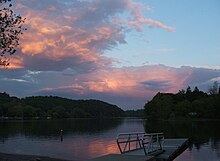
Indian Well State Park boat launch at Sunset
Commodore Hull School: 130 Oak Ave. (added July 30, 1983)
Huntington Center Historic District: Roughly along Church and Huntington Sts., from Ripton Rd. to the Farmill River (added April, 2000)
Plumb Memorial Library: 47 Wooster St. (added December 7, 1978)
Media
The Valley Independent Sentinel, an online-only, non-profit news site, launched in June 2009, thanks to the efforts of The Valley Community Foundation and The Knight Foundation.
Shelton also has a weekly newspaper, the Shelton Herald. The Connecticut Post and the New Haven Register also cover the city. Both are daily papers.
References
^ "City of Shelton Connecticut". Town of Shelton Connecticut. Retrieved September 22, 2012..mw-parser-output cite.citation{font-style:inherit}.mw-parser-output .citation q{quotes:"""""""'""'"}.mw-parser-output .citation .cs1-lock-free a{background:url("//upload.wikimedia.org/wikipedia/commons/thumb/6/65/Lock-green.svg/9px-Lock-green.svg.png")no-repeat;background-position:right .1em center}.mw-parser-output .citation .cs1-lock-limited a,.mw-parser-output .citation .cs1-lock-registration a{background:url("//upload.wikimedia.org/wikipedia/commons/thumb/d/d6/Lock-gray-alt-2.svg/9px-Lock-gray-alt-2.svg.png")no-repeat;background-position:right .1em center}.mw-parser-output .citation .cs1-lock-subscription a{background:url("//upload.wikimedia.org/wikipedia/commons/thumb/a/aa/Lock-red-alt-2.svg/9px-Lock-red-alt-2.svg.png")no-repeat;background-position:right .1em center}.mw-parser-output .cs1-subscription,.mw-parser-output .cs1-registration{color:#555}.mw-parser-output .cs1-subscription span,.mw-parser-output .cs1-registration span{border-bottom:1px dotted;cursor:help}.mw-parser-output .cs1-ws-icon a{background:url("//upload.wikimedia.org/wikipedia/commons/thumb/4/4c/Wikisource-logo.svg/12px-Wikisource-logo.svg.png")no-repeat;background-position:right .1em center}.mw-parser-output code.cs1-code{color:inherit;background:inherit;border:inherit;padding:inherit}.mw-parser-output .cs1-hidden-error{display:none;font-size:100%}.mw-parser-output .cs1-visible-error{font-size:100%}.mw-parser-output .cs1-maint{display:none;color:#33aa33;margin-left:0.3em}.mw-parser-output .cs1-subscription,.mw-parser-output .cs1-registration,.mw-parser-output .cs1-format{font-size:95%}.mw-parser-output .cs1-kern-left,.mw-parser-output .cs1-kern-wl-left{padding-left:0.2em}.mw-parser-output .cs1-kern-right,.mw-parser-output .cs1-kern-wl-right{padding-right:0.2em}
^ ab "Population and Housing Unit Estimates". Retrieved June 9, 2017.
^ "Huntington Green Shelton".
^ "Welcome to the City of Shelton, Connecticut, Official WebSite".
^ Samuel Orcutt. A History of the Old Town of Stratford and the City of Bridgeport, Connecticut. pp. 1002–1004.
^ "Derby History Quiz – Edward Shelton". Town of Derby.
^ "Ousatonic Dam & Canals".
^ "CT0426: Ousatonic Water Power Company, Dam & Canals, CT Routes 34 & 108, 1-mile (1.6 km) North of Derby-Shelton Bridge, Derby, New Haven County, CT". The Library of Congress. Retrieved February 7, 2008.
^ "Shelton's History in a Nutshell". Shelton Historical Society. Archived from the original on 2007-09-12.
^ "Shelton Historical Society's FAQs". Shelton Historical Society. Archived from the original on 2007-09-12.
^ Greenwald, Judy. "Jury rules no cover for bombed building." Business Insurance, April 4, 1988.
^ ab "IF YOU'RE THINKING OF LIVING IN SHELTON".The New York Times. Accessed January 30, 2012.
^ Developer Robert D. Scinto pleads guilty in Shelton corruption probe (video, documents)- The New Haven Register - Serving New Haven, Connecticut. Nhregister.com. Retrieved on 2013-08-16.
^ Eleanor Charles (November 2, 1997). "In the Region/Connecticut; How Shelton Won a Role in Fairfield's Office Market". The New York Times. Retrieved November 14, 2007.
^ Musante, Fred (March 20, 2008). "Rell delivers $2 million for downtown revival". The Huntington Herald. Archived from the original on September 21, 2008. Retrieved March 20, 2008.
^ "Crews cut Shelton spruce for Rockefeller Center Christmas tree". Boston.com. Associated Press. November 7, 2007. Archived from the original on August 5, 2012. Retrieved November 14, 2007.
^ Shelton tornado clean up continues | wtnh.com Connecticut. WTNH. Retrieved on 2013-08-16.
^ Shelton spruce to grace Rockefeller Center Connecticut Post. ctpost.com. November 8, 2013. Retrieved on November 12, 2013.
^ "Census of Population and Housing". Census.gov. Archived from the original on May 12, 2015. Retrieved June 4, 2015.
^ "American FactFinder". United States Census Bureau. Archived from the original on 2013-09-11. Retrieved 2008-01-31.
^ American FactFinder. Factfinder.census.gov. Retrieved on 2013-08-16.
^ Shelton Board of Aldermen Archived February 3, 2007, at the Wayback Machine
^ By The Numbers Shelton Election Results, Shelton Patch, November 6 2013
^ 2000 Election Results, Connecticut Secretary of the State
^ 2004 Election Results, Connecticut Secretary of the State
^ 2008 Presidential Election Results by Town, Connecticut Secretary of the State, Accessed 23 Dec 10
^ [1]
^ "Registration and Party Enrollment Statistics as of November 05, 2018" (PDF). Connecticut Secretary of State. Retrieved 20 April 2017.
^ Teresa Gallagher. "sheltonconservation.org". Retrieved March 2, 2010.
^ "Shelton Public Schools". Retrieved May 24, 2008.
^ Fire Department. cityofshelton.org. Retrieved on 2013-08-16.
^ "State to aid Shelton firm's move," by Maya Rao, The Hartford Courant, June 15, 2006; Rao cites James Ryan, head of the Shelton Economic Development Commission.
Further reading
- Reverend Samuel Orcutt, History of the Old Town of Stratford and the City of Bridgeport Connecticut, Fairfield County Historical Society, 1886
External links
| Wikimedia Commons has media related to Shelton, Connecticut. |
| Wikivoyage has a travel guide for Shelton, Connecticut. |
City of Shelton official website Portal style website, Government, Business, Library, Recreation and more- Shelton Historical Society
- Plumb Memorial Library
Derby Historical Society; the society was "Founded April 18, 1946, to serve the Naugatuck Valley towns of Ansonia, Derby, Oxford, Seymour, & Shelton."
City-Data.com Comprehensive Statistical Data and more about Shelton
Shelton Voters Network Your non-partisan website for election information and other Shelton resources.
Municipalities and communities of Fairfield County, Connecticut, United States | ||
|---|---|---|
County seat: Bridgeport | ||
| Cities |
|  |
| Towns |
| |
| Borough |
| |
| CDPs |
| |
| Other communities |
| |
| Ghost town |
| |
| Indian reservation |
| |
| Footnotes | ‡This populated place also has portions in an adjacent county or counties | |
Hartford (capital) | ||
| Topics |
|  |
| Society |
| |
| Regions |
| |
| Counties |
| |
| Cities |
| |
| All Towns |
| |
| Places |
| |
New York metropolitan area | ||
|---|---|---|
| Counties |
|  |
| Major cities |
| |
| Cities and towns over 100,000 |
| |
| Cities and towns over 25,000 |
| |
| Cities and towns over 10,000 |
| |
| Regions |
| |
New England | |||||||
|---|---|---|---|---|---|---|---|
| Topics |
| ||||||
| States |
| ||||||
| Major cities |
| ||||||
| State capitals |
| ||||||
| Transportation |
| ||||||
| |||||||


