Chaldoran County
Chaldoran County شهرستان چالدران | |
|---|---|
County | |
 Counties of West Azerbaijan Province | |
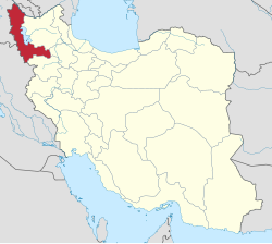 Location of West Azerbaijan Province in Iran | |
| Coordinates: 39°04′N 44°20′E / 39.067°N 44.333°E / 39.067; 44.333Coordinates: 39°04′N 44°20′E / 39.067°N 44.333°E / 39.067; 44.333 | |
| Country | |
| Province | West Azerbaijan |
| Capital | Siah Cheshmeh |
Bakhsh (Districts) | Central District, Dashtaki District |
| Population (2006) | |
| • Total | 44,572 |
| Time zone | UTC+3:30 (IRST) |
| • Summer (DST) | UTC+4:30 (IRDT) |
| Chaldoran County can be found at GEOnet Names Server, at this link, by opening the Advanced Search box, entering "9205908" in the "Unique Feature Id" form, and clicking on "Search Database". | |
Chaldoran County (Persian: شهرستان چالدران) is a county in West Azerbaijan Province, Iran. The capital of the county is Siah Cheshmeh (Persian: سيه چشمه) or Qara Aineh is also called Chaldoran. The other prominent town in the district is Avajiq. At the 2006 census, the county's population was 44,572, in 9,006 families.[1] The county is subdivided into two districts: the Central District and Dashtaki District. The county has two cities: Siah Cheshmeh and Avajiq. The population of Chaldoran are Azeri and Kurmancî Kurds.
Chaldoran is one of the tourist areas of West Azerbaijan Province of Iran because of its cold weather in winter and cool in summer.
History
Chaldoran is the site of the historic Battle of Chaldiran, which took place in 1514 between the armies of Ottoman Sultan Selim I and Safavid Shah Ismail I on the narrow plain outside of the town. The Ottoman army had the advantage of using firearms as well as superiority in size, and defeated the Safavid army for the first time.
After the Ottomans took this area, they resettled many of the Kurdish tribes further west.
Holy Tatavous Church (Ghare Kelisa) or St. Thaddeus's is in Chaldoran district, 7 km north east of the town of Seyah Cheshmah.

A panorama of the site of Saint Thaddeus Monastery
Economy
The expansion of pastures and cultivable lands has given this region the opportunity of enjoying prosperous cattle breeding, agriculture and apiculture with highest rate of job creation in the region. According to the census of the year 2003, population of Chaldoran district is 46,700; 33.5 percent of whom live in urban areas and 66.5 percent are rural and tribal settlers. Chaldoran's Wednesday Market (Chaharshanbeh Bazar) enjoys a particular fame for various types of cattle, agricultural, farming products and local handicrafts.[citation needed] The most important tourism attractions of this city are : Holy Tatavous Church (Ghareh Kelisa), Tomb of shahid sedreddin shirazi, Tombs of Martyrs in chaldoran City and Zarzar Church in Baroum Village
References
^ "Census of the Islamic Republic of Iran, 1385 (2006)". Islamic Republic of Iran. Archived from the original (Excel) on 2011-11-11..mw-parser-output cite.citation{font-style:inherit}.mw-parser-output .citation q{quotes:"""""""'""'"}.mw-parser-output .citation .cs1-lock-free a{background:url("//upload.wikimedia.org/wikipedia/commons/thumb/6/65/Lock-green.svg/9px-Lock-green.svg.png")no-repeat;background-position:right .1em center}.mw-parser-output .citation .cs1-lock-limited a,.mw-parser-output .citation .cs1-lock-registration a{background:url("//upload.wikimedia.org/wikipedia/commons/thumb/d/d6/Lock-gray-alt-2.svg/9px-Lock-gray-alt-2.svg.png")no-repeat;background-position:right .1em center}.mw-parser-output .citation .cs1-lock-subscription a{background:url("//upload.wikimedia.org/wikipedia/commons/thumb/a/aa/Lock-red-alt-2.svg/9px-Lock-red-alt-2.svg.png")no-repeat;background-position:right .1em center}.mw-parser-output .cs1-subscription,.mw-parser-output .cs1-registration{color:#555}.mw-parser-output .cs1-subscription span,.mw-parser-output .cs1-registration span{border-bottom:1px dotted;cursor:help}.mw-parser-output .cs1-ws-icon a{background:url("//upload.wikimedia.org/wikipedia/commons/thumb/4/4c/Wikisource-logo.svg/12px-Wikisource-logo.svg.png")no-repeat;background-position:right .1em center}.mw-parser-output code.cs1-code{color:inherit;background:inherit;border:inherit;padding:inherit}.mw-parser-output .cs1-hidden-error{display:none;font-size:100%}.mw-parser-output .cs1-visible-error{font-size:100%}.mw-parser-output .cs1-maint{display:none;color:#33aa33;margin-left:0.3em}.mw-parser-output .cs1-subscription,.mw-parser-output .cs1-registration,.mw-parser-output .cs1-format{font-size:95%}.mw-parser-output .cs1-kern-left,.mw-parser-output .cs1-kern-wl-left{padding-left:0.2em}.mw-parser-output .cs1-kern-right,.mw-parser-output .cs1-kern-wl-right{padding-right:0.2em}
- اطلس گیتاشناسی استانهای ایران [Atlas Gitashenasi Ostanhai Iran] (Gitashenasi Province Atlas of Iran)
List of cities, towns and villages in West Azerbaijan Province | ||
| Capital |
|  |
Counties and cities |
| |
| Tourism |
| |
| Places | List of cities, towns and villages in West Azerbaijan Province | |
| Capital |
| ||||||||||||||||||||||
|---|---|---|---|---|---|---|---|---|---|---|---|---|---|---|---|---|---|---|---|---|---|---|---|
| Districts |
| ||||||||||||||||||||||


