River Wandle
| Wandle | |
|---|---|
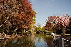
 River Wandle in Morden Hall Park | |
| Location | |
| Country | England |
| Counties | Greater London |
| Districts / Boroughs | Croydon, Sutton, Lambeth, Merton, Wandsworth |
| Towns | Merton, Morden, Earlsfield, Wandsworth |
| Physical characteristics | |
| Source | |
| - location | Waddon Ponds & Carshalton Ponds |
| - elevation | 35 m (115 ft) |
| Mouth | River Thames |
| Wandsworth | |
| Length | 14 km (8.7 mi) |
| Discharge | |
| - location | Connollys Mill |
| - average | 1.70 m3/s (60 cu ft/s) |
| - minimum | 0.22 m3/s (7.8 cu ft/s)29 January 1963 |
| - maximum | 39.3 m3/s (1,390 cu ft/s)16 September 1968 |
| Discharge | |
| - location | Beddington Park |
| - average | 0.18 m3/s (6.4 cu ft/s) |
| Basin features | |
| Tributaries | |
| - left | The Wrythe, Carshalton |
| - right | River Graveney (Norbury Brook) |
The River Wandle is the largest river of the south southwest sector of London, England. Its name is thought to derive from the community around its mouth, Wandsworth (Old English "Wendlesworth" meaning "Wendle's Settlement"). About 9 miles (14 km) long, it passes through the London Boroughs of Croydon, Sutton, Merton, and Wandsworth to join the River Thames on the Tideway. Much of the river is accessible on the Wandle Trail. A short headwater - the Caterham Bourne - is in Surrey, the historic county of the river's catchment.
Contents
1 History and boundaries
2 Headwaters
2.1 Intermittently visible watercourses
2.2 The Wrythe
2.3 The Norbury Brook
3 Use
4 Local Nature Reserves
5 Incidents
5.1 21st century hazardous discharges
6 Makeup
7 Namesakes
8 Landmarks
9 See also
10 Further reading
11 Notes and references
12 External links
History and boundaries

Carshalton Pond, London Borough of Sutton

River Wandle at Beddington Park in the London Borough of Sutton
In the pleistocene before the carving of the Mole Gap, water lapped the north of the area between the North Downs and Greensand Hills known as the Vale of Holmesdale taking the Caterham or Coulsdon Bourne routes, to form the much less deep Merstham Gap, a wind gap.[1] In more recent times, precipitation on the local central, small section of the long escarpment percolates through the chalk and reappears as springs in central Croydon, Beddington, and Carshalton. The occasional stream, known as the Bourne, which runs through the Caterham valley (and Smitham Bottom in Coulsdon) is a source of the River Wandle but only surfaces after heavy rainfall.[2] A series of ditches and culverts carries the water from Purley to Croydon.
For many centuries the River Wandle rose from a spring by Brighton Road to enter and flow through the Haling neighbourhood in the south of Croydon. It ran along Southbridge Road and upon reaching Old Town it reached a maximal 20 ft (6 m) across and began to divide into smaller channels. The grounds of the Old Palace and Scarbrook Hill had springs engineered with ponds, streams and canals where fish swam, especially trout. Over the years it became renowned for its fish, appearing in chronicles, such as, William Camden's Britannia (1586) and Izaak Walton's The Compleat Angler (1653). [3]Lord Nelson would fish in its water's, leading his mistress, Lady Hamilton, to rename the Wandle, as it flowed through her garden, the "River Nile", in Nelson's memory. [3]
However, as Croydon's population grew and use of the water closet increased, the Old Town streams became little more than open sewers and were filled in or culverted from 1840 after outbreaks of typhoid and cholera.[4]
The river then flowed through Pitlake and on through two marshy fields — Froggs Mead and Stubbs Mead — drained to form Wandle Park in 1890. Local springs were used to form a boating lake in the park, but frequent drying up problems led to the lake being filled in and the river was culverted in 1967. In 2012, the Wandle was restored to the surface in Wandle Park. From there, the river continues underground, through where the gas works used to stand, under the Purley Way road past Waddon Ponds and appears on the surface at the road Richmond Green where a small green buffer to its south acts as the green after the footpath at the end of Mill Lane in Waddon, Croydon.[5]
For part of its length, the Wandle forms the boundary between the London Boroughs of Croydon and Lambeth and, further downstream bounds Merton and Wandsworth. Shortly before reaching the Thames the navigable Bell Lane Creek splits from the river, rejoining close to the confluence.
Localities adjoining the river and its mentioned main tributaries include: Croydon, Waddon, Beddington, Wallington, Carshalton, The Wrythe, Hackbridge, Mitcham, Ravensbury, St Helier, Morden, Merton Abbey, Colliers Wood, South Wimbledon, Summerstown, and Wandsworth. Carshalton Village is home to Honeywood Museum, which includes displays and an interactive map about the River Wandle and its influence on the life of the area.[6]

170 degree panorama of Carshalton Upper Pond in the London Borough of Sutton with Honeywood Museum on the right, which has displays about the River Wandle
Headwaters
Intermittently visible watercourses
Rain falling on part of the North Downs mainly filters through a thin topsoil into chalk and emerges on the spring line and in gentle ravines carved by water erosion. At the top of the catchment the Wandle has four main headwaters historically noted as winterbournes — streams which only flow when the water table is high.[4]
Two such streams, culverted, combine in Central Croydon beneath Bourne Street to form the Wandle which emerges immediately north-west in Wandle Park. The Wandle is piped part-way-through neighbouring New South Quarter to flow under Purley Way (formerly Waddon Marsh Lane) and part of its retail park. From its central gathering the flow is westwards (or WSW) until merger with the Wrythe. On its route the early Wandle surfaces to receive springs at a long lake Waddon Ponds beside Mill Lane, Croydon.
The Coulsdon Bourne and linked Caterham Bourne south of Croydon town centre ran in wet seasons. They have been culverted since before 1900. When the water table is medium or high these waters meet at Purley, run in a culvert the length of the Brighton Road, South Croydon, and merge into the surface water drains and culverts in the town centre (which become much of the above stream).
The Wrythe
The Wrythe at about 115 feet (35 m) AOD collects at Carshalton Ponds which merges with the above channels underneath Watermill House giving its name to northern neighbourhood The Wrythe, Carshalton.
The Norbury Brook

The Norbury Brook is in its western section for parochial boundaries called the Graveney River. Aggregated streams combine under Grant Road, Addiscombe. Straightened, it roughly bounds Croydon and Lambeth Boroughs forming the ancient boundary of Croydon and Norwood (once the large woodland in Norbury parish). Its long, culverted mouth with the Wandle is in Tooting Graveney – it meets the Wandle fronting the Haydons Road part of Wimbledon in the Borough of Merton.
Use
River Wandle in Carshalton
The river has been well-used since Roman times and was heavily industrialised in the 18th and 19th centuries (the industrial revolution), and was declared one of the most polluted rivers in England.[citation needed] The main industries then were tobacco and textiles. The river was used to power 68 water wheels, of which only a few survive, such as at Merton Abbey Mills for paper, print and tapestries.[7]
The Liberty print works and Merton Board Mills before early 20th century demolition dominated the riverscape (replaced by a two-retailer clothes and food megastore in Merton). Local concentration of heavy industry resulted in multiple leats being cut during the 18th century; a remnant of the old courses, the Pickle, is two ditches, one runs beneath Liberty Avenue. The former leat has become the main river next to Merton Abbey Mills craft village.
Clean-ups of the Wandle have improved the water quality dramatically, leading to a return of the river's brown trout. This improvement in water quality has also seen other fish thrive with stocks of Chub, Roach and Dace all flourishing once again with the most popular angling spots being in Hackbridge and Colliers Wood.
Local Nature Reserves

A bell powered by the rising and falling tide at the southern end of Bell Lane Creek, the highest tidal point on the Wandle
A stretch of the river between Trewint Street and Plough Lane in Merton has been designated as the Lower Wandle Local Nature Reserve (LNR). It is lined by mature trees and patches of grassland.[8][9] South of the Lower Wandle, an area of wetland between the River Wandle and the Wandle trail is the Wandle Meadow Nature Park LNR.[10][11] Another LNR adjacent to the Wandle is the Wandle Valley Wetland in Carshalton.[12][13]
In 2017, a new nature reserve was created in Bell Lane Creek in the Wandle Delta, by removing a half-tide weir that had been installed in the 1980s at the junction of the Wandle and the River Thames. This had been built as the first part of a project to create a marina, however it had ceased to work some years previously. Restoring it would allow the tide to clear out silt and restore a natural tidal river. In addition, a section of the Thames river wall was lowered as part of the Wandsworth Riverside Quarter residential development, to allow reeds and vegetation to develop and provide a more natural sloping embankment. As part of the project layers of contaminated sediment were dredged from the site, to restore a gravel bed and restore a wildlife habitat measuring roughly a hectare in size.[14]
Incidents
21st century hazardous discharges
In 2007, Sodium hypochlorite was accidentally flushed into the Wandle from Thames Water's Beddington sewage works. The chemical was being used to clean its tertiary treatment screens. Its use is permitted if captured ("re-circulated") for further treatment. The discharge killed over 2,000 fish of various species. The sewerage undertaker failed to notify the Environment Agency – its site manager thought it was minor. The company apologised; it offered to meet local angling clubs and the Wandle Trust to discuss restocking and long-term support for the Trust's work.[15][16] The regulator fined the provider £125,000 and legal costs.[17] In 2009 it was the greatest penalty for a one-day unlawful disharge into controlled waters.[18] In 2010 a High Court judge found the fine was under the statutory rules governing pollution penalties "manifestly" excessive, reducing it to £50,000, noting Thames Water had donated £500,000 to clean up the river.[19]
Makeup

Tidal section of the Wandle, where it joins the River Thames
The predominant geology of the south part is chalk interspersed with flint and narrow alluvial gravel beds in the south. London clay overlaid with patches of gravel topped by deeper humus forms the north; the top soil, tempered by the chalk beneath is less acidic where still seasonally turned in the south.
The river has since the 18th century been largely terraformed with tributary artificial channels (becoming surface water drains) and runoff ditches. It has its relatively few underground (culverted) stretches; these are in Croydon.
Namesakes
- Current
- The Wandle River in South Island, New Zealand.
- The SS Wandle, four successive steamships. Three were built for the local Wandsworth, Wimbledon and Epsom District Gas Company.
- Former
In the 1980s Wandle designated one of the London bus districts. Its logo was a water wheel above the London Transport roundel.[20]
Landmarks
- Current
- Wimbledon Stadium
Ram Brewery (converted)- A signposted link to the Thames Path exists in the north including its riverside at Wandsworth Park
- Bridges, one with an information plaque, cross the river at Wandsworth High Street and its central park, dotted with high rise housing.
- Former
Plough Lane stadium.
See also
- Tributaries of the River Thames
- List of rivers in England
- Wandle Trail
- Wandle Meadow Nature Park
Further reading
- "River Wandle Companion and Wandle Trail Guide" by Bob Steel, with Derek Coleman. Culverhouse Books 2012, 248pp fully illustrated. Paperback and hardback. .mw-parser-output cite.citation{font-style:inherit}.mw-parser-output .citation q{quotes:"""""""'""'"}.mw-parser-output .citation .cs1-lock-free a{background:url("//upload.wikimedia.org/wikipedia/commons/thumb/6/65/Lock-green.svg/9px-Lock-green.svg.png")no-repeat;background-position:right .1em center}.mw-parser-output .citation .cs1-lock-limited a,.mw-parser-output .citation .cs1-lock-registration a{background:url("//upload.wikimedia.org/wikipedia/commons/thumb/d/d6/Lock-gray-alt-2.svg/9px-Lock-gray-alt-2.svg.png")no-repeat;background-position:right .1em center}.mw-parser-output .citation .cs1-lock-subscription a{background:url("//upload.wikimedia.org/wikipedia/commons/thumb/a/aa/Lock-red-alt-2.svg/9px-Lock-red-alt-2.svg.png")no-repeat;background-position:right .1em center}.mw-parser-output .cs1-subscription,.mw-parser-output .cs1-registration{color:#555}.mw-parser-output .cs1-subscription span,.mw-parser-output .cs1-registration span{border-bottom:1px dotted;cursor:help}.mw-parser-output .cs1-ws-icon a{background:url("//upload.wikimedia.org/wikipedia/commons/thumb/4/4c/Wikisource-logo.svg/12px-Wikisource-logo.svg.png")no-repeat;background-position:right .1em center}.mw-parser-output code.cs1-code{color:inherit;background:inherit;border:inherit;padding:inherit}.mw-parser-output .cs1-hidden-error{display:none;font-size:100%}.mw-parser-output .cs1-visible-error{font-size:100%}.mw-parser-output .cs1-maint{display:none;color:#33aa33;margin-left:0.3em}.mw-parser-output .cs1-subscription,.mw-parser-output .cs1-registration,.mw-parser-output .cs1-format{font-size:95%}.mw-parser-output .cs1-kern-left,.mw-parser-output .cs1-kern-wl-left{padding-left:0.2em}.mw-parser-output .cs1-kern-right,.mw-parser-output .cs1-kern-wl-right{padding-right:0.2em}
ISBN 978-0-9572582-0-4 and
ISBN 978-0-9572582-1-1 . See http://www.wandlebook.co.uk
- The Wandle Group edited by Doug Cluett and John Phillips The Wandle Guide Sutton Leisure Services 1997
ISBN 0 907335 330
Notes and references
^ Natural England - Geodiversity Archived 2 October 2013 at the Wayback Machine
^ H.E. Malden (editor) (1912). "Parishes: Caterham". A History of the County of Surrey: Volume 4. Institute of Historical Research. Retrieved 23 November 2012.CS1 maint: Extra text: authors list (link)
^ ab Ackroyd, P. (2012). London Under. London: Vintage Books.
ISBN 978-0-099-28737-7
^ ab H.E. Malden (editor) (1912). "Croydon: Introduction and Croydon Palace". A History of the County of Surrey: Volume 4. Institute of Historical Research. Retrieved 23 November 2012.CS1 maint: Extra text: authors list (link)
^ Ordnance Survey map, courtesy of English Heritage
^ "Honeywood Museum". Friendsofhoneywood.co.uk. Retrieved 26 June 2014.
^ Ben Weinreb and Christopher Hibbert (eds.). The London Encyclopaedia (1991 ed.). Macmillan. p. 947. ISBN 0-333-57688-8.CS1 maint: Uses editors parameter (link) Retrieved 29 August 2013.
^ "Lower Wandle". Local Nature Reserves. Natural England. 5 March 2013. Retrieved 20 December 2013.
^ "Map of Lower Wandle". Local Nature Reserves. Natural England. Retrieved 20 December 2013.
^ "Wandle Meadow Nature Park". Local Nature Reserves. Natural England. Retrieved 20 December 2013.
^ "Map of Wandle Meadow Nature Park". Local Nature Reserves. Natural England. Retrieved 20 December 2013.
^ "Wandle Valley Wetland". Local Nature Reserves. Natural England. Retrieved 20 December 2013.
^ "Map of Wandle Valley Wetland". Local Nature Reserves. Natural England. Retrieved 20 December 2013.
^ "Work to deliver new Wandle Delta nature reserve nears completion". Wandsworth Borough Council. 9 March 2017. Retrieved 21 May 2017.
^ "Thames Water 'mortified' after 2,000 fish die in River Wandle » Environment". 24dash.com. 21 September 2007. Archived from the original on 17 July 2012. Retrieved 13 October 2010.
^ http://www.wandletrust.org
^ "Environment Agency press release". Environment-agency.gov.uk. Archived from the original on 5 June 2011. Retrieved 13 October 2010.
^ "Thames Water fined £125,000 for bleach spill". The ENDS Report. 1 February 2009. Retrieved 18 May 2017.
^ Thames Water fine for toxic spill in River Wandle cut BBC News, 15 February 2010
^ "London Transport - Local Bus Maps". eplates.info. Retrieved 27 August 2013.
External links
| Wikimedia Commons has media related to River Wandle. |
- The Wandle Trust
- River Wandle Images
River Wandle on UK Rivers Guidebook- The Wandle Piscators fishing club
- Nature Conservation Plan for the Lower Wandle Local Nature Reserve, Merton Council, 2001
| Next confluence upstream | River Thames | Next confluence downstream |
Beverley Brook (south) | River Wandle | Falconbrook (south) |
Coordinates: 51°27′34″N 0°11′37″W / 51.45938°N 0.19357°W / 51.45938; -0.19357


