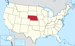
Nebraska
| State of Nebraska | |||||
|---|---|---|---|---|---|
| |||||
Nickname(s): Cornhusker State | |||||
Motto(s): Equality before the law | |||||
State song(s): "Beautiful Nebraska" | |||||
 | |||||
| Official language | English | ||||
| Demonym | Nebraskan | ||||
| Capital | Lincoln | ||||
| Largest city | Omaha | ||||
| Largest metro | Omaha–Council Bluffs | ||||
| Area | Ranked 16th | ||||
| • Total | 77,358 sq mi (200,356 km2) | ||||
| • Width | 210 miles (340 km) | ||||
| • Length | 430 miles (690 km) | ||||
| • % water | 0.7 | ||||
| • Latitude | 40° N to 43° N | ||||
| • Longitude | 95° 19' W to 104° 03' W | ||||
| Population | Ranked 37th | ||||
| • Total | 1,920,076 (2017 est.)[1] | ||||
| • Density | 24.6/sq mi (9.5/km2) Ranked 43rd | ||||
| • Median household income | $60,474[2] (18th) | ||||
| Elevation | |||||
| • Highest point | Panorama Point[3][4] 5,424 ft (1654 m) | ||||
| • Mean | 2,600 ft (790 m) | ||||
| • Lowest point | Missouri River at Kansas border[3][4] 840 ft (256 m) | ||||
| Before statehood | Nebraska Territory | ||||
| Admission to Union | March 1, 1867 (37th) | ||||
| Governor | Pete Ricketts (R) | ||||
| Lieutenant Governor | Mike Foley (R) | ||||
| Legislature | Nebraska Legislature | ||||
| • Upper house | None (unicameral) | ||||
| • Lower house | None (unicameral) | ||||
| U.S. Senators | Deb Fischer (R) Ben Sasse (R) | ||||
| U.S. House delegation | Jeff Fortenberry (R) Don Bacon (R) Adrian Smith (R) (list) | ||||
| Time zones | |||||
| • Most of state | Central: UTC −6/−5 | ||||
| • Panhandle | Mountain: UTC −7/−6 | ||||
| ISO 3166 | US-NE | ||||
| Abbreviations | NE, Neb., Nebr. | ||||
| Website | www.nebraska.gov | ||||


| Nebraska state symbols | |
|---|---|
 The Flag of Nebraska | |
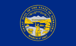
 The Seal of Nebraska | |
| Living insignia | |
| Bird | Western meadowlark |
| Fish | Channel catfish |
| Flower | Goldenrod |
| Grass | Little bluestem |
| Insect | Western honey bee |
| Mammal | White-tailed deer |
| Tree | Eastern Cottonwood |
| Inanimate insignia | |
| Beverage | Milk Soft drink: Kool-aid |
| Dance | Square dance |
| Fossil | Mammoth |
| Gemstone | Chalcedony |
| Rock | Prairie agate |
| Slogan | Welcome to NEBRASKAland where the West begins[5] 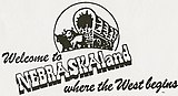 |
| Soil | Holdrege series |
| Other | River: Platte River |
| State route marker | |
 | |
| State quarter | |
 Released in 2006 | |
| Lists of United States state symbols | |
Nebraska /nəˈbræskə/ (![]() listen) is a state that lies in both the Great Plains and the Midwestern United States. It is bordered by South Dakota to the north, Iowa to the east and Missouri to the southeast, both across the Missouri River, Kansas to the south, Colorado to the southwest and Wyoming to the west. It is the only triply landlocked U.S. state. Nebraska's area is just over 77,220 square miles (200,000 km2) with almost 1.9 million people. Its state capital is Lincoln, and its largest city is Omaha, which is on the Missouri River.
listen) is a state that lies in both the Great Plains and the Midwestern United States. It is bordered by South Dakota to the north, Iowa to the east and Missouri to the southeast, both across the Missouri River, Kansas to the south, Colorado to the southwest and Wyoming to the west. It is the only triply landlocked U.S. state. Nebraska's area is just over 77,220 square miles (200,000 km2) with almost 1.9 million people. Its state capital is Lincoln, and its largest city is Omaha, which is on the Missouri River.
Indigenous peoples including Omaha, Missouria, Ponca, Pawnee, Otoe, and various branches of the Lakota (Sioux) tribes lived in the region for thousands of years before European exploration. The state is crossed by many historic trails and was explored by the Lewis and Clark Expedition.
Nebraska was admitted as the 37th state of the United States in 1867. It is the only state in the United States whose legislature is unicameral and officially nonpartisan.
Nebraska is composed of two major land regions: the Dissected Till Plains and the Great Plains. The Dissected Till Plains is a region of gently rolling hills and contains the state's largest cities, Omaha and Lincoln. The Great Plains occupy most of western Nebraska, characterized by treeless prairie, suitable for cattle-grazing. The state has a large agriculture sector and is a major producer of beef, pork, corn and soybeans. There are two major climatic zones: the eastern half of the state has a humid continental climate (Köppen climate classification Dfa), with a unique warmer subtype considered "warm-temperate" near the southern plains like in Kansas and Oklahoma which have a predominantly humid subtropical climate. The western half has a primarily semi-arid climate (Koppen BSk). The state has wide variations between winter and summer temperatures, decreasing south through the state. Violent thunderstorms and tornadoes occur primarily during spring and summer, but sometimes in autumn. Chinook winds tend to warm the state significantly in the winter and early spring.
Contents
1 Etymology
2 History
3 Geography
3.1 Federal land management
3.2 Climate
4 Demographics
4.1 Population
4.2 Religion
4.3 Settlement
5 Taxation
6 Economy
6.1 Industry
7 Transportation
7.1 Railroads
7.2 Roads and highways
8 Law and government
8.1 Executive branch
8.2 Legislative branch
8.3 Judicial branch
8.4 Federal government representation
8.5 Politics
9 Education
9.1 Colleges and universities
10 Culture
10.1 Arts
10.2 Sports
10.2.1 Professional sports
10.2.2 Junior-level sports
10.2.3 College sports
11 See also
12 References
13 Bibliography
13.1 Surveys
13.2 Scholarly special studies
14 External links
Etymology
Nebraska's name is derived from transliteration of the archaic Otoe words Ñí Brásge, pronounced [ɲĩbɾasꜜkɛ] (contemporary Otoe Ñí Bráhge), or the Omaha Ní Btháska, pronounced [nĩbɫᶞasꜜka], meaning "flat water", after the Platte River that flows through the state.[6]
History

Nebraska in 1718, Guillaume de L'Isle map, with the approximate area of the future state highlighted.
Indigenous peoples lived in the region of present-day Nebraska for thousands of years before European exploration. The historic tribes in the state included the Omaha, Missouria, Ponca, Pawnee, Otoe, and various branches of the Lakota (Sioux), some of which migrated from eastern areas into this region. When European exploration, trade, and settlement began, both Spain and France sought to control the region. In the 1690s, Spain established trade connections with the Apaches, whose territory then included western Nebraska. By 1703, France had developed a regular trade with the native peoples along the Missouri River in Nebraska, and by 1719 had signed treaties with several of these peoples. After war broke out between the two countries, Spain dispatched an armed expedition to Nebraska under Lieutenant General Pedro de Villasur in 1720. The party was attacked and destroyed near present-day Columbus by a large force of Pawnees and Otoes, both allied to the French. The massacre ended Spanish exploration of the area for the remainder of the 18th century.[7][8][9]
In 1762, during the Seven Years' War, France ceded the Louisiana territory to Spain. This left Britain and Spain competing for dominance along the Mississippi; by 1773, the British were trading with the native peoples of Nebraska. In response, Spain dispatched two trading expeditions up the Missouri in 1794 and 1795; the second, under James Mackay, established the first European settlement in Nebraska near the mouth of the Platte. Later that year, Mackay's party built a trading post, dubbed Fort Carlos IV (Fort Charles), near present-day Homer.[7][10][11]
In 1819, the United States established Fort Atkinson as the first U.S. Army post west of the Missouri River, just east of present-day Fort Calhoun. The army abandoned the fort in 1827 as migration moved further west. European-American settlement was scarce until 1848 and the California Gold Rush. On May 30, 1854, the US Congress created the Kansas and the Nebraska territories, divided by the Parallel 40° North, under the Kansas–Nebraska Act.[12] The Nebraska Territory included parts of the current states of Colorado, North Dakota, South Dakota, Wyoming, and Montana.[13] The territorial capital of Nebraska was Omaha.

Homesteaders in central Nebraska in 1888.
In the 1860s, after the U.S. government forced many of the Native American tribes to cede their lands and settle on reservations, it opened large tracts of land to agricultural development by Europeans and Americans. Under the Homestead Act, thousands of settlers migrated into Nebraska to claim free land granted by the federal government. Because so few trees grew on the prairies, many of the first farming settlers built their homes of sod, as had Native Americans such as the Omaha. The first wave of settlement gave the territory a sufficient population to apply for statehood.[14] Nebraska became the 37th state on March 1, 1867, and the capital was moved from Omaha to the center at Lancaster, later renamed Lincoln after the recently assassinated President of the United States, Abraham Lincoln. The battle of Massacre Canyon on August 5, 1873, was the last major battle between the Pawnee and the Sioux.[15]
During the 1870s to the 1880s, Nebraska experienced a large growth in population. Several factors contributed to attracting new residents. The first was that the vast prairie land was perfect for cattle grazing. This helped settlers to learn the unfamiliar geography of the area. The second factor was the invention of several farming technologies. Agricultural inventions such as barbed wire, wind mills, and the steel plow, combined with good weather, enabled settlers to use of Nebraska as prime farming land. By the 1880s, Nebraska's population had soared to more than 450,000 people.[16] The Arbor Day holiday was founded in Nebraska City by territorial governor J. Sterling Morton. The National Arbor Day Foundation is still headquartered in Nebraska City, with some offices in Lincoln.
In the late 19th century, many African Americans migrated from the South to Nebraska as part of the Great Migration, primarily to Omaha which offered working class jobs in meat packing, the railroads and other industries. Omaha has a long history of civil rights activism. Blacks encountered discrimination from other Americans in Omaha and especially from recent European immigrants, ethnic whites who were competing for the same jobs. In 1912, African Americans founded the Omaha chapter of the National Association for the Advancement of Colored People to work for improved conditions in the city and state.
Since the 1960s, Native American activism in the state has increased, both through open protest, activities to build alliances with state and local governments, and in the slower, more extensive work of building tribal institutions and infrastructure. Native Americans in federally recognized tribes have pressed for self-determination, sovereignty and recognition. They have created community schools to preserve their cultures, as well as tribal colleges and universities. Tribal politicians have also collaborated with state and county officials on regional issues.
Geography

Map of Nebraska
The state is bordered by South Dakota to the north; Iowa to the east and Missouri to the southeast, across the Missouri River; Kansas to the south; Colorado to the southwest; and Wyoming to the west. The state has 93 counties and is split between two time zones, with the state's eastern half observing Central Time and the western half observing Mountain Time. Three rivers cross the state from west to east. The Platte River, formed by the confluence of the North Platte and the South Platte, runs through the state's central portion, the Niobrara River flows through the northern part, and the Republican River runs across the southern part.
Nebraska is composed of two major land regions: the Dissected Till Plains and the Great Plains. The easternmost portion of the state was scoured by Ice Age glaciers; the Dissected Till Plains were left after the glaciers retreated. The Dissected Till Plains is a region of gently rolling hills; Omaha and Lincoln are in this region. The Great Plains occupy most of western Nebraska, with the region consisting of several smaller, diverse land regions, including the Sandhills, the Pine Ridge, the Rainwater Basin, the High Plains and the Wildcat Hills. Panorama Point, at 5,424 feet (1,653 m), is Nebraska's highest point; though despite its name and elevation, it is a relatively low rise near the Colorado and Wyoming borders. A past Nebraska tourism slogan was "Where the West Begins" (currently, "Honestly, it's not for everyone"[17]); locations given for the beginning of the "West" include the Missouri River, the intersection of 13th and O Streets in Lincoln (where it is marked by a red brick star), the 100th meridian, and Chimney Rock.
Federal land management

Nebraska National Forest
Areas under the management of the National Park Service include:
Agate Fossil Beds National Monument near Harrison
- California National Historic Trail
Chimney Rock National Historic Site near Bayard
Homestead National Monument of America in Beatrice
- Lewis and Clark National Historic Trail
Missouri National Recreational River near Ponca
- Mormon Pioneer National Historic Trail
Niobrara National Scenic River near Valentine
- Oregon National Historic Trail
- Pony Express National Historic Trail
Scotts Bluff National Monument at Gering
Areas under the management of the National Forest Service include:
- Nebraska National Forest
- Oglala National Grassland
- Samuel R. McKelvie National Forest
Climate

Köppen climate types in Nebraska

Winter at Scotts Bluff National Monument
Two major climatic zones are represented in Nebraska: the state's eastern half and its western half. The eastern half of the state has a humid continental climate (Köppen climate classification Dfa). The western half has a semi-arid climate (Koppen BSk). The entire state experiences wide seasonal variations in both temperature and precipitation. Average temperatures are fairly uniform across Nebraska, with hot summers and generally cold winters.
Average annual precipitation decreases east to west from about 31.5 inches (800 mm) in the southeast corner of the state to about 13.8 inches (350 mm) in the Panhandle. Humidity also decreases significantly from east to west. Snowfall across the state is fairly even, with most of Nebraska receiving between 25 to 35 inches (640 to 890 mm) of snow each year.[18] Nebraska's highest-recorded temperature was 118 °F (48 °C) in Minden on July 24, 1936. The state's lowest-recorded temperature was −47 °F (−44 °C) in Camp Clarke on February 12, 1899.
Nebraska is located in Tornado Alley. Thunderstorms are common during both the spring and the summer. Violent thunderstorms and tornadoes happen primarily during those two seasons, although they also can occur occasionally during the autumn. The chinook winds from the Rocky Mountains provide a temporary moderating effect on temperatures in the state's western portion during the winter.[19][20]
| Location | July (°F) | July (°C) | January (°F) | January (°C) |
|---|---|---|---|---|
| Omaha | 87/66 | 30/19 | 33/13 | 1/–10 |
| Lincoln | 89/66 | 31/19 | 35/14 | 2/–10 |
| Grand Island | 87/64 | 31/17 | 36/14 | 2/–10 |
| Kearney | 90/63 | 32/17 | 36/12 | 2/–11 |
| North Platte | 88/60 | 31/16 | 39/11 | 4/–11 |
| Papillion | 87/66 | 31/19 | 32/12 | 0/–11 |
Demographics
Population
| Historical population | |||
|---|---|---|---|
| Census | Pop. | %± | |
| 1860 | 28,841 | — | |
| 1870 | 122,993 | 326.5% | |
| 1880 | 452,402 | 267.8% | |
| 1890 | 1,062,656 | 134.9% | |
| 1900 | 1,066,300 | 0.3% | |
| 1910 | 1,192,214 | 11.8% | |
| 1920 | 1,296,372 | 8.7% | |
| 1930 | 1,377,963 | 6.3% | |
| 1940 | 1,315,834 | −4.5% | |
| 1950 | 1,325,510 | 0.7% | |
| 1960 | 1,411,330 | 6.5% | |
| 1970 | 1,483,493 | 5.1% | |
| 1980 | 1,569,825 | 5.8% | |
| 1990 | 1,578,385 | 0.5% | |
| 2000 | 1,711,263 | 8.4% | |
| 2010 | 1,826,341 | 6.7% | |
| Est. 2018 | 1,929,268 | 5.6% | |
| Source: 1910–2010[22] 2018 estimate[23] | |||
The United States Census Bureau estimates that the population of Nebraska was 1,896,190 on July 1, 2015, a 3.82% increase since the 2010 United States Census.[23] The center of population of Nebraska is in Polk County, in the city of Shelby.[24]
The table below shows the racial composition of Nebraska's population as of 2016.
| Race | Population (2016 est.) | Percentage |
|---|---|---|
| Total population | 1,881,259 | 100% |
| White | 1,655,708 | 88.0% |
| Black or African American | 88,388 | 4.7% |
| American Indian and Alaska Native | 15,739 | 0.8% |
| Asian | 39,794 | 2.1% |
| Native Hawaiian and Other Pacific Islander | 1,305 | 0.1% |
| Some other race | 36,672 | 1.9% |
| Two or more races | 43,653 | 2.3% |
| Racial composition | 1990[26] | 2000[27] | 2010[28] |
|---|---|---|---|
| White | 93.8% | 89.6% | 86.1% |
| Black | 3.6% | 4.0% | 4.5% |
| Asian | 0.8% | 1.3% | 1.8% |
| Native | 0.8% | 0.9% | 1.0% |
Native Hawaiian and other Pacific Islander | - | 0.1% | 0.1% |
| Other race | 1.0% | 2.8% | 4.3% |
| Two or more races | - | 1.4% | 2.2% |
According to the 2016 American Community Survey, 10.2% of Nebraska's population were of Hispanic or Latino origin (of any race): Mexican (7.8%), Puerto Rican (0.2%), Cuban (0.2%), and other Hispanic or Latino origin (2.0%).[25] The five largest ancestry groups were: German (36.1%), Irish (13.1%), English (7.8%), Czech (4.7%), and American (4.0%).[29]
Nebraska has the largest Czech American and non-Mormon Danish American population (as a percentage of the total population) in the nation. German Americans are the largest ancestry group in most of the state, particularly in the eastern counties. Thurston County (made up entirely of the Omaha and Winnebago reservations) has an American Indian majority, and Butler County is one of only two counties in the nation with a Czech-American plurality.
- Birth data
As of 2011, 31.0% of Nebraska's population younger than age 1 were minorities.[30]
Note: Births in table don't add up, because Hispanics are counted both by their ethnicity and by their race, giving a higher overall number.
Race | 2013[31] | 2014[32] | 2015[33] | 2016[34] |
|---|---|---|---|---|
White: | 22,670 (86.9%) | 23,178 (86.5%) | 23,126 (86.7%) | ... |
| > Non-Hispanic White | 19,237 (73.7%) | 19,471 (72.6%) | 19,201 (72.0%) | 18,729 (70.4%) |
Black | 1,979 (7.6%) | 2,015 (7.5%) | 2,009 (7.5%) | 1,685 (6.3%) |
Asian | 854 (3.3%) | 1,048 (3.9%) | 987 (3.7%) | 894 (3.4%) |
American Indian | 592 (2.3%) | 553 (2.1%) | 557 (2.1%) | 353 (1.3%) |
Hispanic (of any race) | 3,895 (14.9%) | 4,143 (15.6%) | 4,249 (15.9%) | 4,282 (16.1%) |
Total Nebraska | 26,095 (100%) | 26,794 (100%) | 26,679 (100%) | 26,589 (100%) |
- Since 2016, data for births of White Hispanic origin are not collected, but included in one Hispanic group; persons of Hispanic origin may be of any race.
Religion
The religious affiliations of the people of Nebraska are:
The largest single denominations by number of adherents in 2010 were the Roman Catholic Church (372,838), the Lutheran Church–Missouri Synod (112,585), the Evangelical Lutheran Church in America (110,110) and the United Methodist Church (109,283).[36]
Settlement

Population density in Nebraska
Eighty-nine percent of the cities in Nebraska have fewer than 3,000 people. Nebraska shares this characteristic with five other Midwestern states: Kansas, Oklahoma, North Dakota and South Dakota, and Iowa. Hundreds of towns have a population of fewer than 1,000. Regional population declines have forced many rural schools to consolidate.
Fifty-three of Nebraska's 93 counties reported declining populations between 1990 and 2000, ranging from a 0.06% loss (Frontier County) to a 17.04% loss (Hitchcock County).

Omaha, Nebraska's largest city
More urbanized areas of the state have experienced substantial growth. In 2000, the city of Omaha had a population of 390,007; in 2005, the city's estimated population was 414,521 (427,872 including the recently annexed city of Elkhorn), a 6.3% increase over five years. The 2010 census showed that Omaha has a population of 408,958. The city of Lincoln had a 2000 population of 225,581 and a 2010 population of 258,379, a 14.5% increase.
As of the 2010 Census, there were 530 cities and villages in the state of Nebraska. There are five classifications of cities and villages in Nebraska, which is based upon population. All population figures are 2017 Census Bureau estimates unless flagged by a reference number.
Metropolitan Class City (300,000 or more)
Omaha – 466,893 [37]
Primary Class City (100,000 – 299,999)
Lincoln – 284,736 [37]
First Class City (5,000 – 99,999)
Bellevue – 53,424
Grand Island – 51,390
Kearney – 33,835
Fremont – 26,457
Hastings – 24,989
Norfolk – 24,434
North Platte – 23,888
Columbus – 23,128
Papillion – 19,539
La Vista – 17,116
Scottsbluff – 14,874
South Sioux City – 12,911
Beatrice – 12,295
Lexington – 10,024
Gering – 8,319
Alliance – 8,164
Blair – 8,091
York – 7,862
McCook – 7,540
Ralston – 7,333
Nebraska City – 7,313
Seward – 7,181
Crete – 7,160
Sidney – 6,620
Plattsmouth – 6,451
Schuyler – 6,212
Chadron – 5,648
Wayne – 5,439
Holdrege – 5,494
Gretna – 5,062
Second Class Cities (800 – 4,999) and Villages (100–800) make up the rest of the communities in Nebraska. There are 116 second-class cities and 382 villages in the state.
Metropolitan areas – 2012 estimate data
| Micropolitan areas - 2012 estimate data
|
Other areas
- Grand Island, Hastings and Kearney comprise the "Tri-Cities" area, with a combined population of 168,748
- The northeast corner of Nebraska is part of the Siouxland region.
Taxation
Nebraska has a progressive income tax. The portion of income from $0 to $2,400 is taxed at 2.56%; from $2,400 to $17,500, at 3.57%; from $17,500 to $27,000, at 5.12%; and income over $27,000, at 6.84%. The standard deduction for a single taxpayer is $5,700; the personal exemption is $118.[38]
Nebraska has a state sales and use tax of 5.5%. In addition to the state tax, some Nebraska cities assess a city sales and use tax, in 0.5% increments, up to a maximum of 1.5%. Dakota County levies an additional 0.5% county sales tax.[39] Food and ingredients that are generally for home preparation and consumption are not taxable.[40] All real property within the state of Nebraska is taxable unless specifically exempted by statute. Since 1992, only depreciable personal property is subject to tax and all other personal property is exempt from tax. Inheritance tax is collected at the county level.
Economy

Nebraska grain bins and elevator
The Bureau of Economic Analysis estimates of Nebraska's gross state product in 2010 was $89.8 billion.[41]Per capita personal income in 2004 was $31,339, 25th in the nation. Nebraska has a large agriculture sector, and is a major producer of beef, pork, corn (maize), soybeans, and sorghum.[42] Other important economic sectors include freight transport (by rail and truck), manufacturing, telecommunications, information technology, and insurance.
As of November 2018, the state's unemployment rate was 2.8%[43],
the 5th lowest in the nation.[44]
Industry
Kool-Aid was created in 1927 by Edwin Perkins in the city of Hastings, which celebrates the event the second weekend of every August with Kool-Aid Days, and Kool-Aid is the official soft drink of Nebraska.[45]CliffsNotes were developed by Clifton Hillegass of Rising City. He adapted his pamphlets from the Canadian publications, Coles Notes.
Omaha is home to Berkshire Hathaway, whose chief executive officer (CEO), Warren Buffett, was ranked in March 2009 by Forbes magazine as the second-richest person in the world. The city is also home to Mutual of Omaha, InfoUSA, TD Ameritrade, West Corporation, Valmont Industries, Woodmen of the World, Kiewit Corporation, Union Pacific Railroad, and Gallup. Ameritas Life Insurance Corp., Nelnet, Sandhills Publishing Company, Duncan Aviation, and Hudl are based in Lincoln; The Buckle is based in Kearney. Sidney is the national headquarters for Cabela's, a specialty retailer of outdoor goods.
The world's largest train yard, Union Pacific's Bailey Yard, is in North Platte. The Vise-Grip was invented by William Petersen in 1924, and was manufactured in De Witt until the plant was closed and moved to China in late 2008.[46]
Lincoln's Kawasaki Motors Manufacturing is the only Kawasaki plant in the world to produce the Jet Ski, All-terrain vehicle (ATV), and Mule lines of product. The facility employs more than 1,200 people.
The Spade Ranch, in the Sandhills, is one of Nebraska's oldest and largest beef cattle operations.
Transportation
Railroads
The Union Pacific Railroad, headquartered in Omaha, was incorporated on July 1, 1862, in the wake of the Pacific Railway Act of 1862.[47][48]Bailey Yard, in North Platte, is the largest railroad classification yard in the world. The route of the original transcontinental railroad runs through the state.
Other major railroads with operations in the state are: Amtrak; BNSF Railway; Canadian National Railway; and Iowa Interstate Railroad.
Roads and highways
Interstate Highways through the State of Nebraska
![]()
![]()
![]()
![]()
![]()
![]()
The U.S. Routes in Nebraska
![]()
![]()
![]()
![]()
![]()
![]()
![]()
![]()
![]()
![]()
![]()
![]()
![]()
![]()
![]()
![]()
![]()
![]()
Law and government
Wikisource has original text related to this article: Nebraska Constitution |
| Year | Republican | Democrat |
|---|---|---|
2016 | 58.70% 495,961 | 33.70% 284,494 |
2012 | 59.80% 475,064 | 38.03% 302,081 |
2008 | 56.53% 452,979 | 41.60% 333,319 |
2004 | 65.90% 512,814 | 32.68% 254,328 |
2000 | 62.25% 433,862 | 33.25% 231,780 |
1996 | 53.65% 363,467 | 34.95% 236,761 |
1992 | 46.58% 344,346 | 29.40% 217,344 |
1988 | 60.15% 398,447 | 39.20% 259,646 |
1984 | 70.55% 460,054 | 28.81% 187,866 |
1980 | 65.50% 419,937 | 26.00% 166,851 |
1976 | 59.19% 359,705 | 38.46% 233,692 |
1972 | 70.50% 405,298 | 30.70% 198,899 |
1968 | 59.82% 321,163 | 31.81% 170,784 |
1964 | 47.39% 276,847 | 52.61% 307,307 |

Treemap of the popular vote by county, 2016 presidential election.
Nebraska's government operates under the framework of the Nebraska Constitution, adopted in 1875,[49] and is divided into three branches: executive, legislative, and judicial.
Executive branch
The head of the executive branch is Governor Pete Ricketts. Other elected officials in the executive branch are Lieutenant Governor Mike Foley, Attorney General Doug Peterson, Secretary of State Bob Evnen, State Treasurer John Murante, and State Auditor Charlie Janssen. All elected officials in the executive branch serve four-year terms.
Legislative branch
Nebraska is the only state in the United States with a unicameral legislature. Although this house is officially known simply as the "Legislature", and more commonly called the "Unicameral", its members call themselves "senators". Nebraska's Legislature is also the only state legislature in the United States that is officially nonpartisan. The senators are elected with no party affiliation next to their names on the ballot, and members of any party can be elected to the positions of speaker and committee chairs. The Nebraska Legislature can also override the governor's veto with a three-fifths majority, in contrast to the two-thirds majority required in some other states.
When Nebraska became a state in 1867, its legislature consisted of two houses: a House of Representatives and a Senate. For years, U.S. Senator George Norris and other Nebraskans encouraged the idea of a unicameral legislature, and demanded the issue be decided in a referendum. Norris argued:
.mw-parser-output .templatequote{overflow:hidden;margin:1em 0;padding:0 40px}.mw-parser-output .templatequote .templatequotecite{line-height:1.5em;text-align:left;padding-left:1.6em;margin-top:0}
The constitutions of our various states are built upon the idea that there is but one class. If this be true, there is no sense or reason in having the same thing done twice, especially if it is to be done by two bodies of men elected in the same way and having the same jurisdiction.
Unicameral supporters also argued that a bicameral legislature had a significant undemocratic feature in the committees that reconciled House and Senate legislation. Votes in these committees were secretive, and would sometimes add provisions to bills that neither house had approved. Nebraska's unicameral legislature today has rules that bills can contain only one subject, and must be given at least five days of consideration. In 1934, due in part to the budgetary pressure of the Great Depression, Nebraska citizens ran a state initiative to vote on a constitutional amendment creating a unicameral legislature, which was approved, which, in effect, abolished the House of Representatives (the lower house).
The Legislature meets in the third Nebraska State Capitol building, built between 1922 and 1932. It was designed by Bertram G. Goodhue. Built from Indiana limestone, the capitol's base is a cross within a square. A 400-foot domed tower rises from this base. The Sower, a 19-foot bronze statue representing agriculture, crowns the building.
Judicial branch
The judicial system in Nebraska is unified, with the Nebraska Supreme Court having administrative authority over all the courts within the state. Nebraska uses the Missouri Plan for the selection of judges at all levels, including county courts (as the lowest-level courts) and twelve district courts, which contain one or more counties. The Nebraska State Court of Appeals hears appeals from the district courts, juvenile courts, and workers' compensation courts, and is the final court of appeal.
Federal government representation

The Nebraska State Capitol in Lincoln, Nebraska.
Nebraska's U.S. senators are Deb Fischer and Ben Sasse, both Republicans; Fischer, elected in 2012, is the senior.
Nebraska has three representatives in the House of Representatives: Jeff Fortenberry (R) of the 1st district; Don Bacon (R) of the 2nd district; and Adrian Smith (R) of the 3rd district.
Nebraska is one of two states (Maine being the other) that allow for a split in the state's allocation of electoral votes in presidential elections. Under a 1991 law, two of Nebraska's five votes are awarded to the winner of the statewide popular vote, while the other three go to the highest vote-getter in each of the state's three congressional districts.
Politics
For most of its history, Nebraska has been a solidly Republican state. Republicans have carried the state in all but one presidential election since 1940: the 1964 landslide election of Lyndon B. Johnson. In the 2004 presidential election, George W. Bush won the state's five electoral votes by a margin of 33 percentage points (making Nebraska's the fourth-strongest Republican vote among states) with 65.9% of the overall vote; only Thurston County, which is majority-Native American, voted for his Democratic challenger John Kerry. In 2008, the state split its electoral votes for the first time: Republican John McCain won the popular vote in Nebraska as a whole and two of its three congressional districts; the second district, which includes the city of Omaha, went for Democrat Barack Obama.
Despite the current Republican domination of Nebraska politics, the state has a long tradition of electing centrist members of both parties to state and federal office; examples include George W. Norris (who served a few years in the Senate as an independent), J. James Exon, Bob Kerrey, and Chuck Hagel. Voters have tilted to the right in recent years, a trend evidenced when Hagel retired from the Senate in 2008 and was succeeded by conservative Republican Mike Johanns to the U.S. Senate, as well as with the 2006 re-election of Ben Nelson, who was considered the most conservative Democrat in the Senate until his retirement in 2013. Johanns retired in 2015 and was succeeded by another conservative, Sasse. Nelson retired in 2013 and was replaced by conservative Republican Fischer.
Former President Gerald Ford was born in Nebraska, but moved away shortly after birth. Illinois native William Jennings Bryan represented Nebraska in Congress, served as U.S. Secretary of State under President Woodrow Wilson, and unsuccessfully ran for President three times.
Education
Colleges and universities
University of Nebraska system
Nebraska State College System
| Community Colleges
| Private colleges/universities
|
Culture
Arts
Sports

Football game at the University of Nebraska on September 6, 2008.
Professional sports
| Team | Home | First game | Sport | League |
|---|---|---|---|---|
Nebraska Stampede | Ralston | April 10, 2010 | Football (Women's) | Women's Football Alliance |
Lincoln Saltdogs | Lincoln | May 2001 | Baseball (independent) | American Association |
Nebraska Danger | Grand Island | March 7, 2011 | Football (indoor) | Indoor Football League |
Omaha Beef | Omaha | May 2000 | Football (indoor) | Champions Indoor Football |
Omaha Storm Chasers | Omaha | 1969 | Baseball (minor league) (AAA) | Pacific Coast League |
Omaha Heart | Ralston | April 13, 2013 | Football (lingerie) | Legends Football League |
Bugeaters FC | Lincoln | April 28, 2018 | Soccer | United Premier Soccer League |
Junior-level sports
| Club | Sport | League | Founded |
|---|---|---|---|
Lincoln Stars | Ice hockey | United States Hockey League | 1996 |
Omaha Lancers | Ice hockey | United States Hockey League | 1986 |
Tri-City Storm | Ice hockey | United States Hockey League | 2006 |
No Coast Derby Girls | Roller derby | Women's Flat Track Derby Association | 2005 |
Omaha Rollergirls | Roller derby | Women's Flat Track Derby Association | 2006 |
College sports
Nebraska is currently home to 7 member schools of the NCAA, 8 of the NAIA, 7 of the NJCAA, one of the NCCAA, and one independent school.
The College World Series has been held in Omaha since 1950. It was held at Rosenblatt Stadium from 1950 through 2010, and at TD Ameritrade Park Omaha since 2011.
See also
Outline of Nebraska – organized list of topics about Nebraska- Index of Nebraska-related articles
References
^ "Nebraska: Population estimates". U.S. Census Bureau. July 1, 2017. Retrieved May 6, 2017..mw-parser-output cite.citation{font-style:inherit}.mw-parser-output .citation q{quotes:"""""""'""'"}.mw-parser-output .citation .cs1-lock-free a{background:url("//upload.wikimedia.org/wikipedia/commons/thumb/6/65/Lock-green.svg/9px-Lock-green.svg.png")no-repeat;background-position:right .1em center}.mw-parser-output .citation .cs1-lock-limited a,.mw-parser-output .citation .cs1-lock-registration a{background:url("//upload.wikimedia.org/wikipedia/commons/thumb/d/d6/Lock-gray-alt-2.svg/9px-Lock-gray-alt-2.svg.png")no-repeat;background-position:right .1em center}.mw-parser-output .citation .cs1-lock-subscription a{background:url("//upload.wikimedia.org/wikipedia/commons/thumb/a/aa/Lock-red-alt-2.svg/9px-Lock-red-alt-2.svg.png")no-repeat;background-position:right .1em center}.mw-parser-output .cs1-subscription,.mw-parser-output .cs1-registration{color:#555}.mw-parser-output .cs1-subscription span,.mw-parser-output .cs1-registration span{border-bottom:1px dotted;cursor:help}.mw-parser-output .cs1-ws-icon a{background:url("//upload.wikimedia.org/wikipedia/commons/thumb/4/4c/Wikisource-logo.svg/12px-Wikisource-logo.svg.png")no-repeat;background-position:right .1em center}.mw-parser-output code.cs1-code{color:inherit;background:inherit;border:inherit;padding:inherit}.mw-parser-output .cs1-hidden-error{display:none;font-size:100%}.mw-parser-output .cs1-visible-error{font-size:100%}.mw-parser-output .cs1-maint{display:none;color:#33aa33;margin-left:0.3em}.mw-parser-output .cs1-subscription,.mw-parser-output .cs1-registration,.mw-parser-output .cs1-format{font-size:95%}.mw-parser-output .cs1-kern-left,.mw-parser-output .cs1-kern-wl-left{padding-left:0.2em}.mw-parser-output .cs1-kern-right,.mw-parser-output .cs1-kern-wl-right{padding-right:0.2em}
^ "Median Annual Household Income". The Henry J. Kaiser Family Foundation. Retrieved December 9, 2016.
^ ab "Elevations and Distances in the United States". United States Geological Survey. 2001. Archived from the original on October 15, 2011. Retrieved October 24, 2011.
^ ab Elevation adjusted to North American Vertical Datum of 1988.
^ LTC. "Nebraska Legislature". nebraskalegislature.gov. Retrieved September 4, 2017.
^ Koontz, John. "Etymology". Siouan Languages. Retrieved November 28, 2006.
^ ab Hanson, James A. "Spain on the Plains". Nebraska History 74 (Spring 1993), pp. 2–21. Retrieved January 4, 2015.
^ "Villasur Sent to Nebraska". Archived May 25, 2017, at the Wayback Machine Nebraskastudies.org. Retrieved January 4, 2015.
^ "The Villasur expedition—1720". Nebraska State Historical Society. Retrieved January 4, 2015.
^ "Louisiana: European explorations and the Louisiana Purchase". Library of Congress. Retrieved January 4, 2015.
^ Wood, W. Raymond. "Fort Charles or Mr. Mackey's Trading House". Nebraska History 76 (Spring 1995), pp. 2–9. Retrieved January 4, 2015.
^ Interactive Media Group – Nebraska Educational Telecommunications. "1854 Kansas-Nebraska Act signed". Nebraskastudies.unl.edu. Retrieved May 22, 2012.
^ The Handybook for Genealogists: United States of America, 10th ed. (Draper Utah: Everton Publishers, 2002).
^ Marsha Hoffman and Dwight A. Radford, "Nebraska," Redbook: American State, County, and Town Sources, 3rd ed. (Provo: Ancestry, 2004), 408.
^ The Nebraska Indian Wars Reader, 1865–1877 By R. Eli Paul p.88 Publisher: University of Nebraska Press (April 1, 1998) Language: English
ISBN 0-8032-8749-6
^ Redbook
^ Rodrigo, Chris Mills (October 18, 2018). "Nebraska releases new slogan: 'Honestly, it's not for everyone'". TheHill.
^ [1] Archived October 7, 2008, at the Wayback Machine
^ "Nebraska Climate Office | Applied Climate Science | SNR | UNL". Nebraskaclimateoffice.unl.edu. July 23, 2009. Archived from the original on December 7, 2008. Retrieved April 17, 2010.
^ "Climate – Twin Cities Development Association, Inc. – Nebraska: Scottsbluff, Gering, TerryTown, Mitchell, Bayard". Tcdne.org. Archived from the original on June 4, 2009. Retrieved February 24, 2009.
^ "Nebraska climate averages". Weatherbase. Retrieved November 9, 2015.
^ Resident Population Data (May 22, 2012). "Resident Population Data – 2010 Census". 2010.census.gov. Archived from the original on October 19, 2013. Retrieved May 22, 2012.
^ ab "Table 1. Annual Estimates of the Resident Population for the United States, Regions, States, and Puerto Rico: April 1, 2010 to July 1, 2015". U.S. Census Bureau. December 26, 2015. Archived from the original (CSV) on December 23, 2015. Retrieved December 26, 2015.
^ "Population and Population Centers by State: 2000". United States Census Bureau. Archived from the original on September 18, 2008. Retrieved December 5, 2008.
^ ab "2016 American Community Survey - Demographic and Housing Estimates". United States Census Bureau. Retrieved November 21, 2018.
^ Historical Census Statistics on Population Totals By Race, 1790 to 1990, and By Hispanic Origin, 1970 to 1990, For The United States, Regions, Divisions, and States Archived July 25, 2008, at the Wayback Machine
^ "Population of Nebraska: Census 2010 and 2000 Interactive Map, Demographics, Statistics, Quick Facts". Censusviewer.com. Retrieved September 4, 2017.
[permanent dead link]
^ "2010 Census Data". Census.gov. Retrieved September 4, 2017.
^ "2016 American Community Survey - Selected Social Characteristics". United States Census Bureau. Retrieved November 21, 2018.
^ "Americans under age 1 now mostly minorities, but not in Ohio: Statistical Snapshot". The Plain Dealer. June 3, 2012.
^ "Births: Final Data for 2013" (PDF). Cdc.gov. Retrieved September 4, 2017.
^ "Births: Final Data for 2014" (PDF). Cdc.gov. Retrieved September 4, 2017.
^ "Births: Final Data for 2015" (PDF). Cdc.gov. Retrieved September 4, 2017.
^ "Data" (PDF). www.cdc.gov.
^ "Religious Landscape Study". Pewforum.com. May 11, 2015. Retrieved December 12, 2017.
^ "The Association of Religion Data Archives | State Membership Report". www.thearda.com. Retrieved November 22, 2013.
^ ab "City and Town Population Totals: 2010-2017". United States Census Bureau. Retrieved July 6, 2018.
^ "State Individual Income Tax Rates, 2000–2010". The Tax Foundation. March 25, 2010. Retrieved March 3, 2011.
^ "Frequently Asked Questions about Nebraska Sales and Use Tax". Nebraska Department of Revenue. Retrieved August 27, 2012.
^ "Sales and Use Tax FAQs". Revenue.ne.gov. Retrieved September 4, 2017.
^ "GDP by State". Greyhill Advisors. Retrieved September 7, 2011.
^ "Nebraska State Agriculture Overview – 2006" (PDF). United States Department of Agriculture. Archived from the original (PDF) on October 25, 2007. Retrieved October 17, 2007.
^ . Bureau for Labor statistics. December 21, 2018 https://www.bls.gov/eag/eag.ne.htm#eag_ne.f.p. Retrieved December 26, 2018. Missing or empty|title=(help)
^ Bls.gov; Local Area Unemployment Statistics
^ "History: Kool-Aid: Hastings Museum". Hastings Museum. Archived from the original on February 5, 2009. Retrieved February 24, 2009.
^ Jirovsky, Kristin. "Owner of Nail Jack Tools wants to share former Vise-Grip plant", Lincoln Journal-Star. January 8, 2009.
^ "An Act to aid in the construction of a railroad and telegraph line from the Missouri river to the Pacific ocean, and to secure to the government the use of the same for postal, military, and other purposes 12 Stat. 489, July 1, 1862
^ "Profile Showing the Grades upon the Different Routes Surveyed for the Union Pacific Rail Road Between the Missouri River and the Valley of the Platte River". World Digital Library. 1865. Retrieved July 16, 2013.
^ "Nebraska as a State". Andreas's History of the State of Nebraska.. Retrieved February 18, 2010.
Bibliography
Surveys
.mw-parser-output .refbegin{font-size:90%;margin-bottom:0.5em}.mw-parser-output .refbegin-hanging-indents>ul{list-style-type:none;margin-left:0}.mw-parser-output .refbegin-hanging-indents>ul>li,.mw-parser-output .refbegin-hanging-indents>dl>dd{margin-left:0;padding-left:3.2em;text-indent:-3.2em;list-style:none}.mw-parser-output .refbegin-100{font-size:100%}
Chokecherry Places, Essays from the High Plains, Merrill Gilfillan, Johnson Press, Boulder, Colorado, trade paperback,
ISBN 1-55566-227-7.- Olson James C. and Ronald C. Naugle, History of Nebraska 2nd ed (1997)
- Andreas, Alfred T., History of the State of Nebraska (1882) (a highly detailed history)
- Creigh, Dorothy Weyers. Nebraska: A Bicentennial History (1977)
- Faulkner, Virginia, ed. Roundup: A Nebraska Reader (1957)
- Hickey, Donald R. Nebraska Moments: Glimpses of Nebraska's Past (1992).
- Miewald, Robert D., Nebraska Government & Politics (1984)
- Luebke Frederick C. Nebraska: An Illustrated History (1995)
- Morton, J. Sterling, ed. Illustrated History of Nebraska: A History of Nebraska from the Earliest Explorations of the Trans-Mississippi Region. 3 vols. (1905–13)
- Wishart, David J. ed. Encyclopedia of the Great Plains, University of Nebraska Press, 2004,
ISBN 0-8032-4787-7. complete text online; 900 pages of scholarly articles
Nebraska: A Guide to the Cornhusker State, WPA Guide, 1939; scanned online edition
Scholarly special studies
- Barnhart, John D. "Rainfall and the Populist Party in Nebraska." American Political Science Review 19 (1925): 527–40. in JSTOR
- Beezley, William H. "Homesteading in Nebraska, 1862–1872", Nebraska History 53 (spring 1972): 59–75
- Bentley, Arthur F. "The Condition of the Western Farmer as Illustrated by the Economic History of a Nebraska Township." Johns Hopkins University Studies in Historical and Political Science 11 (1893): 285–370
- Cherny, Robert W. Populism, Progressivism, and the Transformation of Nebraska Politics, 1885–1915 (1981)
- Bogue Allen G. Money at Interest: The Farm Mortgage on the Middle Border (1955)
- Brunner, Edmund de S. Immigrant Farmers and Their Children (1929)
- Chudacoff, Howard P. Mobile Americans: Residential and Social Mobility in Omaha, 1880–1920 (1972)
- Chudacoff, Howard P. "A New Look at Ethnic Neighborhoods: Residential Dispersion and the Concept of Visibility in a Medium-sized City." Journal of American History 60 (1973): 76–93. about Omaha; in JSTOR
Coletta, Paolo E. William Jennings Bryan. 3 vols. (1964–69)- Dick, Everett. The Sod-House Frontier: 1854–1890 (1937)
- Farragher, John Mack. Women and Men on the Overland Trail (1979)
- Fuller, Wayne E. The Old Country School: The Story of Rural Education in the Midwest (1982)
- Grant, Michael Johnston. "Down and Out on the Family Farm" (2002)
- Harper, Ivy. Walzing Matilda: Life and Times of Nebraska Senator Robert Kerrey (1992)
- Holter, Don W. Flames on the Plains: A History of United Methodism in Nebraska (1983)
- Jeffrey, Julie Roy. Frontier Women: The Trans-Mississippi West, 1840–1880 (1979)
- Klein, Maury. Union Pacific: The Birth of a Railroad, 1862–1893 (1986)
Klein, Maury (2006) [1989]. Union Pacific: Volume II, 1894-1969. Minneapolis, Minnesota: University of Minnesota Press. ISBN 978-0-8166-4460-5.
- Larsen, Lawrence H. The Gate City: A History of Omaha (1982)
- Lowitt, Richard. George W. Norris 3 vols. (1971)
- Luebke, Frederick C. Immigrants and Politics: The Germans of Nebraska, 1880–1900 (1969)
- Luebke, Frederick C. "The German-American Alliance in Nebraska, 1910–1917." Nebraska History 49 (1969): 165–85
- Olson, James C. J. Sterling Morton (1942)
- Overton, Richard C. Burlington West: A Colonization History of the Burlington Railroad (1941)
- Parsons Stanley B. "Who Were the Nebraska Populists?" Nebraska History 44 (1963): 83–99
- Pierce, Neal. The Great Plains States (1973)
- Pederson, James F., and Kenneth D. Wald. Shall the People Rule? A History of the Democratic Party in Nebraska Politics (1972)
- Riley, Glenda. The Female Frontier. A Comparative View of Women on the Prairie and the Plains (1978)
- Wenger, Robert W. "The Anti-Saloon League in Nebraska Politics, 1898–1910." Nebraska History 52 (1971): 267–92
External links
Nebraskaat Wikipedia's sister projects
 Definitions from Wiktionary
 Media from Wikimedia Commons
 News from Wikinews
 Quotations from Wikiquote
 Texts from Wikisource
 Textbooks from Wikibooks
 Travel guide from Wikivoyage
 Resources from Wikiversity
- Nebraska state government
- Nebraska Division of Travel and Tourism
- Energy Profile for Nebraska
- USGS real-time, geographic, and other scientific resources of Nebraska
- Nebraska State Facts from USDA
- Nebraska Frequently Asked Questions
- Nebraska State Publications Online
- Nebraska city-data
Nebraska at Curlie
nebraskastudies.org – History of Nebraska from Nebraska Department of Education, Nebraska State Historical Society, and NET
Nebraska State Databases – Annotated list of searchable databases produced by Nebraska state agencies and compiled by the Government Documents Roundtable of the American Library Association.
 Geographic data related to Nebraska at OpenStreetMap
| Preceded by Nevada | List of U.S. states by date of statehood Admitted on March 1, 1867 (37th) | Succeeded by Colorado |
| |||||||||||||||||||||||||||||||||||||||||||||||||||||||||||||||||||||||||||||||||||||||||||||||||||||||||||||||||||||||||||||||||||||||||||||||||||||

Coordinates: 41°30′N 100°00′W / 41.5°N 100°W / 41.5; -100
Authority control |
|
|---|


