Nkangala District Municipality
Nkangala | ||
|---|---|---|
District municipality | ||
| ||
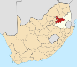 Location in South Africa | ||
| Country | South Africa | |
| Province | Mpumalanga | |
| Seat | Middelburg | |
| Local municipalities | List
| |
| Government [1] | ||
| • Type | Municipal council | |
| • Mayor | Linah Malatjie (African National Congress (ANC)) | |
| Area | ||
| • Total | 16,758 km2 (6,470 sq mi) | |
| Population (2011)[2] | ||
| • Total | 1,308,129 | |
| • Density | 78/km2 (200/sq mi) | |
| Racial makeup (2011) [2] | ||
| • Black African | 87.9% | |
| • Coloured | 1.1% | |
| • Indian/Asian | 0.7% | |
| • White | 9.9% | |
First languages (2011) [3] | ||
| • Southern Ndebele | 28.4% | |
| • Zulu | 23.1% | |
| • Northern Sotho | 14.7% | |
| • Afrikaans | 10.0% | |
| • Other | 23.8% | |
| Time zone | UTC+2 (SAST) | |
| Municipal code | DC31 | |

Nkangala is one of the 3 districts of Mpumalanga province of South Africa. The seat of Nkangala is Middelburg. The Nkangala District Municipality consists of 160 towns and villages. The most spoken language of its 1 020 592 people is IsiNdebele (2001 Census). The district code is DC31.
Contents
1 Geography
1.1 Neighbours
1.2 Local municipalities
2 Demographics
2.1 Gender
2.2 Ethnic group
2.3 Age
3 Politics
3.1 Election results
4 References
5 External links
Geography
Neighbours
Nkangala is surrounded by:
Sekhukhune (CBDC3) to the north
Ehlanzeni (DC32) to the north-east
Gert Sibande (DC30) to the south
Sedibeng (DC42) to the south-west
Ekurhuleni (EastRand) to the south-west
City of Tshwane to the west
Waterberg (DC36) to the north-west
Local municipalities
The district contains the following local municipalities:
| Local municipality | Population | % | Capital | Dominant language |
|---|---|---|---|---|
| Emalahleni | 276 414 | 27.08% | Witbank | Zulu |
| Thembisile Hani | 258 878 | 25.37% | Kwaggafontein | Southern Ndebele |
| Dr JS Moroka | 243 308 | 23.84% | Siyabuswa | Southern Ndebele, Northern Sotho |
| Steve Tshwete | 142 777 | 13.99% | Middelburg | None |
| Victor Khanye | 56 205 | 5.51% | Delmas | Southern Ndebele, Zulu |
| Emakhazeni | 43 008 | 4.21% | Belfast | Swazi |
| Mdala Nature Reserve | 0 | 0.00% | - | - |
Demographics
The following statistics are from the 2001 census.
| Language | Population | % |
|---|---|---|
| IsiNdebele | 319 920 | 31.35% |
| IsiZulu | 232 228 | 22.75% |
| Sepedi | 161 338 | 15.81% |
| Afrikaans | 75 294 | 7.38% |
| SiSwati | 56 496 | 5.54% |
| Setswana | 56 144 | 5.50% |
| Sesotho | 42 474 | 4.16% |
| Xitsonga | 31 624 | 3.10% |
| IsiXhosa | 21 199 | 2.08% |
| English | 17 705 | 1.73% |
| Other | 3 514 | 0.34% |
| Tshivenda | 2 654 | 0.26% |
Gender
| Gender | Population | % |
|---|---|---|
| Female | 529 354 | 51.87% |
| Male | 491 238 | 48.13% |
Ethnic group
| Ethnic group | Population | % |
|---|---|---|
| Black African | 930 873 | 91.21% |
| White | 78 292 | 7.67% |
| Coloured | 8 741 | 0.86% |
| Indian/Asian | 2 686 | 0.26% |
Age
| Age | Population | % |
|---|---|---|
| 000 - 004 | 108 087 | 10.59% |
| 005 - 009 | 114 037 | 11.17% |
| 010 - 014 | 118 590 | 11.62% |
| 015 - 019 | 118 041 | 11.57% |
| 020 - 024 | 98 429 | 9.64% |
| 025 - 029 | 88 106 | 8.63% |
| 030 - 034 | 74 084 | 7.26% |
| 035 - 039 | 69 442 | 6.80% |
| 040 - 044 | 58 251 | 5.71% |
| 045 - 049 | 47 903 | 4.69% |
| 050 - 054 | 35 359 | 3.46% |
| 055 - 059 | 25 013 | 2.45% |
| 060 - 064 | 20 550 | 2.01% |
| 065 - 069 | 14 314 | 1.40% |
| 070 - 074 | 12 782 | 1.25% |
| 075 - 079 | 7 302 | 0.72% |
| 080 - 084 | 6 344 | 0.62% |
| 085 - 089 | 2 273 | 0.22% |
| 090 - 094 | 1 080 | 0.11% |
| 095 - 099 | 420 | 0.04% |
| 100 plus | 185 | 0.02% |
Politics
Election results
Election results for Nkangala in the South African general election, 2004.
- Population 18 and over: 608 871 [59.66% of total population]
- Total votes: 389 097 [38.12% of total population]
- Voting % estimate: 63.90% votes as a % of population 18 and over
| Party | Votes | % |
|---|---|---|
| African National Congress | 333 520 | 85.72% |
| Democratic Alliance | 30 234 | 7.77% |
| United Democratic Movement | 4 188 | 1.08% |
| Freedom Front Plus | 3 997 | 1.03% |
| Pan African Congress | 3 704 | 0.95% |
| African Christian Democratic Party | 3 654 | 0.94% |
| Inkhata Freedom Party | 2 431 | 0.62% |
| New National Party | 1 833 | 0.47% |
| Independent Democrats | 1 710 | 0.44% |
| United Christian Democratic Party | 969 | 0.25% |
| Azanian People's Organisation | 819 | 0.21% |
| SOPA | 381 | 0.10% |
| NA | 272 | 0.07% |
| EMSA | 270 | 0.07% |
| UF | 242 | 0.06% |
| CDP | 226 | 0.06% |
| PJC | 222 | 0.06% |
| TOP | 131 | 0.03% |
| Minority Front | 112 | 0.03% |
| NLP | 92 | 0.02% |
| KISS | 90 | 0.02% |
| Total | 389 097 | 100.00% |
References
^ "Contact list: Executive Mayors". Government Communication & Information System. Archived from the original on 14 July 2010. Retrieved 22 February 2012..mw-parser-output cite.citation{font-style:inherit}.mw-parser-output q{quotes:"""""""'""'"}.mw-parser-output code.cs1-code{color:inherit;background:inherit;border:inherit;padding:inherit}.mw-parser-output .cs1-lock-free a{background:url("//upload.wikimedia.org/wikipedia/commons/thumb/6/65/Lock-green.svg/9px-Lock-green.svg.png")no-repeat;background-position:right .1em center}.mw-parser-output .cs1-lock-limited a,.mw-parser-output .cs1-lock-registration a{background:url("//upload.wikimedia.org/wikipedia/commons/thumb/d/d6/Lock-gray-alt-2.svg/9px-Lock-gray-alt-2.svg.png")no-repeat;background-position:right .1em center}.mw-parser-output .cs1-lock-subscription a{background:url("//upload.wikimedia.org/wikipedia/commons/thumb/a/aa/Lock-red-alt-2.svg/9px-Lock-red-alt-2.svg.png")no-repeat;background-position:right .1em center}.mw-parser-output .cs1-subscription,.mw-parser-output .cs1-registration{color:#555}.mw-parser-output .cs1-subscription span,.mw-parser-output .cs1-registration span{border-bottom:1px dotted;cursor:help}.mw-parser-output .cs1-hidden-error{display:none;font-size:100%}.mw-parser-output .cs1-visible-error{font-size:100%}.mw-parser-output .cs1-subscription,.mw-parser-output .cs1-registration,.mw-parser-output .cs1-format{font-size:95%}.mw-parser-output .cs1-kern-left,.mw-parser-output .cs1-kern-wl-left{padding-left:0.2em}.mw-parser-output .cs1-kern-right,.mw-parser-output .cs1-kern-wl-right{padding-right:0.2em}
^ ab "Statistics by place". Statistics South Africa. Retrieved 27 September 2015.
^ "Statistics by place". Statistics South Africa. Retrieved 27 September 2015.
External links
- Nkangala DM official website
Municipalities of Mpumalanga | ||||||||
|---|---|---|---|---|---|---|---|---|
District and local |
|  | ||||||
List of municipalities in Mpumalanga | ||||||||
Municipalities and communities of Nkangala District Municipality, Mpumalanga | ||
|---|---|---|
District seat: Middelburg | ||
| Emalahleni |
|  |
| Steve Tshwete |
| |
| Emakhazeni |
| |
| Thembisile |
| |
| Dr JS Moroka |
| |
| Victor Khanye |
| |
Coordinates: 25°45′S 29°25′E / 25.750°S 29.417°E / -25.750; 29.417


