Waldo County, Maine
Waldo County, Maine | |
|---|---|
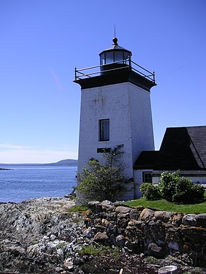 Grindel Point Light | |
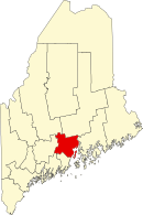 Location in the U.S. state of Maine | |
 Maine's location in the U.S. | |
| Founded | 1827 |
| Named for | Samuel Waldo |
| Seat | Belfast |
| Largest city | Belfast |
| Area | |
| • Total | 853 sq mi (2,209 km2) |
| • Land | 730 sq mi (1,891 km2) |
| • Water | 123 sq mi (319 km2), 14% |
| Population (est.) | |
| • (2016) | 39,364 |
| • Density | 53/sq mi (20/km2) |
| Congressional district | 2nd |
| Time zone | Eastern: UTC−5/−4 |
| Website | waldocountyme.gov |
Waldo County is a county in the state of Maine, in the United States. As of the 2010 census, the population was 38,786.[1] Its county seat is Belfast.[2] The county was founded on 7 February 1827 from a portion of Hancock County and named after Brigadier-General Samuel Waldo, proprietor of the Waldo Patent.[3]
Contents
1 Geography
1.1 Adjacent counties
1.2 National protected area
2 Demographics
2.1 2000 census
2.2 2010 census
3 Politics
4 Communities
4.1 City
4.2 Towns
4.3 Census-designated places
4.4 Other unincorporated villages
5 Cultural references
6 See also
7 References
8 External links
Geography
According to the U.S. Census Bureau, the county has an area of 853 square miles (2,210 km2), of which 730 square miles (1,900 km2) is land and 123 square miles (320 km2) (14%) is water.[4]
Adjacent counties
Penobscot County, Maine – northeast
Hancock County, Maine – east
Knox County, Maine – south
Lincoln County, Maine – southwest
Kennebec County, Maine – west
Somerset County, Maine – northwest
National protected area
- Carlton Pond Waterfowl Production Area
Demographics
| Historical population | |||
|---|---|---|---|
| Census | Pop. | %± | |
| 1830 | 29,788 | — | |
| 1840 | 41,509 | 39.3% | |
| 1850 | 47,230 | 13.8% | |
| 1860 | 38,447 | −18.6% | |
| 1870 | 34,522 | −10.2% | |
| 1880 | 32,463 | −6.0% | |
| 1890 | 27,759 | −14.5% | |
| 1900 | 24,185 | −12.9% | |
| 1910 | 23,383 | −3.3% | |
| 1920 | 21,328 | −8.8% | |
| 1930 | 20,286 | −4.9% | |
| 1940 | 21,159 | 4.3% | |
| 1950 | 21,687 | 2.5% | |
| 1960 | 22,632 | 4.4% | |
| 1970 | 23,328 | 3.1% | |
| 1980 | 28,414 | 21.8% | |
| 1990 | 33,018 | 16.2% | |
| 2000 | 36,280 | 9.9% | |
| 2010 | 38,786 | 6.9% | |
| Est. 2016 | 39,364 | [5] | 1.5% |
| U.S. Decennial Census[6] 1790–1960[7] 1900–1990[8] 1990–2000[9] 2010–2016[1] | |||
2000 census
As of the census[10] of 2000, there were 36,280 people, 14,726 households, and 10,057 families residing in the county. The population density was 50 people per square mile (19/km²). There were 18,904 housing units at an average density of 26 per square mile (10/km²). The racial makeup of the county was 97.89% White, 0.19% Black or African American, 0.40% Native American, 0.21% Asian, 0.01% Pacific Islander, 0.16% from other races, and 1.15% from two or more races. 0.59% of the population were Hispanic or Latino of any race. 24.8% were of English, 14.7% United States or American, 12.7% Irish, 8.5% French and 5.6% German ancestry. 97.1% spoke English and 1.5% French as their first language.
There were 14,726 households out of which 30.70% had children under the age of 18 living with them, 55.20% were married couples living together, 9.00% had a female householder with no husband present, and 31.70% were non-families. 24.90% of all households were made up of individuals and 9.60% had someone living alone who was 65 years of age or older. The average household size was 2.43 and the average family size was 2.88.
In the county, the population was spread out with 24.20% under the age of 18, 7.50% from 18 to 24, 27.80% from 25 to 44, 26.80% from 45 to 64, and 13.60% who were 65 years of age or older. The median age was 39 years. For every 100 females there were 96.60 males. For every 100 females age 18 and over, there were 93.80 males.
The median income for a household in the county was $33,986, and the median income for a family was $40,402. Males had a median income of $29,644 versus $23,816 for females. The per capita income for the county was $17,438. About 10.90% of families and 13.90% of the population were below the poverty line, including 18.60% of those under age 18 and 12.20% of those age 65 or over.
2010 census
As of the 2010 United States Census, there were 38,786 people, 16,431 households, and 10,627 families residing in the county.[11] The population density was 53.1 inhabitants per square mile (20.5/km2). There were 21,566 housing units at an average density of 29.5 per square mile (11.4/km2).[12] The racial makeup of the county was 97.1% white, 0.4% Asian, 0.4% American Indian, 0.4% black or African American, 0.2% from other races, and 1.4% from two or more races. Those of Hispanic or Latino origin made up 0.9% of the population.[11] In terms of ancestry, 18% were English, 13% were American, 11% were Irish, 7% were French, 5% were German, and 4% were French Canadian, 4% Scottish.[13]
Of the 16,431 households, 27.7% had children under the age of 18 living with them, 50.0% were married couples living together, 9.9% had a female householder with no husband present, 35.3% were non-families, and 27.7% of all households were made up of individuals. The average household size was 2.33 and the average family size was 2.81. The median age was 44.1 years.[11]
The county's median household income was $41,312 and the median family income was $50,222. Males had a median income of $38,960 versus $30,321 for females. The county's per capita income was $22,213. About 10.2% of families and 14.6% of the population were below the poverty line, including 20.9% of those under age 18 and 11.6% of those age 65 or over.[14]
Politics
| Voter registration and party enrollment as of June 2014[15] | |||||
|---|---|---|---|---|---|
| Unenrolled | 11,055 | 38.40% | |||
Republican | 8,375 | 29.09% | |||
Democratic | 7,899 | 27.44% | |||
Green Independent | 1,456 | 5.05% | |||
| Total | 28,785 | 100% | |||
| Year | Republican | Democratic | Third parties |
|---|---|---|---|
2016 | 45.7% 10,378 | 46.0% 10,440 | 8.3% 1,889 |
2012 | 43.0% 9,058 | 53.6% 11,296 | 3.4% 707 |
2008 | 43.1% 9,423 | 54.8% 11,967 | 2.1% 460 |
2004 | 46.2% 10,309 | 51.8% 11,555 | 2.0% 454 |
2000 | 45.4% 8,689 | 44.3% 8,477 | 10.3% 1,972 |
1996 | 30.8% 5,318 | 46.4% 8,012 | 22.9% 3,949 |
1992 | 28.3% 5,241 | 34.9% 6,472 | 36.8% 6,816 |
1988 | 55.7% 8,236 | 43.3% 6,402 | 1.0% 140 |
1984 | 62.2% 8,814 | 37.3% 5,289 | 0.4% 63 |
1980 | 49.6% 6,514 | 37.2% 4,883 | 13.3% 1,743 |
1976 | 54.1% 6,289 | 41.7% 4,853 | 4.2% 491 |
1972 | 68.8% 6,480 | 31.2% 2,941 | 0.0% 1 |
1968 | 56.2% 4,821 | 41.1% 3,525 | 2.7% 234 |
1964 | 38.1% 3,324 | 61.9% 5,397 | 0.0% 2 |
1960 | 70.6% 6,844 | 29.4% 2,845 | 0.0% 0 |
1956 | 82.6% 6,590 | 17.4% 1,384 | 0.0% 0 |
1952 | 80.3% 6,363 | 19.5% 1,545 | 0.2% 17 |
1948 | 74.2% 4,371 | 24.9% 1,469 | 0.9% 50 |
1944 | 70.3% 4,291 | 29.6% 1,807 | 0.1% 6 |
1940 | 61.6% 5,170 | 38.3% 3,214 | 0.2% 14 |
1936 | 65.0% 5,309 | 32.8% 2,678 | 2.3% 185 |
1932 | 53.2% 4,505 | 46.1% 3,907 | 0.7% 55 |
1928 | 77.1% 4,851 | 22.3% 1,402 | 0.7% 41 |
1924 | 75.8% 4,003 | 21.3% 1,125 | 2.9% 153 |
1920 | 71.5% 4,383 | 27.2% 1,666 | 1.3% 79 |
1916 | 47.6% 2,418 | 50.0% 2,539 | 2.5% 125 |
1912 | 18.2% 881 | 44.3% 2,145 | 37.5% 1,815 |
1908 | 63.2% 2,491 | 33.9% 1,335 | 2.9% 114 |
Communities
City
Belfast (county seat)
Towns
- Belmont
- Brooks
- Burnham
- Frankfort
- Freedom
- Islesboro
- Jackson
- Knox
- Liberty
- Lincolnville
- Monroe
- Montville
- Morrill
- Northport
- Palermo
- Prospect
- Searsmont
- Searsport
- Stockton Springs
- Swanville
- Thorndike
- Troy
- Unity
- Waldo
- Winterport
Census-designated places
- Searsport
- Unity
- Winterport
Other unincorporated villages
- East Thorndike
- East Troy
- Sandy Point
Cultural references
Waldo County features in Nathaniel Hawthorne's classic novel The House of the Seven Gables as the site of extensive landholdings once claimed by the formerly aristocratic Pyncheon family.
See also
- National Register of Historic Places listings in Waldo County, Maine
References
^ ab "State & County QuickFacts". United States Census Bureau. Retrieved August 19, 2013..mw-parser-output cite.citation{font-style:inherit}.mw-parser-output .citation q{quotes:"""""""'""'"}.mw-parser-output .citation .cs1-lock-free a{background:url("//upload.wikimedia.org/wikipedia/commons/thumb/6/65/Lock-green.svg/9px-Lock-green.svg.png")no-repeat;background-position:right .1em center}.mw-parser-output .citation .cs1-lock-limited a,.mw-parser-output .citation .cs1-lock-registration a{background:url("//upload.wikimedia.org/wikipedia/commons/thumb/d/d6/Lock-gray-alt-2.svg/9px-Lock-gray-alt-2.svg.png")no-repeat;background-position:right .1em center}.mw-parser-output .citation .cs1-lock-subscription a{background:url("//upload.wikimedia.org/wikipedia/commons/thumb/a/aa/Lock-red-alt-2.svg/9px-Lock-red-alt-2.svg.png")no-repeat;background-position:right .1em center}.mw-parser-output .cs1-subscription,.mw-parser-output .cs1-registration{color:#555}.mw-parser-output .cs1-subscription span,.mw-parser-output .cs1-registration span{border-bottom:1px dotted;cursor:help}.mw-parser-output .cs1-ws-icon a{background:url("//upload.wikimedia.org/wikipedia/commons/thumb/4/4c/Wikisource-logo.svg/12px-Wikisource-logo.svg.png")no-repeat;background-position:right .1em center}.mw-parser-output code.cs1-code{color:inherit;background:inherit;border:inherit;padding:inherit}.mw-parser-output .cs1-hidden-error{display:none;font-size:100%}.mw-parser-output .cs1-visible-error{font-size:100%}.mw-parser-output .cs1-maint{display:none;color:#33aa33;margin-left:0.3em}.mw-parser-output .cs1-subscription,.mw-parser-output .cs1-registration,.mw-parser-output .cs1-format{font-size:95%}.mw-parser-output .cs1-kern-left,.mw-parser-output .cs1-kern-wl-left{padding-left:0.2em}.mw-parser-output .cs1-kern-right,.mw-parser-output .cs1-kern-wl-right{padding-right:0.2em}
^ "Find a County". National Association of Counties. Retrieved 2011-06-07.
^ Coolidge, Austin J.; John B. Mansfield (1859). A History and Description of New England. Boston, Massachusetts. pp. 337–338.
^ "2010 Census Gazetteer Files". United States Census Bureau. August 22, 2012. Archived from the original on September 9, 2014. Retrieved September 7, 2014.
^ "Population and Housing Unit Estimates". Retrieved June 9, 2017.
^ "U.S. Decennial Census". United States Census Bureau. Retrieved September 7, 2014.
^ "Historical Census Browser". University of Virginia Library. Retrieved September 7, 2014.
^ "Population of Counties by Decennial Census: 1900 to 1990". United States Census Bureau. Retrieved September 7, 2014.
^ "Census 2000 PHC-T-4. Ranking Tables for Counties: 1990 and 2000" (PDF). United States Census Bureau. Retrieved September 7, 2014.
^ "American FactFinder". United States Census Bureau. Retrieved 2008-01-31.
^ abc "DP-1 Profile of General Population and Housing Characteristics: 2010 Demographic Profile Data". United States Census Bureau. Retrieved 2016-01-21.
^ "Population, Housing Units, Area, and Density: 2010 - County". United States Census Bureau. Retrieved 2016-01-21.
^ "DP02 SELECTED SOCIAL CHARACTERISTICS IN THE UNITED STATES – 2006-2010 American Community Survey 5-Year Estimates". United States Census Bureau. Retrieved 2016-01-21.
^ "DP03 SELECTED ECONOMIC CHARACTERISTICS – 2006-2010 American Community Survey 5-Year Estimates". United States Census Bureau. Retrieved 2016-01-21.
^ "Registration and Party Enrollment Statistics as of June 10, 2014" (PDF). Maine Bureau of Corporations.
^ Leip, David. "Dave Leip's Atlas of U.S. Presidential Elections". uselectionatlas.org. Retrieved 2018-08-26.
External links
- Official Website of Waldo County
- Maine Genealogy: Waldo County, Maine
Places adjacent to Waldo County, Maine | ||||||||||
|---|---|---|---|---|---|---|---|---|---|---|
| ||||||||||
Municipalities and communities of Waldo County, Maine, United States | ||
|---|---|---|
County seat: Belfast | ||
| City |
|  |
| Towns |
| |
| CDPs |
| |
| Other villages |
| |
Augusta (capital) | |
| Topics |
|
| Society |
|
| Regions |
|
| Counties |
|
| Cities |
|
| Largest towns |
|
Coordinates: 44°29′N 69°07′W / 44.48°N 69.12°W / 44.48; -69.12


