Huangshi
Huangshi .mw-parser-output .nobold{font-weight:normal} 黄石市 | |
|---|---|
Prefecture-level city | |
 | |
 Location of Huangshi City in Hubei and the PRC | |
 Huangshi Location in Hubei | |
| Coordinates: 30°13′N 115°05′E / 30.217°N 115.083°E / 30.217; 115.083Coordinates: 30°13′N 115°05′E / 30.217°N 115.083°E / 30.217; 115.083 | |
| Country | People's Republic of China |
| Province | Hubei |
| Area | |
| • Prefecture-level city | 4,582.85 km2 (1,769.45 sq mi) |
| • Urban | 233.8 km2 (90.3 sq mi) |
| • Metro | 1,800.1 km2 (695.0 sq mi) |
| Population (2010 census[1]) | |
| • Prefecture-level city | 2,429,318 |
| • Density | 530/km2 (1,400/sq mi) |
| • Urban | 691,963 |
| • Urban density | 3,000/km2 (7,700/sq mi) |
| • Metro | 1,601,687 |
| • Metro density | 890/km2 (2,300/sq mi) |
| Time zone | UTC+8 (China Standard) |
| ISO 3166 code | CN-HB-02 |
| Licence plate prefixes | 鄂B |
| Website | 黄石市政府网 (Huangshi City Government Website) (in Simplified Chinese) |
Huangshi (simplified Chinese: 黄石; traditional Chinese: 黃石; pinyin: Huángshí) is a prefecture-level city in southeastern Hubei province, People's Republic of China.
Its population was 2,429,318 inhabitants at the 2010 census; 1,601,687 of whom lived in the built-up (or metro) area made up of 4 urban districts plus the city of Daye, now being part of the agglomeration.
Contents
1 History
2 Geography and climate
3 Administration
4 Demographics
5 Economy
6 Transportation
7 Tourism
8 Notable residents
9 References
10 External links
History
In 845 BC Marquis Wen 文侯 Huang Meng 黃孟 (aka Huang Zhang 黃璋) moved the capital of the State of Huang from Yicheng to Huangchuan (present-day Huangchuan, Henan). Huang Xi's descendants ruled State of Huang until 648 BC when it was destroyed by the State of Chu.[2] The Marquis of Huang, Marquis Mu 穆侯 Huang Qisheng 黃企生, fled to the state of Qi. The people of Huang were forced to relocate to Chu. They settled in the region of present-day Hubei province, in a region known as the Jiangxia Prefecture 江夏郡 during the Han dynasty (206 BC-AD 220).
On 9 March 1944, 18 CACW B-25s escorted by 24 P-40s bombed a foundry and floating docks at Huangshi in Hubei. They were intercepted by Japanese fighters from the 25th and 9th Sentai and lost 2 P-40s.
Geography and climate
Huangshi is located in southeastern Hubei province, primarily along the southwestern bank of one of the major bends in the Yangtze River. It is located 100 kilometres (62 mi)[3] south-east of Wuhan, and borders Jiangxi province to the south. Its area was reported by the local government as 4,583 square kilometres (1,770 sq mi);[4] elsewhere, the number of 4,630 square kilometres (1,790 sq mi) was given. The terrain is mostly small mountains and hills. The tallest mountain is 7 Summit Mountain with an elevation of 860 metres (2,820 ft) above sea level. Huangshi is also located in a major lake district between Hunan's Dongting Lake and Jiangxi's Poyang lake and has dozens of large lakes.
Huangshi's climate is sub-temperate. Average annual temperature is 17 °C (63 °F) and precipitation is 1,400 mm (55.1 in). There are 264 frost free days. It is possible to see limited snowfall between December and February.
Administration
As of 2016[update], Huangshi had 4 districts, 1 county, and 1 county-level city:[5][6][7][8]
NBS Area No. | Name (from Mand.) | Chinese (Simp.) | ||||
|---|---|---|---|---|---|---|
| 420201000000 | city-administered area | 市辖区 | ||||
Districts | ||||||
| 420202000000 | Huangshigang District | 黄石港区 | ||||
| 420203000000 | Xisaishan District | 西塞山区 | ||||
| 420204000000 | Xialu District | 下陆区 | ||||
| 420205000000 | Tieshan District | 铁山区 | ||||
| former | Shihuiyao District | 石灰窑区 | ||||
County | ||||||
| 420222000000 | Yangxin County | 阳新县 | ||||
County-level City | ||||||
| 420281000000 | Daye | 大冶市 | ||||
Other Areas | ||||||
| - | Huangshi Economic Technology Development District | 黄石经济技术开发区 | ||||
| Map[9] |
|---|
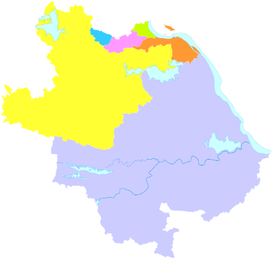 1 Xisaishan Xialu Tieshan Yangxin County Daye (city) 1.Huangshigang |
Demographics
According to the Fifth Population Census of China (2000), the entire prefecture-level city of Huangshi had 2,476,400 people, making for the population density of 540 people per square kilometer.[10] More than 99% of the population belong to the Han ethnic group.
According to Google Map there are 686.894 people in Huangshi; this refers, presumably, to Huangshi's urban core (Huangshigang District
196,600 people, density 5757 people /km2; West Fort Mountain (Xisaishan) Area, 244,000, density 2171 people /km2; Xialu District, 146,600 people, density 2536 people /km2),[10] and excludes the far-flung Yangxin County, Daye, and Tieshan.

Economy
Huangshi's GDP for 2003 was 27.5 billion CNY. Its proximity to Wuhan and location along major rail lines and the Yangtze River make Huangshi an important logistics, distribution, and transportation hub. Mineral resources are plentiful in Huangshi giving it the nickname "The Southern Cornucopia". Metals include iron, manganese, gold, copper, tungsten, molybdenum, zinc, lead, cobalt, silver, gallium, and thallium. Other mineral resources include germanium, indium, selenium, tellurium, sulfur, calcite, limestone, celestine, plaster, and many others.
Agriculture is also a major part of Huangshi's economy. There are more than 3000 species of plants in Huangshi, many of them used for food, pharmaceuticals, and fragrance.
Other industries include metallurgy, textiles, construction materials, energy, light manufacturing, electronics, pharmaceuticals, chemicals, and food processing.
2 of the biggest companies in the city are the Daye Steel Co. Ltd (大冶特钢) and Huaxing Cement Co. Ltd (华新水泥股份有限公司).
Transportation

The Huangshi North Station on the new Wuhan-Huanghshi commuter rail line
The prefecture-level city is served by G45 Daqing–Guangzhou Expressway, G50 Shanghai–Chongqing Expressway, National Highways 106 and 316 and Wuhan–Jiujiang Railway. The city has two Yangtze River crossings, the Huangshi Yangtze River Bridge and the Edong Yangtze River Bridge.
Many of the passenger trains traveling on the Wuhan–Jiujiang Railway between Wuhan (Wuchang and Wuhan Stations) and the points southeast make stops at the Huangshi and Yangxin stations. The Huangshi Station is located within the administrative borders of Daye County-level city (30°9′23″N 114°56′5″E / 30.15639°N 114.93472°E / 30.15639; 114.93472), about 5 km (3 mi) north of downtown Daye and 10 km (6 mi) west of downtown Huangshi. The Yangxin Station is near Yangxin County's county seat, Xingguo Town.
Although Huangshi's main urban area is some distance away from the Wuhan–Jiujiang Railway mainline, it is connected to it by a dead-end branch, of considerable importance for the local industries. It runs all the way to Huangshi's river port on the Yangtze. There was even a downtown passenger station on this branch (Huangshi East Railway Station, 30°12′25″N 115°5′5″E / 30.20694°N 115.08472°E / 30.20694; 115.08472), but, as of 2012[update], it was served by very few trains,[11] and by 2015, was not in operation anymore.
In 2014, the Wuhan-Huangshi line of the Wuhan Metropolitan Area Intercity Railway opened. The three stations of this commuter rail system in the Huangshi area are Huahu (花湖站), Huangshi North[12] and Daye North.[13] Huahu, although technically situated within the boundaries of Ezhou City, is actually located on the north-western edge of Huangshi's central city (30°15′49″N 115°01′00″E / 30.263600°N 115.016645°E / 30.263600; 115.016645); Haungshi North is in Xialu District, in the western part of Huangshi's central city; the Daye North station is north-east of Daye (30°07′31″N 114°59′45″E / 30.125216°N 114.995895°E / 30.125216; 114.995895).
Tourism

Ci Lake is the northern most section of the larger Qingshanhu 青山湖.
Huangshi is situated amongst numerous picturesque lakes and mountains. One of Huangshi’s more famous sites is the Buddhist Temple on Dong Fang Shan 东方山风景区 (East Mountain), Cihu Lake, Xisaishan 西塞山区, TuanChengShan Park, and Qingshanhu 青山湖 with connecting Ci Lake.
Cihu Lake with surrounding Cihu Lake Scenery Park (磁湖风景区) separates the older areas of Huangshi to the newer government development zone.
The former eastern pit of the Daye Iron Mine, which operated from the late 1890s until 2000, has been converted into Huangshi National Mining Park (黄石国家矿山公园), where visitors can see a variety of mining equipment from the past and the present.[14]
Xisaishan, located on the South Bank of the Yangtze River in the eastern part of the provides visitors and locals alike an amazing view of the city and Yangtze River below (considered a 3A class tourist attraction).
Notable residents
Cheng Fei, gymnast (b. 1988)
References
^ http://www.citypopulation.de/php/china-hubei-admin.php
^ 《左传·僖公十二年》:“黄人恃诸侯之睦于齐也,不共楚职,曰:“自郢及我九百里,焉能害我?” 夏,楚灭黄。”
^ "Huangshi (China) - Britannica Online Encyclopedia". Britannica.com. Retrieved 2013-03-26..mw-parser-output cite.citation{font-style:inherit}.mw-parser-output .citation q{quotes:"""""""'""'"}.mw-parser-output .citation .cs1-lock-free a{background:url("//upload.wikimedia.org/wikipedia/commons/thumb/6/65/Lock-green.svg/9px-Lock-green.svg.png")no-repeat;background-position:right .1em center}.mw-parser-output .citation .cs1-lock-limited a,.mw-parser-output .citation .cs1-lock-registration a{background:url("//upload.wikimedia.org/wikipedia/commons/thumb/d/d6/Lock-gray-alt-2.svg/9px-Lock-gray-alt-2.svg.png")no-repeat;background-position:right .1em center}.mw-parser-output .citation .cs1-lock-subscription a{background:url("//upload.wikimedia.org/wikipedia/commons/thumb/a/aa/Lock-red-alt-2.svg/9px-Lock-red-alt-2.svg.png")no-repeat;background-position:right .1em center}.mw-parser-output .cs1-subscription,.mw-parser-output .cs1-registration{color:#555}.mw-parser-output .cs1-subscription span,.mw-parser-output .cs1-registration span{border-bottom:1px dotted;cursor:help}.mw-parser-output .cs1-ws-icon a{background:url("//upload.wikimedia.org/wikipedia/commons/thumb/4/4c/Wikisource-logo.svg/12px-Wikisource-logo.svg.png")no-repeat;background-position:right .1em center}.mw-parser-output code.cs1-code{color:inherit;background:inherit;border:inherit;padding:inherit}.mw-parser-output .cs1-hidden-error{display:none;font-size:100%}.mw-parser-output .cs1-visible-error{font-size:100%}.mw-parser-output .cs1-maint{display:none;color:#33aa33;margin-left:0.3em}.mw-parser-output .cs1-subscription,.mw-parser-output .cs1-registration,.mw-parser-output .cs1-format{font-size:95%}.mw-parser-output .cs1-kern-left,.mw-parser-output .cs1-kern-wl-left{padding-left:0.2em}.mw-parser-output .cs1-kern-right,.mw-parser-output .cs1-kern-wl-right{padding-right:0.2em}
^ [1][permanent dead link]
^ 2016年统计用区划代码和城乡划分代码:黄石市 (in Chinese). National Bureau of Statistics of the People's Republic of China. 2016. Retrieved 24 January 2018.统计用区划代码 名称 420201000000 市辖区 420202000000 黄石港区 420203000000 西塞山区 420204000000 下陆区 420205000000 铁山区 420222000000 阳新县 420281000000 大冶市
^ 黄石市历史沿革 [The Historical Development of Huangshi City] (in Chinese). XZQH.org. 15 August 2014. Retrieved 24 January 2018.2000年第五次全国人口普查,黄石市{...}其中:黄石港区{...}石灰窑区{...}下陆区{...}铁山区{...}阳新县{...}大冶市{...}开发区{...}
^ 湖北黄石市 (in Chinese). 博雅地名网. Retrieved 24 January 2018.
^ 中国地质邮政编码簿(2015). 中国邮政集团公司. 2015. pp. 580–582.
^ 黄石概述 map.png (800×762) (in Chinese). Huangshi People's Government. Retrieved 24 January 2018.黄石市{...}黄石港区{...}西塞山区{...}下陆区{...}铁山区{...}阳新县{...}大冶市{...}
^ ab Huangshi population statistics[permanent dead link], as reported by Huangshi Prefecture-Level City Government
^ Huangshi East schedule (in Chinese)
^ Huangshi North schedule
^ Daye North schedule
^ "Mining for tourism in Hubei", By Li Jing (China Daily). Updated: 2008-09-22
External links
| Wikimedia Commons has media related to Huangshi. |
- Official Newspaper(Chinese)
Hubei topics | |
|---|---|
Wuhan (capital) | |
| General |
|
| Geography |
|
| Education |
|
| Culture |
|
| Cuisine |
|
| Visitor attractions |
|
| |
Authority control |
|
|---|


