Sakha Republic
Republic of Sakha (Yakutia) Республика Саха (Якутия) (Russian) Саха Өрөспүүбүлүкэтэ (Yakut) | |||||
|---|---|---|---|---|---|
| — Republic — | |||||
| |||||
| Anthem: National Anthem of the Sakha Republic | |||||
| |||||
| Coordinates: 66°24′N 129°10′E / 66.400°N 129.167°E / 66.400; 129.167Coordinates: 66°24′N 129°10′E / 66.400°N 129.167°E / 66.400; 129.167 | |||||
| Political status | |||||
| Country | Russia | ||||
| Federal district | Far Eastern[1] | ||||
| Economic region | Far Eastern[2] | ||||
| Established | April 27, 1922[3] | ||||
| Capital | Yakutsk | ||||
| Government (as of May 2018) | |||||
| • Head[4] | Aysen Nikolayev | ||||
| • Legislature | State Assembly (Il Tumen)[4] | ||||
| Statistics | |||||
Area [5] | |||||
| • Total | 3,083,523 km2 (1,190,555 sq mi) | ||||
| Area rank | 1st | ||||
Population (2010 Census)[6] | |||||
| • Total | 958,528 | ||||
| • Rank | 55th | ||||
| • Density[7] | 0.31/km2 (0.80/sq mi) | ||||
| • Urban | 64.1% | ||||
| • Rural | 35.9% | ||||
Time zone(s) | [8] | ||||
| ISO 3166-2 | RU-SA | ||||
| License plates | 14 | ||||
| Official languages | Russian;[9] Yakut[10] | ||||
| Official website | |||||


The Republic of Sakha (Yakutia) (Russian: Республика Саха (Якутия), tr. Respublika Sakha (Yakutiya), IPA: [rʲɪsˈpublʲɪkə sɐˈxa jɪˈkutʲɪjə]; Sakha: Саха Өрөспүүбүлүкэтэ, translit. Sakha Öröspüübülükete, IPA: [saˈxa øɾøsˈpyːbylykete], (Russian: Саха (Якутия); Sakha: Саха Сирэ, translit. Sakha Sire), is a federal Russian republic. It had a population of 958,528 at the 2010 Census,[6] mainly ethnic Yakuts and Russians.
Comprising half the Far Eastern Federal District, it is the largest subnational governing body by area in the world at 3,083,523 square kilometers (1,190,555 sq mi).[5] Its capital is the city of Yakutsk. It is also known for its extreme and severe climate, with the lowest temperatures in the Northern Hemisphere being recorded in Verkhoyansk, Oymyakon, and Delyankir, and regular winter averages commonly being below −35 °C (−31 °F) in Yakutsk. The hypercontinental tendencies also result in very warm summers for much of the republic.
Contents
1 Geography
1.1 Time zones
1.2 Rivers
1.3 Lakes
1.4 Mountains
1.5 Peninsulas
1.6 Islands
1.7 Natural resources
1.8 Climate
2 Administrative divisions
3 History
3.1 Pre-history
3.2 Early history
3.3 Russian conquest
3.4 Russian Empire
3.5 Soviet era
4 Demographics
4.1 Settlements
4.2 Vital statistics
4.3 Ethnic groups
4.4 Languages
4.5 Religion
5 Politics
6 Economy
7 Transportation
8 Education
9 Culture
10 National days
11 See also
12 References
12.1 Notes
12.2 Sources
13 External links
Geography

Fauna of the Sakha Republic: Ross's gull, the Siberian crane, polar bear, horse and reindeer. Russian post miniature sheet, 2006.
Borders:
internal: Chukotka Autonomous Okrug (660 km)(E), Magadan Oblast (1520 km)(E/SE), Khabarovsk Krai (2130 km)(SE), Amur Oblast (S), Zabaykalsky Krai (S), Irkutsk Oblast (S/SW), Krasnoyarsk Krai (W).
water: Arctic Ocean (including Laptev Sea and Eastern Siberian Sea) (N).
Highest point: Peak Pobeda (3,003 m), Mus-Khaya Mountain Peak (2959 m or 3,011 m)
Maximum N->S distance: 2,500 km (1,600 mi)
Maximum E->W distance: 2,000 km (1,200 mi)
Sakha stretches to the Henrietta Island in the far north and is washed by the Laptev and Eastern Siberian Seas of the Arctic Ocean. These waters, the coldest and iciest of all seas in the Northern Hemisphere, are covered by ice for 9–10 months of the year. New Siberian Islands are a part of the republic's territory. After Nunavut was separated from Canada's Northwest Territories, Sakha became the largest subnational entity (statoid) in the world, with an area of 3,083,523 square kilometers (1,190,555 sq mi),[5] slightly smaller than the territory of India (3.3 million km2).
Sakha can be divided into three great vegetation belts. About 40% of Sakha lies above the Arctic circle and all of it is covered by permafrost which greatly influences the region's ecology and limits forests in the southern region. Arctic and subarctic tundra define the middle region, where lichen and moss grow as great green carpets and are favorite pastures for reindeer. In the southern part of the tundra belt, scattered stands of dwarf Siberian pine and larch grow along the rivers. Below the tundra is the vast taiga forest region. Larch trees dominate in the north and stands of fir and pine begin to appear in the south. Taiga forests cover about 47% of Sakha and almost 90% of the cover is larch.
The Sakha Republic is the site of Pleistocene Park, a project directed at recreating Pleistocene tundra grasslands by stimulating the growth of grass with the introduction of animals which thrived in the region during the late Pleistocene — early Holocene period.
Time zones

Map of Sakha (Yakutia).
Sakha spans three time zones (no Daylight Saving Time in summer):
Yakutsk Time Zone (YAKT, UTC+9). Covers the republic's territory to the west of the Lena River as well as the territories of the districts located on both sides of the Lena River.
Vladivostok Time Zone (VLAT, UTC+10). Covers most of the republic's territory located between 127°E and 140°E longitude. Districts: Oymyakonsky, Ust-Yansky, Verkhoyansky.[11]
Magadan Time Zone (SRET, UTC+11). Covers most of the republic's territory located east of 140°E longitude. Districts: Abyysky, Allaikhovsky, Momsky, Nizhnekolymsky, Srednekolymsky, Verkhnekolymsky.

Detailed map of the three time zones in the Sakha Republic (as of September 2011).
Rivers

Ura River.

Olyokma River.

Lena Pillars.
Navigable Lena River (4,400 km), as it moves northward, includes hundreds of small tributaries located in the Verkhoyansk Range. Other major rivers include:
Vilyuy River (2,650 km) Lena River tributary
Olenyok River (2,292 km)
Aldan River (2,273 km) Lena River tributary
Kolyma River (2,129 km)
Indigirka River (1,726 km)
Alazeya River (1,590 km)
Amga River (1,462 km) Aldan River tributary
Olyokma River (1,320 km) Lena River tributary
Markha River (1,181 km) Vilyuy River tributary
Tyung River (1,092 km) Vilyuy River tributary
Maya River (1,053 km) Aldan River tributary
Anabar River (939 km)
Yana River (872 km)
Morkoka River (812 km) Markha River tributary
Uchur River (812 km) Aldan River tributary
Linde River (804 km) Lena River tributary
Nyuya River (798 km) Lena River tributary
Selennyakh River (796 km) Indigirka River tributary
Lakes
There are over 800,000 lakes in the republic.[12] Major lakes and reservoirs include:
- Lake Mogotoyevo
- Lake Nedzheli
- Lake Nerpichye
- Vilyuyskoye Reservoir
Mountains
Sakha's greatest mountain range, the Verkhoyansk Range, runs parallel and east of the Lena River, forming a great arc that begins in the Sea of Okhotsk and ends in the Laptev Sea.
The Chersky Range runs east of the Verkhoyansk Range and has the highest peak in Sakha, Peak Pobeda (3,147 m). The second highest peak is Peak Mus-Khaya reaching 3,011 m.
The Stanovoi Range borders Sakha in the south.

Udachnaya pipe diamond mine.
Peninsulas
The Republic's extensive coastline contains a number of peninsulas; from west to east the most prominent are:
- Uryung-Tumus Peninsula
- Nordvik Peninsula
- Terpyay-Tumsa Peninsula
- Bykovsky Peninsula
- Buor-Khaya Peninsula
- Manyko Peninsula
- Shirokostan Peninsula
- Merkushina Strelka Peninsula
- Lopatka Peninsula
Islands
From west to east the main islands of Sakha are:
- Preobrazheniya Island
- Bolshoy Begichev Island
- Maliy Begichev Island
- Peschany Island
- Salkay Island
- Orto Ary
- Daldalakh
- Dyangylakh Island
- Dunay Islands
- Leykina Island
- Islands of the Lena Delta
- Brusneva Island
- Muostakh Island
- Ulakhan Ary Island
- Yarok Island
- Shelonsky Islands
- Makar Island
- Stolbovoy Island
New Siberian Islands (by far the largest group)- De Long Islands
- Medvezhyi Islands
- Kolesovsky Island
- Kolesovskaya Otmel
- Gabyshevskiy Island
- Kamenka Island
- Markhayanovskiy Island
- Gusmp Island
- Sukhanyy Island
Natural resources
Sakha is well endowed with raw materials. The soil contains large reserves of oil, gas, coal, diamonds, gold, silver, tin, tungsten and many others. Sakha produces 99% of all Russian diamonds and over 25% of the diamonds mined in the world.[13][14]
Climate
Sakha is known for its climate extremes, with the Verkhoyansk Range being the coldest area in the Northern Hemisphere. Some of the lowest natural temperatures ever recorded have been here. The Northern Hemisphere's Pole of Cold is at Verkhoyansk, where the temperatures reached as low as −67.8 °C (−90.0 °F) in 1892, and at Oymyakon, where the temperatures reached as low as −71.2 °C (−96.2 °F) in 1926.
| City | July (°C) | July (°F) | January (°C) | January (°F) |
|---|---|---|---|---|
| Aldan | 22.6/10.9 | 72.7/51.6 | –21.9/–30.6 | –7.4/–23.1 |
Delyankir | 22/7 | 71.6/44.6 | –43/–51 | –45/–60 |
| Olyokminsk | 24.8/12 | 75.2/53.6 | –26.2/–34.6 | –15.2/–30.28 |
| Oymyakon | 22.7/6.1 | 72.9/43 | –42.5/–50 | –44.5/–58 |
| Verkhoyansk | 23.5/9.7 | 74.3/49.5 | –42.4/–48.3 | –44.3/–54.9 |
| Yakutsk | 25.5/12.7 | 78/54.9 | –35.1/–41.5 | –31.2/–42.7 |
Average annual precipitation: 200 mm (central parts) to 700 mm (mountains of Eastern Sakha).
Administrative divisions
History
Pre-history
Siberia, and particularly Yakutia is of paleontological significance, as it contains bodies of prehistoric animals from the Pleistocene Epoch, preserved in ice or permafrost. In 2015, the frozen bodies of Dina and Uyan the cave lion cubs were found. The region was also the location the bodies of Yuka and another Woolly mammoth from Oymyakon, a Woolly rhinoceros from the Kolyma River, and bison and horses from Yukagir.[20]
Ymyakhtakh culture (c. 2200-1300 BC) was a Late Neolithic culture of Siberia, with a very large archaeological horizon. Its origins were in Sakha, in the Lena river basin. From there it spread both to the east and to the west.[21]
Early history
The Turkic Sakha people or Yakuts probably settled in the area in the 13th and 14th centuries, migrating north from the Lake Baikal area to the middle Lena. From their new center along the middle Lena, they gradually expanded northeast and west beyond the Lena basin towards the Arctic Ocean.
The name Sakha is of Turkic origin, "saqa-saha" meaning "cue" or "bat". The term Yakut is a Turkic word, a corruption of zhaqut - yakut "precious stone", referring to the ruby.
The Sakha displaced earlier, much smaller populations who lived on hunting and reindeer herding, introducing the pastoralist economy of Central Asia. The indigenous populations of Paleosiberian and Tungusic stock
were mostly assimilated to the Sakha by the 17th century.[22]
Russian conquest
The Tsardom of Russia began its conquest of the region in the 17th century, moving east after the defeat of the Khanate of Sibir. Tygyn, a king of the Khangalassky Yakuts, granted territory for Russian settlement in return for a military pact that included war against indigenous rebels of all North Eastern Asia (Magadan, Chukotka, Kamchatka and Sakhalin). Kull, a king of the Megino-Khangalassky Yakuts, began a Sakha conspiracy by allowing the first stockade construction.[citation needed]
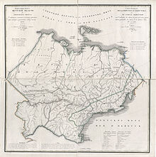
1821 map of Yakutsk Oblast.
In August 1638, the Moscow Government formed a new administrative unit with the administrative center of Lensky Ostrog (Fort Lensky), the future city of Yakutsk, which had been founded by Pyotr Beketov in 1632.
The arrival of the Russian settlers at the remote Russkoye Ustye in the Indigirka delta likely also dates to the 17th century.[23] The Siberian Governorate was established as part of the Russian Tsardom in 1708.
Russian settlers began to form a community in the 18th century, which adopted certain Yakut customs and was often called Yakutyane (Якутя́не) or Lena Early Settlers (ленские старожилы). However, the influx of later settlers assimilated them into the Russian mainstream by the 20th century.
Russian Empire
In an administrative reform of 1782, Irkutsk Governorate was created. In 1805, Yakutsk Oblast was split from Irkutsk Governorate.
Yakutsk Oblast in the early 19th century marked the easternmost territory of the Russian Empire, including such Far Eastern (Pacific) territories as were acquired, known as Okhotsk Okrug within Yakutsk Oblast. With the formation of Primorskaya Oblast in 1856, the Russian territories of the Pacific were detached from Yakutia.

Members of the Siberian Regional Duma from Yakutsk, 1917.
The Russians established agriculture in the Lena River basin. The members of religious groups who were exiled to Sakha in the second half of the 19th century began to grow wheat, oats, and potatoes. The fur trade established a cash economy. Industry and transport began to develop at the end of the 19th century and in the beginning of the Soviet period. This was also the beginning of geological prospecting, mining, and local lead production. The first steam-powered ships and barges arrived.
Yakutia's remoteness, even compared to the rest of Siberia, made it a place of exile of choice for both Tsarist and Communist governments of Russia. Among the famous Tsarist-era exiles were the democratic writer Nikolay Chernyshevsky; Doukhobor conscientious objectors, whose story was told to Leo Tolstoy by Vasily Pozdnyakov; the Socialist Revolutionary and writer Vladimir Zenzinov, who left an interesting account of his Arctic experiences; and Polish socialist activist Wacław Sieroszewski, who pioneered in ethnographic research on Yakut people.
Soviet era
On April 27, 1922, former Yakutsk Oblast was proclaimed the Yakut ASSR, although in fact the eastern part of the territory, including the city of Yakutsk, was controlled by the White Russians (see Yakut revolt).
In 1992, after the fall of the Soviet Union, Yakutia was recognized in Moscow as the Sakha (Yakutia) Republic under the jurisdiction of the Russian Federation.
Yakutia is historically part of Russian Siberia, but since the formation of the Far Eastern Federal District in 2000, it is administratively part of the Russian Far East.
Demographics
Population: 958,528 (2010 Census);[6]949,280 (2002 Census);[24]1,081,408 (1989 Census).[25]
Settlements
Largest cities or towns in the Sakha Republic 2010 Russian Census | |||||||||
|---|---|---|---|---|---|---|---|---|---|
| Rank | Administrative division | Pop. | |||||||
 Yakutsk  Neryungri | 1 | Yakutsk | City of republic significance of Yakutsk | 269,601 |  Mirny  Lensk | ||||
| 2 | Neryungri | Neryungrinsky District | 61,747 | ||||||
| 3 | Mirny | Mirninsky District | 37,188 | ||||||
| 4 | Lensk | Lensky District | 24,966 | ||||||
| 5 | Aldan | Aldansky District | 21,275 | ||||||
| 6 | Aykhal | Mirninsky District | 13,727 | ||||||
| 7 | Udachny | Mirninsky District | 12,613 | ||||||
| 8 | Vilyuysk | Vilyuysky District | 10,234 | ||||||
| 9 | Nyurba | Nyurbinsky District | 10,157 | ||||||
| 10 | Suntar | Suntarsky District | 10,034 | ||||||
Vital statistics

Breakdown of population changes, 1939–2002.

Russian President Vladimir Putin with local residents in Lensk.

Statehood Day celebrations in Yakutsk.

Vitim, Sakha Republic.

Dapparay.

Cruise on the Lena River.
- Source: Russian Federal State Statistics Service
| Average population (x 1000) | Live births | Deaths | Natural change | Crude birth rate (per 1000) | Crude death rate (per 1000) | Natural change (per 1000) | Fertility rates | |
|---|---|---|---|---|---|---|---|---|
| 1970 | 674 | 13,899 | 5,700 | 8,199 | 20.6 | 8.5 | 12.2 | |
| 1975 | 775 | 15,636 | 6,242 | 9,394 | 20.2 | 8.1 | 12.1 | |
| 1980 | 887 | 18,132 | 7,501 | 10,631 | 20.4 | 8.5 | 12.0 | |
| 1985 | 1,002 | 22,823 | 7,266 | 15,557 | 22.8 | 7.3 | 15.5 | |
| 1990 | 1,115 | 21,662 | 7,470 | 14,192 | 19.4 | 6.7 | 12.7 | 2.46 |
| 1991 | 1,110 | 19,805 | 7,565 | 12,240 | 17.8 | 6.8 | 11.0 | 2.32 |
| 1992 | 1,090 | 17,796 | 8,710 | 9,086 | 16.3 | 8.0 | 8.3 | 2.17 |
| 1993 | 1,072 | 16,771 | 9,419 | 7,352 | 15.6 | 8.8 | 6.9 | 2.08 |
| 1994 | 1,051 | 16,434 | 10,371 | 6,063 | 15.6 | 9.9 | 5.8 | 2.07 |
| 1995 | 1,029 | 15,731 | 10,079 | 5,652 | 15.3 | 9.8 | 5.5 | 2.01 |
| 1996 | 1,015 | 14,584 | 9,638 | 4,946 | 14.4 | 9.5 | 4.9 | 1.88 |
| 1997 | 1,003 | 13,909 | 9,094 | 4,815 | 13.9 | 9.1 | 4.8 | 1.81 |
| 1998 | 986 | 13,640 | 8,856 | 4,784 | 13.8 | 9.0 | 4.9 | 1.80 |
| 1999 | 970 | 12,724 | 9,480 | 3,244 | 13.1 | 9.8 | 3.3 | 1.71 |
| 2000 | 960 | 13,147 | 9,325 | 3,822 | 13.7 | 9.7 | 4.0 | 1.77 |
| 2001 | 954 | 13,262 | 9,738 | 3,524 | 13.9 | 10.2 | 3.7 | 1.78 |
| 2002 | 950 | 13,887 | 9,700 | 4,187 | 14.6 | 10.2 | 4.4 | 1.85 |
| 2003 | 949 | 14,224 | 9,660 | 4,564 | 15.0 | 10.2 | 4.8 | 1.86 |
| 2004 | 950 | 14,716 | 9,692 | 5,024 | 15.5 | 10.2 | 5.3 | 1.91 |
| 2005 | 950 | 13,591 | 9,696 | 3,895 | 14.3 | 10.2 | 4.1 | 1.74 |
| 2006 | 950 | 13,713 | 9,245 | 4,468 | 14.4 | 9.7 | 4.7 | 1.73 |
| 2007 | 951 | 15,268 | 9,179 | 6,089 | 16.1 | 9.7 | 6.4 | 1.92 |
| 2008 | 953 | 15,363 | 9,579 | 5,784 | 16.1 | 10.1 | 6.1 | 1.92 |
| 2009 | 955 | 15,970 | 9,353 | 6,617 | 16.7 | 9.8 | 6.9 | 2.00 |
| 2010 | 958 | 16,109 | 9,402 | 6,707 | 16.8 | 9.8 | 7.0 | 2.02 |
| 2011 | 957 | 16,402 | 8,992 | 7,410 | 17.1 | 9.4 | 7.7 | 2.06 |
| 2012 | 956 | 16,998 | 8,918 | 8,080 | 17.8 | 9.3 | 8.5 | 2.17 |
| 2013 | 955 | 16,704 | 8,351 | 8,353 | 17.5 | 8.7 | 8.8 | 2.17 |
| 2014 | 956 | 17,010 | 8,209 | 8,801 | 17.8 | 8.6 | 9.2 | 2.25 |
| 2015 | 958 | 16,459 | 8,233 | 8,226 | 17.1 | 8.6 | 8.5 | 2.19 |
| 2016 | 961 | 15,424 | 8,052 | 7,372 | 16.0 | 8.4 | 7.6 | 2.08(e) |
| 2017 | 963 | 13,954 | 7,817 | 6,137 | 14.5 | 8.1 | 6.4 |
Ethnic groups
According to the 2010 Census, the ethnic composition was:[6]
- 466,492 Yakuts (49.9%)
- 353,649 Russians (37.8%)
- 21,080 Evenks (2.2%)
- 20,341 Ukrainians (2.2%)
- 15,071 Evens (1.6%)
- 8,122 Tatars (0.9%)
Historical population figures are shown below:
| Ethnic group | 1926 Census | 1939 Census | 1959 Census | 1970 Census | 1979 Census | 1989 Census | 2002 Census | 2010 Census1 | ||||||||
|---|---|---|---|---|---|---|---|---|---|---|---|---|---|---|---|---|
| Number | % | Number | % | Number | % | Number | % | Number | % | Number | % | Number | % | Number | % | |
Yakuts | 235,926 | 81.6% | 233,273 | 56.5% | 226,053 | 46.4% | 285,749 | 43.0% | 313,917 | 36.9% | 365,236 | 33.4% | 432,290 | 45.5% | 466,492 | 49.9% |
Dolgans | 0 | 0.0% | 10 | 0.0% | 64 | 0.0% | 408 | 0.0% | 1,272 | 0.1% | 1,906 | 0.2% | ||||
Evenks | 13,502 | 4.7% | 10,432 | 2.5% | 9,505 | 2.0% | 9,097 | 1.4% | 11,584 | 1.4% | 14,428 | 1.3% | 18,232 | 1.9% | 21,008 | 2.2% |
Evens | 738 | 0.3% | 3,133 | 0.8% | 3,537 | 0.7% | 6,471 | 1.0% | 5,763 | 0.7% | 8,668 | 0.8% | 11,657 | 1.2% | 15,071 | 1.6% |
Yukaghir | 396 | 0.1% | 267 | 0.1% | 285 | 0.1% | 400 | 0.1% | 526 | 0.1% | 697 | 0.1% | 1,097 | 0.1% | 1,281 | 0.1% |
Chukchis | 1,298 | 0.4% | 400 | 0.1% | 325 | 0.1% | 387 | 0.1% | 377 | 0.0% | 473 | 0.0% | 602 | 0.1% | 670 | 0.1% |
Russians | 30,156 | 10.4% | 146,741 | 35.5% | 215,328 | 44.2% | 314,308 | 47.3% | 429,588 | 50.4% | 550,263 | 50.3% | 390,671 | 41.2% | 353,649 | 37.8% |
Ukrainians | 138 | 0.0% | 4,229 | 1.0% | 12,182 | 2.5% | 20,253 | 3.0% | 46,326 | 5.4% | 77,114 | 7.0% | 34,633 | 3.6% | 20,341 | 2.2% |
Tatars | 1,671 | 0.6% | 4,420 | 1.1% | 5,172 | 1.1% | 7,678 | 1.2% | 10.976 | 1.3% | 17,478 | 1.6% | 10,768 | 1.1% | 8,122 | 0.9% |
| Others | 5,260 | 1.8% | 10,303 | 2.5% | 14,956 | 3.1% | 19,770 | 3.0% | 32,719 | 3.8% | 59,300 | 5.4% | 48,058 | 5.1% | 46,124 | 4.9% |
123,864 people were registered from administrative databases, and could not declare an ethnicity. It is estimated that the proportion of ethnicities in this group is the same as that of the declared group.[26] | ||||||||||||||||
Languages
The official languages are both Russian and Sakha, also known as Yakut, which is spoken by approximately 40% of the population. The Yakut language is a member of the Turkic language family.
Religion
Before the arrival of the Russian Empire, the majority of the local population was Tengrist, similar to the other Turkic people of Central Asia, or in Paleoasian indigenous shamanism with both 'light' (community leading) and 'dark' (healing through spirit journey) shamans. Under the Russians, the local population was converted to the Russian Orthodox Church and required to take Orthodox Christian names, but in practice generally continued to follow traditional religions. During the Soviet era, most or all of the shamans died without successors.
In the 1990s, a neopagan shamanist movement called aiyy yeurekhé was founded by the controversial journalist Ivan Ukhkhan and a philologist calling himself Téris.[29] This group and others cooperated to build a shaman temple in downtown Yakutsk in 2002.[30]
Currently, while Orthodox Christianity maintains a following (however, with very few priests willing to be stationed outside of Yakutsk), there is interest and activity toward renewing the traditional religions. As of 2008, Orthodox leaders described the worldview of the republic's indigenous population (or, rather, those among the population who are not completely indifferent to religion) as dvoyeverie (dual belief system), or a "tendency toward syncretism", as evidenced by the locals sometimes first inviting a shaman, and then an Orthodox priest to carry out their rites in connection with some event in their life.[31]
According to the Information Center under the President of Sakha Republic (Информационный центр при Президенте РС(Я)), the religious demography of the republic was as follows:[32] Orthodoxy: 44.9%, Shamanism: 26.2%, Non-religious: 23.0%, New religious movements: 2.4%, Islam: 1.2%, Buddhism: 1.0%, Protestantism: 0.9%, Catholicism: 0.4%.
According to a 2012 survey,[27] 37.8% of the population of Yakutia adheres to the Russian Orthodox Church, 13% to Tengrism or Yakut shamanism, 2% to Islam, 1% are unaffiliated Christians, 1% to forms of Protestantism, and 0.4% to Tibetan Buddhism. In addition, 26% of the population deems itself atheist, 17% is "spiritual but not religious", and 1.8% follows other religions or did not give an answer to the question.[27]
Politics

Russia Day celebrations in Mirny, June 12, 2014.
The head of government in Sakha is the Head (previously President). The first Head of the Sakha Republic was Mikhail Yefimovich Nikolayev.[33] As of 2010, the president is Yegor Borisov, who took office on May 31, 2010; his vice president is Yevgeniya Mikhaylova.
The supreme legislative body of state authority in Sakha is a unicameral State Assembly known as the Il Tumen. The government of the Sakha (Yakutia) Republic is the executive body of state authority.
The republic fosters close cultural, political, economic, and industrial relations with the independent Turkic states through membership in organizations such as the Turkic Council and the Joint Administration of Turkic Arts and Culture.[34][35][36]
Economy

Unusual gold specimen from Bulun District, Lena River basin. Weight is about 6 grams.
Industry generates slightly above 50%[citation needed] of the gross national product of Sakha, stemming primarily from mineral exploitation. Industrial enterprises are concentrated in the capital Yakutsk, as well as in Aldan, Mirny, Neryungri, Pokrovsk, and Udachny. The diamond, gold, and tin ore mining industries are the major focus of the economy. Uranium ore is beginning to be mined. The Turkic-speaking Sakha people are engaged in politics, government, finance, economy, and cattle-breeding (horses and cows for milk and meat). The Paleoasian indigenous peoples are hunters, fishermen, and reindeer herders. As of 2008, Sakha Republic is the 19th most developed federal subject in Russia.
The largest companies in the region include Alrosa, Yakutugol, Yakutskenergo, Yakutia Airlines.[37]
Transportation
Water transport ranks first for cargo turnover. There are six river ports, two seaports (Tiksi and Zelyony Mys). Four shipping companies, including the Arctic Sea Shipping Company, operate in the republic. The republic's main waterway is the Lena River, which links Yakutsk with the rail station of Ust-Kut in Irkutsk Oblast.
Air transport is the most important for transporting people. Airlines connect the republic with most regions of Russia. Yakutsk Airport has an international terminal.
Two federal roads pass the republic. They are Yakutsk–Skovorodino (A360 Lena highway) and Yakutsk–Magadan (M56 Kolyma Highway).
However, due to the presence of permafrost, use of asphalt is not practical, and therefore the roads are made of clay. When heavy rains blow over the region, the roads often turn to mud, sometimes stranding hundreds of travelers in the process.[38]
The Berkakit–Tommot railroad is currently in operation. It links the Baikal Amur Mainline with the industrial centers in South Yakutia. Construction of the Amur Yakutsk Mainline continues northward; the railway was completed to Nizhny Bestyakh, across the river from Yakutsk, in 2013. Though this one track railroad from Tommot to Nizhny Bestyakh is under temporary operation (30% of its full capacity), the main customer - the Federal agency for railways declared that this railroad will be in full operation in fall of 2015.[needs update] Also the private company is now[when?] constructing the transport and logistics center in Nizhny Bestyakh.
Education
The most important facilities of higher education include North-Eastern Federal University (previously Yakutsk State University) and Yakutsk State Agricultural Academy.
Culture

Yakut dance with traditional clothing.
The State Russian drama theatre named after A. S. Pushkin; the Sakha Theater named after P. A. Oiyunsky; the State Academic Opera and Ballet Theatre named after D. K. Sivtsev; and Suorun Omoloon, Young Spectator's Theatre are all points of interest in the city.
There are a number of museums as well. These include the National Fine Arts Museum of Sakha, the Museum of Local Lore and History named after E. Yaroslavsky, and the Khomus Museum and Museum of Permafrost.
National days
- April 27: Republic Day
- June 21: Ysyakh festival
See also
- Cuisine of Sakha
- Lena Pillars
- List of rural localities in the Sakha Republic
- Music in the Sakha Republic
- Yakutian knife
References
Notes
^ Президент Российской Федерации. Указ №849 от 13 мая 2000 г. «О полномочном представителе Президента Российской Федерации в федеральном округе». Вступил в силу 13 мая 2000 г. Опубликован: "Собрание законодательства РФ", №20, ст. 2112, 15 мая 2000 г. (President of the Russian Federation. Decree #849 of May 13, 2000 On the Plenipotentiary Representative of the President of the Russian Federation in a Federal District. Effective as of May 13, 2000.).
^ Госстандарт Российской Федерации. №ОК 024-95 27 декабря 1995 г. «Общероссийский классификатор экономических регионов. 2. Экономические районы», в ред. Изменения №5/2001 ОКЭР. (Gosstandart of the Russian Federation. #OK 024-95 December 27, 1995 Russian Classification of Economic Regions. 2. Economic Regions, as amended by the Amendment #5/2001 OKER. ).
^ Minahan, James (2002). Encyclopedia of the Stateless Nations: S-Z. Greenwood Publishing Group. pp. 1630ff..mw-parser-output cite.citation{font-style:inherit}.mw-parser-output q{quotes:"""""""'""'"}.mw-parser-output code.cs1-code{color:inherit;background:inherit;border:inherit;padding:inherit}.mw-parser-output .cs1-lock-free a{background:url("//upload.wikimedia.org/wikipedia/commons/thumb/6/65/Lock-green.svg/9px-Lock-green.svg.png")no-repeat;background-position:right .1em center}.mw-parser-output .cs1-lock-limited a,.mw-parser-output .cs1-lock-registration a{background:url("//upload.wikimedia.org/wikipedia/commons/thumb/d/d6/Lock-gray-alt-2.svg/9px-Lock-gray-alt-2.svg.png")no-repeat;background-position:right .1em center}.mw-parser-output .cs1-lock-subscription a{background:url("//upload.wikimedia.org/wikipedia/commons/thumb/a/aa/Lock-red-alt-2.svg/9px-Lock-red-alt-2.svg.png")no-repeat;background-position:right .1em center}.mw-parser-output .cs1-subscription,.mw-parser-output .cs1-registration{color:#555}.mw-parser-output .cs1-subscription span,.mw-parser-output .cs1-registration span{border-bottom:1px dotted;cursor:help}.mw-parser-output .cs1-hidden-error{display:none;font-size:100%}.mw-parser-output .cs1-visible-error{font-size:100%}.mw-parser-output .cs1-subscription,.mw-parser-output .cs1-registration,.mw-parser-output .cs1-format{font-size:95%}.mw-parser-output .cs1-kern-left,.mw-parser-output .cs1-kern-wl-left{padding-left:0.2em}.mw-parser-output .cs1-kern-right,.mw-parser-output .cs1-kern-wl-right{padding-right:0.2em}
^ ab Constitution of the Sakha (Yakutia) Republic 53.1
^ abc Rosstat (Russian Statistical Service), 2010 Archived October 18, 2012, at the Wayback Machine. (xls). Retrieved June 15, 2012.
^ abcd Russian Federal State Statistics Service (2011). "Всероссийская перепись населения 2010 года. Том 1" [2010 All-Russian Population Census, vol. 1]. Всероссийская перепись населения 2010 года [2010 All-Russia Population Census] (in Russian). Federal State Statistics Service.
^ The density value was calculated by dividing the population reported by the 2010 Census by the area shown in the "Area" field. Please note that this value may not be accurate as the area specified in the infobox is not necessarily reported for the same year as the population.
^ Правительство Российской Федерации. Федеральный закон №107-ФЗ от 3 июня 2011 г. «Об исчислении времени», в ред. Федерального закона №271-ФЗ от 03 июля 2016 г. «О внесении изменений в Федеральный закон "Об исчислении времени"». Вступил в силу по истечении шестидесяти дней после дня официального опубликования (6 августа 2011 г.). Опубликован: "Российская газета", №120, 6 июня 2011 г. (Government of the Russian Federation. Federal Law #107-FZ of June 31, 2011 On Calculating Time, as amended by the Federal Law #271-FZ of July 03, 2016 On Amending Federal Law "On Calculating Time". Effective as of after sixty days following the day of the official publication.).
^ Official throughout the Russian Federation according to Article 68.1 of the Constitution of Russia.
^ Constitution of the Sakha (Yakutia) Republic, Article 46
^ New Russian Time Zones as of August 31, 2011 according to Decree 725 of the Government of the Russian Federation, World Time Zone, August 31, 2011.
^ [1] Archived January 3, 2007, at the Wayback Machine.
^ Yakovleva, Natalia P. (2000). "Natural resource use in the Russian North: a case study of diamond mining in the Republic of Sakha". Environmental Management and Health. 11 (4): 318–336. doi:10.1108/09566160010372743. Retrieved 18 March 2018.
^ Bohlen, Celestine (1992). "Poor Region in Russia Lays Claim to Its Diamonds". New York Times. Retrieved 18 March 2018.
^ "CLIMATE Aldan". pogodaiklimat. Retrieved June 12, 2017.
^ "CLIMATE Olyokminsk". pogodaiklimat.ru. Retrieved June 12, 2017.
^ "CLIMATE Oimjakon". pogodaikilmat.ru. Retrieved June 12, 2017.
^ "CLIMATE Verkhoyansk". pogodaiklimat.ru. Retrieved June 12, 2017.
^ "CLIMATE Yakutsk". pogodaiklimat.ru. Retrieved June 12, 2017.
^ "Meet this extinct cave lion, at least 10,000 years old - world exclusive". siberiantimes.com. Retrieved January 30, 2016.
^ Kicki Näslund, Short summary of Siberian pre-history and cultures - Academia.edu
^ "Scott Polar Research Institute — Republic of Sakha". Spri.cam.ac.uk. Retrieved February 25, 2014.
^ А. И. Гоголев. "История Якутии: (Обзор исторических событий до начала ХХ в.)". (A. I. Gogolev. History of Yakutia: Review of Historical Events to the beginning of the 20th century Archived May 27, 2005, at the Wayback Machine.) Yakutsk, 1999.
^ Russian Federal State Statistics Service (21 May 2004). "Численность населения России, субъектов Российской Федерации в составе федеральных округов, районов, городских поселений, сельских населённых пунктов – районных центров и сельских населённых пунктов с населением 3 тысячи и более человек" [Population of Russia, Its Federal Districts, Federal Subjects, Districts, Urban Localities, Rural Localities—Administrative Centers, and Rural Localities with Population of Over 3,000] (XLS). Всероссийская перепись населения 2002 года [All-Russia Population Census of 2002] (in Russian).
^ "Всесоюзная перепись населения 1989 г. Численность наличного населения союзных и автономных республик, автономных областей и округов, краёв, областей, районов, городских поселений и сёл-райцентров" [All Union Population Census of 1989: Present Population of Union and Autonomous Republics, Autonomous Oblasts and Okrugs, Krais, Oblasts, Districts, Urban Settlements, and Villages Serving as District Administrative Centers]. Всесоюзная перепись населения 1989 года [All-Union Population Census of 1989] (in Russian). Институт демографии Национального исследовательского университета: Высшая школа экономики [Institute of Demography at the National Research University: Higher School of Economics]. 1989 – via Demoscope Weekly.
^ http://www.perepis-2010.ru/news/detail.php?ID=6936
^ abc "Arena: Atlas of Religions and Nationalities in Russia". Sreda, 2012.
^ 2012 Arena Atlas Religion Maps. "Ogonek", № 34 (5243), 27/08/2012. Retrieved 21/04/2017. Archived.
^ Yakutia (Sakha) Faces a Religious Choice: Shamanism or Christianity
^ Whose Steeple is Higher? Religious Competition in Siberia
^ Елена Дятлова (Yelena Dyatlova) (October 1, 2008). "В Якутии господствует двоеверие (Ч. 1) (Yakutia is dominated by a dual belief system)".Во многих случаях нам говорили, что при совершении тех или иных обрядов или просто действий приглашают сначала шамана, потом священника. Правда, именно в таком порядке, признавая христианство чем-то высшим по отношению к местной магической языческой традиции, но это соединяя. Даже среди тех представителей якутской интеллигенции, с которыми мы общались, это стремление к синкретизму было отчетливо приметно.
(An interview with Maxim Kozlov, a Moscow priest who had recently returned from a missionary trip down the Lena along with the Bishop of Yakutsk).
^ "РЕЛИГАРЕ - Современная религиозная ситуация в Республике Саха (Якутия): проблемы и перспективы". Religare.ru. Retrieved February 25, 2014.
^ "Михаил Ефимович НИКОЛАЕВ". Члены Совета Федерации Федерального Собрания РФ. Government of the Sakha Republic (Yakutia). Archived from the original on November 11, 2007. Retrieved February 18, 2010.
^ "Turkey seeks to institutionalize relations with Turkic republics - Today's Zaman, your gateway to Turkish daily news". Todayszaman.com. October 9, 2011. Archived from the original on October 14, 2013. Retrieved February 25, 2014.
^ http://www.turkishweekly.net/columnist/3540/turkey-and-the-turkic-republics-is-there-a-new-vision-.html
^ "Foreign Relations of the Sakha Republic (Yakutia)". YakutiaToday.Com. January 1, 2008. Retrieved February 25, 2014.
^ "Выписки ЕГРЮЛ и ЕГРИП, проверка контрагентов, ИНН и КПП организаций, реквизиты ИП и ООО". СБИС (in Russian). Retrieved 20 October 2018.
^ EnglishRussia.com – Russian Roads
Sources
Верховный Совет Республики Саха (Якутия). 4 апреля 1992 г. «Конституция (основной закон) Республики Саха (Якутия)», в ред. Конституционного закона №581-З 53-IV от 22 июля 2008 г. (Supreme Council of the Sakha (Yakutia) Republic. April 4, 1992 Constitution (Basic Law) of the Sakha (Yakutia) Republic, as amended by the Constitutional Law #581-Z 53-IV of July 22 2008. ).
External links
| Wikimedia Commons has media related to Sakha Republic. |
| Wikivoyage has a travel guide for Sakha Republic. |
(in Russian) Official website of the government of Sakha Republic
(in Russian) Sakhalife – Live news
(in English) (in Russian) Official website of the Ministry of Foreign Relations of Sakha (in development)
(in Sakha) Orto Doydu — Samples of music, songs and video in Sakha
(in Sakha) Kyym — weekly newspaper
- Yakutia Organized — Independent Travelogues, Photo Blogs, General Info
(in Russian) Official website of the Yakutsk State University
- Information on Sakha from Scott Polar Research Institute
(in Russian) History of Yakutia
- Sakha's Anthem
- Ask Yakutia - Ask Questions about Sakha Republic
- eYakutia – English Yakutia – Blog about the life in Yakutia
- Independent guide on Yakutia
(in English) (in Russian) Yakutia in Pictures
Administrative divisions of the Sakha (Yakutia) Republic | |||
|---|---|---|---|
Capital: Yakutsk • Rural localities | |||
| Districts |
| ||
| Cities and towns |
| ||
| Urban-type settlements |
| ||
| |||||||||||||||||
| |||||||||||||||||
International Organization of Turkic Culture (TÜRKSOY) | |
|---|---|
| Members |
|
| Former |
|
Authority control |
|
|---|


