Złotów
Złotów | |
|---|---|
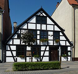 Złotów Museum, located in a historical timber framed house | |
 Flag  Coat of arms | |
 Złotów | |
| Coordinates: 53°21′37″N 17°2′27″E / 53.36028°N 17.04083°E / 53.36028; 17.04083 | |
| Country | |
| Voivodeship | Greater Poland |
| County | Złotów County |
| Gmina | Złotów (urban gmina) |
| Established | 8th century |
| Town rights | before 1370 |
| Government | |
| • Mayor | Adam Pulit |
| Area | |
| • Total | 11.58 km2 (4.47 sq mi) |
| Elevation | 110 m (360 ft) |
| Population (2011) | |
| • Total | 18,303 |
| • Density | 1,600/km2 (4,100/sq mi) |
| Time zone | UTC+1 (CET) |
| • Summer (DST) | UTC+2 (CEST) |
| Postal code | 77-400 |
| Area code(s) | +48 067 |
| Car plates | PZL |
| Climate | Dfb |
| Website | http://www.zlotow.eu |
Złotów [ˈzwɔtuf] (German: Flatow) is a town in northwestern Poland, with a population of 18,303 inhabitants (2011). Today it is part of Greater Poland Voivodeship (province), previously being in Piła Voivodeship (1975–1998). Since 1999 Złotów has been the seat of Złotów County.
The town is located on the river Głomia and is surrounded by five lakes. A railway line connects it to Piła and Chojnice, with buses operating locally. The local Metaplast windows fitting factory is the biggest industrial employer. The Euro Eco Meeting is organized regularly there each July.
Contents
1 History
1.1 Demographic development
2 Notable residents
3 Sport
4 International relations
4.1 Twin towns — Sister cities
5 External links
6 Footnotes
History

Town Hall
Złotów is the historical centre of the northern part of Krajna. Human activity in the region goes as far back as the 8th century BC. Around 700 AD, a hill fort on the shore of the Baba lake was the residence of a Pomeranian tribal chief. The land belonged to the dukes of Pomerelia from the house of the Samborides until the dukedom came to an end in 1294. Later, the Teutonic Knights ruled the area but the sovereignty of the territory was disputed between them and Kingdom of Poland. Złotów was mentioned in 1370 in the chronicle of Janko of Czarnkow. In 1370, Złotów was granted Magdeburg rights while under Polish rule. According to the last will of Polish king Casimir III after his death in 1370 his grandson, Casimir IV, Duke of Pomerania, was to inherit the lands of Dobrzyń, Bydgoszcz, Kruszwica, Złotów and Wałcz as fiefs.[1]
The city was destroyed in 1455 during the war with the Teutonic Knights. The town later belonged to the Potulicki family which provided it with a new Gothic castle in Renaissance style at the beginning of the 17th century. In 1619, Jan Potulicki issued a founding document for the church and parish of the Holy Assumption of Mary. Later it passed to the Grudziński family. In 1665 the town still had Magdeburg rights.[citation needed] The castle was destroyed during the Swedish invasion in 1657. The bombardment also destroyed other parts of the city including the city hall. A new church, still standing today, was founded there in 1664 by Andrzej Karol Grudziński. After the rule of the Grudziński family came to an end in 1688, the Działyński family came into power.

County Office
From 1709 to 1711, a plague known as the Black Death affected the area. According to incomplete church records, approximately 1,650 people died as a result of the epidemic. After the first partition of Poland in 1772, Złotów was incorporated into Prussia. In 1784 a Protestant half-timbered church was built on the great market square, which during the time span 1829–31 was replaced by a modern church designed by Karl Friedrich Schinkel.[citation needed]
The town was given county (Kreis) town status in 1818. From 1772 to 1945 as part of Prussia (later Germany) it was known as Flatow. In 1871, a railway line from Schneidemühl was completed. Around this time many local people emigrated to America, including many members of the local Polish minority.
In 1919 it was decided that while most of the Kreis Flatow was ceded to the restored Polish Republic, the city of Flatow would remain inside Germany. This caused huge protests from the large Polish minority of the city (approx. 12%) and the surrounding rural lands. From 1922 until 1938 Flatow was part of the newly formed Province of Grenzmark Posen-West Prussia inside Germany. When this province was dissolved on 1 October 1938, Flatow was integrated into the Province of Pomerania. The local synagogue was destroyed during the Kristallnacht in 1938.
After World War II, with the German–Polish border moved westwards to the Oder–Neisse line, Złotów and its surroundings became part of Poland. The German population was expelled.
Demographic development
| Year | Inhabitants | Notes |
|---|---|---|
| 1783 | 01,597 | incl. approx. 600 German Protestants, 300 Catholics and 714 Jews[2] |
| 1805 | 01,764 | incl. 1,058 Christians and 705 Jews[3] |
| 1831 | 01,960 | [4] |
| 1849 | 02,841 | [5] |
| 1853 | 02,772 | incl. 2,163 Christians and 609 Jews[3] |
| 1864 | 03,172 | incl. 1,631 Protestants and 993 Catholics[6] |
| 1875 | 03,510 | [7] |
| 1880 | 03,921 | [7] |
| 1890 | 03,852 | incl. 2,082 Protestants, 1,368 Catholics and 402 Jews[7] |
| 1925 | 05,939 | incl. 3,555 Protestants, 2,105 Catholics and 211 Jews (800 Poles)[8] |
| 1933 | 07,112 | [7] |
| 1939 | 07,496 | [7] |
| 2012 | 18,754 |
Notable residents
Eberhard Schöler (born 1940), German table tennis competitor
Walter Krueger (1881–1967), a United States army general
Karl Friedrich Schinkel, German architect and urban planner
Paweł Buzała, Polish football player
Agnieszka Bednarek-Kasza volleyball player
Sport
The local women's volleyball team, Sparta Złotów, plays in the third national league.
International relations
Twin towns — Sister cities
Złotów is twinned with:
 Rathenow, Germany
Eggesin, Germany
Gifhorn, Germany
There has also been some cooperation with:
 Goole, United Kingdom
 Nieśwież, Belarus
 La Flèche, France
External links
- Official website
- County website with some information on the town
Footnotes
^ Werner Buchholz, Pommern, Siedler, 1999, p.154-158, .mw-parser-output cite.citation{font-style:inherit}.mw-parser-output .citation q{quotes:"""""""'""'"}.mw-parser-output .citation .cs1-lock-free a{background:url("//upload.wikimedia.org/wikipedia/commons/thumb/6/65/Lock-green.svg/9px-Lock-green.svg.png")no-repeat;background-position:right .1em center}.mw-parser-output .citation .cs1-lock-limited a,.mw-parser-output .citation .cs1-lock-registration a{background:url("//upload.wikimedia.org/wikipedia/commons/thumb/d/d6/Lock-gray-alt-2.svg/9px-Lock-gray-alt-2.svg.png")no-repeat;background-position:right .1em center}.mw-parser-output .citation .cs1-lock-subscription a{background:url("//upload.wikimedia.org/wikipedia/commons/thumb/a/aa/Lock-red-alt-2.svg/9px-Lock-red-alt-2.svg.png")no-repeat;background-position:right .1em center}.mw-parser-output .cs1-subscription,.mw-parser-output .cs1-registration{color:#555}.mw-parser-output .cs1-subscription span,.mw-parser-output .cs1-registration span{border-bottom:1px dotted;cursor:help}.mw-parser-output .cs1-ws-icon a{background:url("//upload.wikimedia.org/wikipedia/commons/thumb/4/4c/Wikisource-logo.svg/12px-Wikisource-logo.svg.png")no-repeat;background-position:right .1em center}.mw-parser-output code.cs1-code{color:inherit;background:inherit;border:inherit;padding:inherit}.mw-parser-output .cs1-hidden-error{display:none;font-size:100%}.mw-parser-output .cs1-visible-error{font-size:100%}.mw-parser-output .cs1-maint{display:none;color:#33aa33;margin-left:0.3em}.mw-parser-output .cs1-subscription,.mw-parser-output .cs1-registration,.mw-parser-output .cs1-format{font-size:95%}.mw-parser-output .cs1-kern-left,.mw-parser-output .cs1-kern-wl-left{padding-left:0.2em}.mw-parser-output .cs1-kern-right,.mw-parser-output .cs1-kern-wl-right{padding-right:0.2em}
ISBN 3-88680-272-8 (in German)
^ Johann Friedrich Goldbeck: Vollständige Topographie des Königreichs Preußen. Part II, Marienwerder 1789, pp. 99-100, no. 4). (in German).
^ ab F. W. F. Schmitt: Topographie des Flatower Kreises. In: Preußische Provinzialblätter, Andere Folge, Vol. VII, Königsberg 1855, p. 116 (in German).
^ August Eduard Preuß: Preußische Landes- und Volkskunde. Königsberg 1835, p. 377, no. 6 (in German).
^ Amtsblatt für den Regierungsbezirk Marienwerder. Vol. 43, No. 23 from 8 June 1853, p. 135 (in German).
^ E. Jacobson: Topographisch-statistisches Handbuch für den Regierungsbezirk Marienwerder, Danzig 1868, pp. 4–5, no. 36 (in German).
^ abcde Michael Rademacher Deutsche Verwaltungsgeschichte Pommern - Landkreis Flatow (2006) (in German).
^ Gunthard Stübs und Pommersche Forschungsgemeinschaft: Die Stadt Flatow im ehemaligen Kreis Flatow in Pommern (2011) (in German).
Coordinates: 53°22′N 17°02′E / 53.367°N 17.033°E / 53.367; 17.033
| Wikimedia Commons has media related to Złotów. |
Gminas of Złotów County | ||
|---|---|---|
| Seat |
|  |
| Urban-rural gminas |
| |
| Rural gminas |
| |
Gmina Złotów | ||
|---|---|---|
| Seat (not part of the gmina) |
| |
| Villages |
| |
Authority control |
|
|---|


