Brainerd, Minnesota
Coordinates: 46°21′29″N 94°12′03″W / 46.35806°N 94.20083°W / 46.35806; -94.20083
Brainerd, Minnesota | |
|---|---|
City | |
 Seal | |
 Location within Crow Wing County | |
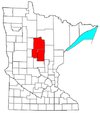
 Brainerd Location within Minnesota Show map of Minnesota  Brainerd Location within the United States Show map of the United States | |
| Coordinates: 46°21′29″N 94°12′03″W / 46.35806°N 94.20083°W / 46.35806; -94.20083 | |
| Country | United States |
| State | Minnesota |
| County | Crow Wing |
| Founded | 1870 |
| Incorporated | 1873 |
| Government | |
| • Mayor | Ed Menk |
| Area [1] | |
| • Total | 12.88 sq mi (33.36 km2) |
| • Land | 12.16 sq mi (31.49 km2) |
| • Water | 0.72 sq mi (1.87 km2) 5.78% |
| Elevation | 1,217 ft (371 m) |
| Population (2010)[2] | |
| • Total | 13,590 |
| • Estimate (2017)[3] | 13,428 |
| • Density | 1,104.46/sq mi (426.44/km2) |
| Time zone | UTC-6 (Central) |
| • Summer (DST) | UTC-5 (Central) |
| ZIP code | 56401 |
| Area code(s) | 218 |
| FIPS code | 27-07300 |
GNIS feature ID | 0640426[4] |
| Website | www.ci.brainerd.mn.us |
Brainerd is a city in Crow Wing County, Minnesota, United States. Its population was 13,592 as of the 2010 census.[5] It is the county seat of Crow Wing County,[6] and is one of the largest cities in Central Minnesota. Brainerd straddles the Mississippi River several miles upstream from its confluence with the Crow Wing River, having been founded as a site for a railroad crossing above said confluence. Brainerd is the principal city of the Brainerd Micropolitan Area, a micropolitan area covering Cass and Crow Wing counties and with a combined population of 91,067 as of the 2010 census. The Brainerd area serves as a major tourist destination for Minnesota, and Baxter is a regional retail center.
Brainerd is the home to one of five medevac helicopter flight stations in the state for "AirCare," operated by North Memorial Medical Center in Robbinsdale, a Level 1 Trauma Center. This station covers the central part of Minnesota. The city is also known for the Brainerd International Raceway, which hosts races frequently throughout the year and has a national drag racing meet annually in August.
Contents
1 History
2 Geography
2.1 Major highways
2.2 Climate
3 Superfund site and environmental damage
4 Demographics
4.1 2010 census
4.2 2000 census
4.3 2016 poorest town in Minnesota
5 Media
5.1 Radio
5.2 Television
6 In popular culture
7 Notable people
8 Points of interest
9 See also
10 References
11 External links
History
The area that is now Brainerd was traditionally territory inhabited by the Ojibwe.[citation needed] Brainerd was first seen by European settlers on Christmas Day in 1805, when Zebulon Pike stopped there while searching for the headwaters of the Mississippi River. Crow Wing Village, a fur and logging community near Fort Ripley, brought settlers to the area in the mid-19th century.
In those early years the relationship between the settlers and the Native Americans was complicated. The most famous example of this tenuous relationship was the so-called "Blueberry War" of 1872. Two Ojibwe were hanged for allegedly murdering a missing girl. When a group of Native Americans approached the town, troops from nearby Fort Ripley were called to prevent a potential reprisal. As it turned out, however, the Ojibwe only wanted to sell blueberries and the settlers avoided a bloody misunderstanding. Guilt of the two Native Americans was never proven.

The water tower along
Minnesota Highway 210 in downtown Brainerd serves as a symbol of the community
Brainerd was the idea of Northern Pacific railroad president John Gregory Smith, who in 1870 named the township after his wife, Anne Eliza Brainerd Smith, and father-in-law, Lawrence Brainerd. The company built a bridge over the Mississippi seven miles north of Crow Wing Village and used the Brainerd station as a machine and car shop, prompting many to move north and abandon Crow Wing. Brainerd was organized as a city on March 6, 1873.[7]
On January 11, 1876, the state legislature revoked Brainerd's charter for six years, as a reaction to the election of local handyman Thomas Lanihan as mayor instead of Judge C.B. Sleeper. Brainerd functioned as a township in the interim.
In 1881, the railroad, and with it the town, expanded. Lumber and paper, as well as agriculture in general, were important early industries, but for many decades Brainerd remained a railroad town: in the 1920s roughly 90 percent of Brainerd residents were dependent on the railroad. Participation in the nationwide railroad strike on July 1, 1922, left the majority of Brainerd residents unemployed and embittered many of those involved.
On October 27, 1933, the First National Bank of Brainerd became briefly famous when it was held up by Baby Face Nelson and his gang.
Over the years, increased efficiency and the better positioning of the more centralized Livingston, Montana, shops led to a decline in the importance of a railroad station that once employed over 1000 and serviced locomotives for the whole Northern Pacific line. The BNSF Railway (successor to the Northern Pacific) continues to employ approximately 70 people in Brainerd at a maintenance-of-way equipment shop responsible for performing repairs and preventive maintenance to track and equipment.
The Northwest Paper Company built Brainerd's first paper mill in 1903 and with the steady increase in tourism since the early 20th century the paper and service industries have become Brainerd's primary employers. The town's coating mill was sold by Potlatch to Missota Paper in 2003 and then by Missota Paper to Wausau Paper in 2004. It is now used as a small industrial center called Brainerd Industrial Center (BIC).
Due to the many lakes in the area, Brainerd had become a popular summertime destination for those owning cabins in the area. Brainerd itself is now heavily developed into commercial and residential areas and most new construction in the area takes place in neighboring Baxter.
Geography
Brainerd is located just north of the geographical center of Minnesota in a relatively hilly terminal moraine area created by the Superior Lobe of the Labradorian ice sheet. The town occupies land on both sides of the Mississippi River, though the older parts of Brainerd are almost all to the east.
Though the city itself has relatively few lakes, there are over 460 lakes within 25 miles (40 km) of Brainerd, located mostly to the north. For this reason, Crow Wing County and parts of the adjoining counties are often collectively referred to as the Brainerd Lakes Area.
According to the United States Census Bureau, the city has a total area of 12.64 square miles (32.74 km2), of which 11.91 square miles (30.85 km2) is land and 0.73 square miles (1.89 km2) is water.[8]
Brainerd has been assigned ZIP code 56401 by the USPS.
Major highways
The following routes are located in the Brainerd area.
 Minnesota State Highway 18
 Minnesota State Highway 25
 Minnesota State Highway 210
 Minnesota State Highway 371
Climate
Brainerd has a humid continental climate (Köppen Dfb) with vast seasonal differences. Summers are warm and occasionally hot, whereas winters are often severely cold.
| Climate data for Brainerd, Minnesota 1981-2010 normals | |||||||||||||
|---|---|---|---|---|---|---|---|---|---|---|---|---|---|
| Month | Jan | Feb | Mar | Apr | May | Jun | Jul | Aug | Sep | Oct | Nov | Dec | Year |
| Record high °F (°C) | 56 (13) | 57 (14) | 78 (26) | 94 (34) | 95 (35) | 100 (38) | 102 (39) | 100 (38) | 96 (36) | 88 (31) | 73 (23) | 60 (16) | 102 (39) |
| Average high °F (°C) | 20.4 (−6.4) | 26.2 (−3.2) | 38.3 (3.5) | 54.5 (12.5) | 67.4 (19.7) | 75.7 (24.3) | 80.5 (26.9) | 78.7 (25.9) | 69.0 (20.6) | 55.4 (13.0) | 38.0 (3.3) | 23.7 (−4.6) | 52.3 (11.3) |
| Daily mean °F (°C) | 8.3 (−13.2) | 13.5 (−10.3) | 26.6 (−3.0) | 41.7 (5.4) | 54.9 (12.7) | 64.1 (17.8) | 68.7 (20.4) | 66.5 (19.2) | 56.6 (13.7) | 43.9 (6.6) | 28.8 (−1.8) | 13.9 (−10.1) | 40.6 (4.8) |
| Average low °F (°C) | −3.7 (−19.8) | 0.9 (−17.3) | 14.8 (−9.6) | 29 (−2) | 42.4 (5.8) | 52.4 (11.3) | 57.0 (13.9) | 54.3 (12.4) | 44.2 (6.8) | 32.5 (0.3) | 19.5 (−6.9) | 4.1 (−15.5) | 28 (−2) |
| Record low °F (°C) | −48 (−44) | −54 (−48) | −33 (−36) | −12 (−24) | 16 (−9) | 32 (0) | 36 (2) | 29 (−2) | 18 (−8) | 4 (−16) | −24 (−31) | −43 (−42) | −54 (−48) |
| Average precipitation inches (mm) | 0.77 (20) | 0.67 (17) | 1.52 (39) | 2.35 (60) | 3.37 (86) | 4.39 (112) | 3.78 (96) | 3.07 (78) | 3.18 (81) | 2.93 (74) | 1.54 (39) | 0.81 (21) | 28.38 (723) |
| Source: http://w2.weather.gov/climate/xmacis.php?wfo=dlh | |||||||||||||
Superfund site and environmental damage
The Burlington Northern (Brainerd/Baxter) United States Environmental Protection Agency Superfund site is located on the boundary between the cities of Brainerd and Baxter. The site served as a Burlington Northern Railroad tie treatment plant, between the years of 1907 and 1985. During that time, wastewater generated from the wood-treating process was sent to two shallow, unlined ponds. This created a sludge which contaminated both the underlying soils and the groundwater with creosote and polynuclear aromatic hydrocarbons (PAHs).[9]
Demographics
| Historical population | |||
|---|---|---|---|
| Census | Pop. | %± | |
| 1880 | 1,865 | — | |
| 1890 | 5,703 | 205.8% | |
| 1900 | 7,524 | 31.9% | |
| 1910 | 8,526 | 13.3% | |
| 1920 | 9,591 | 12.5% | |
| 1930 | 10,221 | 6.6% | |
| 1940 | 12,071 | 18.1% | |
| 1950 | 12,087 | 0.1% | |
| 1960 | 12,898 | 6.7% | |
| 1970 | 11,667 | −9.5% | |
| 1980 | 11,489 | −1.5% | |
| 1990 | 12,353 | 7.5% | |
| 2000 | 13,178 | 6.7% | |
| 2010 | 13,590 | 3.1% | |
| Est. 2017 | 13,428 | [3] | −1.2% |
| U.S. Decennial Census[10] 2015 Estimate[11] | |||
2010 census
As of the census[2] of 2010, there were 13,590 people, 5,851 households, and 3,069 families residing in the city. The population density was 1,141.1 inhabitants per square mile (440.6/km2). There were 6,390 housing units at an average density of 536.5 per square mile (207.1/km2). The racial makeup of the city was 93.5% White, 1.2% African American, 1.6% Native American, 0.3% Asian, 0.4% from other races, and 3.0% from two or more races. Hispanic or Latino of any race were 1.8% of the population.
There were 5,851 households of which 30.2% had children under the age of 18 living with them, 31.7% were married couples living together, 15.6% had a female householder with no husband present, 5.2% had a male householder with no wife present, and 47.5% were non-families. 37.8% of all households were made up of individuals and 14.2% had someone living alone who was 65 years of age or older. The average household size was 2.23 and the average family size was 2.92.
The median age in the city was 32.2 years. 24.5% of residents were under the age of 18; 12.5% were between the ages of 18 and 24; 27.5% were from 25 to 44; 20.5% were from 45 to 64; and 15.1% were 65 years of age or older. The gender makeup of the city was 47.6% male and 52.4% female.
2000 census
At the 2000 census, there were 13,178 people, 5,623 households and 3,036 families residing in the city. The population density was 1,652.8 per square mile (638.4/km²). There were 5,847 housing units at an average density of 733.3 per square mile (283.3/km²). The racial makeup of the city was 95.83% White, 0.71% African American, 1.44% Native American, 0.46% Asian, 0.01% Pacific Islander, 0.26% from other races, and 1.29% from two or more races. Hispanic or Latino of any race were 0.86% of the population. 31.4% were of German, 28.1% were Finnish, 17.7% Norwegian, 7.1% Swedish, 6.8% Irish, and 6.1% United States or American ancestry.
There were 5,623 households of which 29.4% had children under the age of 18 living with them, 35.8% were married couples living together, 14.3% had a female householder with no husband present, and 46.0% were non-families. 37.5% of all households were made up of individuals and 16.8% had someone living alone who was 65 years of age or older. The average household size was 2.23 and the average family size was 2.94.
Age distribution was 25.1% under the age of 18, 13.7% from 18 to 24, 26.3% from 25 to 44, 16.8% from 45 to 64, and 18.1% who were 65 years of age or older. The median age was 33 years. For every 100 females, there were 85.1 males. For every 100 females age 18 and over, there were 79.4 males.
The median household income was $26,901, and the median family income was $35,212. Males had a median income of $27,677 versus $21,217 for females. The per capita income for the city was $15,744. About 11.8% of families and 17.6% of the population were below the poverty line, including 20.5% of those under age 18 and 16.0% of those age 65 or over.
2016 poorest town in Minnesota
In 2016, Brainerd was reported to be the poorest town in Minnesota, with a median household income of $32,169.[12]
Media
Radio stations and television channels in the Brainerd Lakes Area.
Radio
AM Radio Stations
- 1270 – WWWI – Red Zone Sports Radio – Sports
- 1340 – KVBR – Brainerd Business Radio – News/Talk
- 1380 – KLIZ - "The Fan 1380" - Sports
FM radio stations
- 88.3 – KBPN – Minnesota Public Radio – News/Talk
- 89.9 – K210DR - "Northern Community Radio" - Community/Public radio format, translator of KAXE
- 90.7 – KBPR – Minnesota Public Radio – classical music
- 93.3 – KBLB - "B93.3 Today's Best Country" - Country
- 95.9 – WWWI-FM - "Cash 95.9" – Country and Adult Standards
- 100.1 – KLKS (FM) - "Talk 100" - News/Talk
- 101.5 – KFGI - "101.5 Jack FM" - Variety Hits/Adult Hits format
- 102.7 – KTIG - "The Word" - Christian
- 103.5 – KUAL-FM - "The Lakes Greatest Hits" - Oldies
- 104.3 – WZFJ - "The Pulse" - Contemporary Christian
- 106.7 – WJJY-FM - "Today's Best Variety" - Adult contemporary
- 107.5 – KLIZ-FM - "The Power Loon" - Classic rock
Television
Brainerd also has a full power television station that serves the area.
KAWB-TV, PBS, (ATSC virtual channel 22, RF channel 28, cable channel 2), is a satellite station of KAWE in Bemidji.
In popular culture
Though taking its title from the nearby city in North Dakota, the Coen brothers' 1996 film Fargo was set partly in Brainerd. However, production took place in Hallock, Minnesota.[13]
Notable people
Joe Haeg - NFL offensive lineman for the Indianapolis Colts, played college football at North Dakota State Bison football.
Win Borden - Minnesota State Senator, lawyer, and businessman.[14]
Frank B. Johnson - Mayor and legislator.[15]
Bullet Joe Bush - MLB pitcher of early 20th century, born in Brainerd.
Brian Thompson - World Renowned instructor for Mitas International, Cal Worthington Ford, and Ford ASSET; born in Brainerd.
Rick Nolan - United States Representative

Brainerd International Raceway
Points of interest
- Paul Bunyan State Trail
- Cuyuna Country State Recreation Area
- Northland Arboretum
- Brainerd International Raceway
See also
- Burlington Northern (Brainerd/Baxter)
- List of Superfund sites in Minnesota
References
Notes
^ "2017 U.S. Gazetteer Files". United States Census Bureau. Retrieved Jan 2, 2019..mw-parser-output cite.citation{font-style:inherit}.mw-parser-output .citation q{quotes:"""""""'""'"}.mw-parser-output .citation .cs1-lock-free a{background:url("//upload.wikimedia.org/wikipedia/commons/thumb/6/65/Lock-green.svg/9px-Lock-green.svg.png")no-repeat;background-position:right .1em center}.mw-parser-output .citation .cs1-lock-limited a,.mw-parser-output .citation .cs1-lock-registration a{background:url("//upload.wikimedia.org/wikipedia/commons/thumb/d/d6/Lock-gray-alt-2.svg/9px-Lock-gray-alt-2.svg.png")no-repeat;background-position:right .1em center}.mw-parser-output .citation .cs1-lock-subscription a{background:url("//upload.wikimedia.org/wikipedia/commons/thumb/a/aa/Lock-red-alt-2.svg/9px-Lock-red-alt-2.svg.png")no-repeat;background-position:right .1em center}.mw-parser-output .cs1-subscription,.mw-parser-output .cs1-registration{color:#555}.mw-parser-output .cs1-subscription span,.mw-parser-output .cs1-registration span{border-bottom:1px dotted;cursor:help}.mw-parser-output .cs1-ws-icon a{background:url("//upload.wikimedia.org/wikipedia/commons/thumb/4/4c/Wikisource-logo.svg/12px-Wikisource-logo.svg.png")no-repeat;background-position:right .1em center}.mw-parser-output code.cs1-code{color:inherit;background:inherit;border:inherit;padding:inherit}.mw-parser-output .cs1-hidden-error{display:none;font-size:100%}.mw-parser-output .cs1-visible-error{font-size:100%}.mw-parser-output .cs1-maint{display:none;color:#33aa33;margin-left:0.3em}.mw-parser-output .cs1-subscription,.mw-parser-output .cs1-registration,.mw-parser-output .cs1-format{font-size:95%}.mw-parser-output .cs1-kern-left,.mw-parser-output .cs1-kern-wl-left{padding-left:0.2em}.mw-parser-output .cs1-kern-right,.mw-parser-output .cs1-kern-wl-right{padding-right:0.2em}
^ ab "American FactFinder". United States Census Bureau. Retrieved 2012-11-13.
^ ab "Population and Housing Unit Estimates". Retrieved March 24, 2018.
^ "US Board on Geographic Names". United States Geological Survey. October 25, 2007. Retrieved January 31, 2008.
^ "2010 Census Redistricting Data (Public Law 94-171) Summary File". American FactFinder. U.S. Census Bureau, 2010 Census. Archived from the original on 21 July 2011. Retrieved 23 April 2011.
^ "Find a County". National Association of Counties. Archived from the original on 2011-05-31. Retrieved 2011-06-07.
^ Upham, Warren (1920). Minnesota Geographic Names: Their Origin and Historic Significance. Minnesota Historical Society. p. 156.
^ "US Gazetteer files 2010". United States Census Bureau. Archived from the original on 2012-01-24. Retrieved 2012-11-13.
^ "Burlington Northern (Brainerd/Baxter) Fact Sheet" Archived December 5, 2012, at the Wayback Machine, EPA, 07/13/12
^ United States Census Bureau. "Census of Population and Housing". Archived from the original on May 12, 2015. Retrieved July 14, 2014.
^ "Population Estimates". United States Census Bureau. Archived from the original on October 19, 2016. Retrieved June 17, 2016.
^ Sauter, Michael B. (24 May 2016). "Poorest Town in Every State". 24/7 Wall St. p. 6. Archived from the original on 29 July 2016. Retrieved 30 May 2017.
^ "Death in the snow". The Guardian. Retrieved 29 October 2015.
^ "Borden, Winston W. "Win"". state.mn.us. Retrieved 29 October 2015.
^ "Johnson, Frank B." state.mn.us. Retrieved 29 October 2015.
External links
| Wikimedia Commons has media related to Brainerd, Minnesota. |
Wikisource has the text of the 1911 Encyclopædia Britannica article Brainerd. |
- City of Brainerd, MN – Official Website
- Brainerd Lakes Vacationland – Brainerd.com
- Brainerd History site
- Brainerd Community Action site
- Explore Brainerd Lakes.com – Visitor Information and official Chamber website
Brainerd Dispatch newspaper site- "Visit Brainerd" Tourism Bureau
- Brainerd Medical Center
- Essentia Health St Joseph's Medical Center
- Brainerd Eye Care Center
- Gillette Children's Specialty Healthcare Brainerd Lakes Clinic
- Brainerd Medical Supply
- St. Cloud VA Health Care System - Brainerd Community Based Outpatient Clinic
Municipalities and communities of Crow Wing County, Minnesota, United States | ||
|---|---|---|
County seat: Brainerd | ||
| Cities |
|  |
| Townships |
| |
| Unorganized territories |
| |
| CDP |
| |
| Unincorporated communities |
| |
| Indian reservation |
| |
| Ghost towns |
| |
| Footnotes | ‡This populated place also has portions in an adjacent county or counties | |
Cities in the Brainerd Lakes area, Minnesota | |||||
|---|---|---|---|---|---|
| Core City |
|  | |||
| Surrounding communities |
| ||||
| Counties |
| ||||
† indicates a county seat. ‡ indicates that it is partially in the micropolitan area. § indicates a CDP. | |||||
Saint Paul (capital) | |
| Topics |
|
| Society |
|
| Regions |
|
| Largest cities pop. over 25,000 |
|
| Counties |
|
Authority control |
|
|---|


